Cof Cymru: National Historic Assets of Wales · Wales
Sunday School at Capel Carmel, including forecourt wall and gates
Conwy, Conwy, Wales
A Grade II listed building in Walled town, Conwy, designated on 8 October 1981.
The record
- Designation
- Listed building, Grade II
- Broad class
- Religious, Ritual and Funerary
- Date of designation
- 8 October 1981
- Locality
- Walled town
- Town
- Conwy
- Community
- Conwy
- Unitary authority
- Conwy
- Country
- Wales
- Coordinates
- 53.28195, -3.82978
- Cadw reference
- 3272
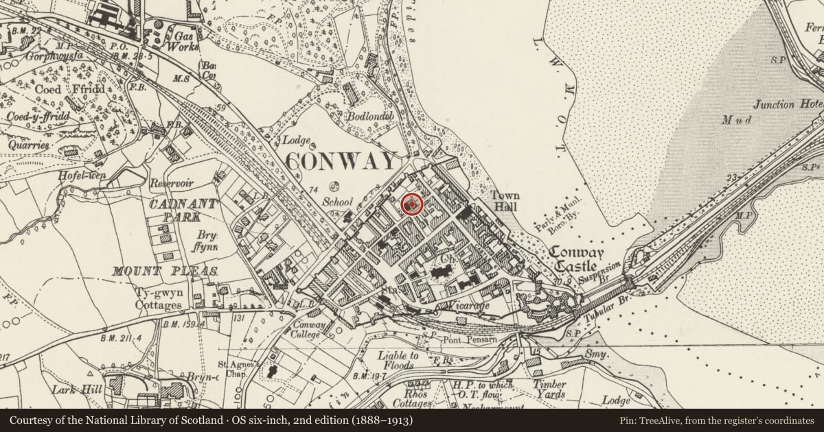
Slide toward Today to fade the historical sheet and see the modern map underneath.
David Rumsey Map Collection, Stanford LibrariesDavid Rumsey Map Collection, Stanford LibrariesDavid Rumsey Map Collection, Stanford LibrariesLlyfrgell Genedlaethol Cymru – The National Library of WalesDavid Rumsey Map Collection, Stanford Libraries
5 historical maps cover this location, the earliest the 1795 map "To Sir Watkin Williams-Wynn Bart ... the map of the six counties of North Wales is most humbly inscribed by his obedient humble servant" (Llyfrgell Genedlaethol Cymru – The National Library of Wales).
Historical maps covering this location
- 1795 · To Sir Watkin Williams-Wynn Bart ... the map of the six counties of North Wales is most… (Llyfrgell Genedlaethol Cymru – The National Library of Wales)
- 1830 · V.3:11-15:XV. Britisches Reich. A. Kon: England. b. Frstenthum Wales: Shire: 37-40 (David Rumsey Map Collection, Stanford Libraries)
- 1883 · Watershed map England, Wales 3. (David Rumsey Map Collection, Stanford Libraries)
- 1899 · 94 Beaumaris (Hills) (David Rumsey Map Collection, Stanford Libraries)
- 1901 · Sheet 9 and 10. (David Rumsey Map Collection, Stanford Libraries)
Cadw's description
Location
Set back from the road on the NE side of the chapel.
History
Built in the second half of the C19, contemporary with its chapel, and shown on the 1889 Ordnance Survey.
Exterior
A 1-storey former school of scribed roughcast front and rubble-stone side walls, with slate roof behind a coped gable to the front which has an ironwork apex finial. The front is slightly recessed between rusticated quoin strips and slightly projecting verge. Three stepped round-headed lights, wider in the centre, on a single corbelled sill have round arches and faceted keys like the main chapel (but the windows have been blocked since the previous survey in 1975).
The 3-window L side wall has 16-pane hornless sashes under segmental heads with dressed voussoirs. At the rear end is a porch with a single-pitch roof at R angles to the main range, and attached to the main chapel. It has a panel door on the R, a 2-pane horned sash window on the L, both under big stone lintels. The 5-window R side wall has windows similar to the L. Behind is an added lean-to.
The forecourt is above a rubble-stone retaining wall with freestone coping. On the L side are 2 square hammer-dressed gate piers with pyramid caps, spanning double cast iron gates.
Interior
The 5-bay collar-beam roof is ceiled at collar-beam level.
Reason for designation
Listed as a Sunday school retaining definite C19 character, and for group value with the chapel.
Nearby in the register
- Capel Carmel (Eglwys Bresbyteraidd Cymru), including forecourt railings and pierReligious, Ritual and Funeraryunder 1 mi
- 14 Llewelyn StreetNo class recordedunder 1 mi
- 12 Llewelyn StreetNo class recordedunder 1 mi
- 17 Berry StreetNo class recordedunder 1 mi
Other entries of the same register within about three miles of this one, by straight line.