Cof Cymru: National Historic Assets of Wales · Wales
Barn to the SW of Maenan Hall
Llanddoged and Maenan, Conwy, Wales
A Grade II listed building in Maenan, Llanddoged and Maenan, Conwy, designated on 13 October 1966.
The record
- Designation
- Listed building, Grade II
- Broad class
- Agriculture and Subsistence
- Date of designation
- 13 October 1966
- Locality
- Maenan
- Community
- Llanddoged and Maenan
- Unitary authority
- Conwy
- Country
- Wales
- Coordinates
- 53.16758, -3.80720
- Cadw reference
- 3215
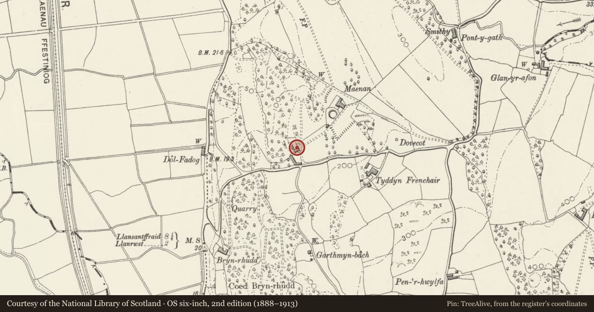
Slide toward Today to fade the historical sheet and see the modern map underneath.
David Rumsey Map Collection, Stanford LibrariesDavid Rumsey Map Collection, Stanford LibrariesDavid Rumsey Map Collection, Stanford LibrariesLlyfrgell Genedlaethol Cymru – The National Library of WalesDavid Rumsey Map Collection, Stanford Libraries
5 historical maps cover this location, the earliest the 1795 map "To Sir Watkin Williams-Wynn Bart ... the map of the six counties of North Wales is most humbly inscribed by his obedient humble servant" (Llyfrgell Genedlaethol Cymru – The National Library of Wales).
Historical maps covering this location
- 1795 · To Sir Watkin Williams-Wynn Bart ... the map of the six counties of North Wales is most… (Llyfrgell Genedlaethol Cymru – The National Library of Wales)
- 1883 · Watershed map England, Wales 3. (David Rumsey Map Collection, Stanford Libraries)
- 1899 · 106 Bangor (Outline) (David Rumsey Map Collection, Stanford Libraries)
- 1899 · 106 Bangor (Hills) (David Rumsey Map Collection, Stanford Libraries)
- 1901 · Sheet 9 and 10. (David Rumsey Map Collection, Stanford Libraries)
Cadw's description
Location
Located approximately 150m SW of Maenan Hall
Exterior
Early C19 century rubble barn with roof of small slates; deep verges to entrance gable with surmounting stone ball finial (awaiting re-positioning at time of inspection, July 1996). Large boarded double doors to gable with tripartite segmental light above with wooden divisions and latticing; round-headed arch with sandstone ashlar voussoirs and projecting central key. Large full-height openings (to eaves) on both long sides, with re-used oak lintels. Plain upper loading bay, unglazed, to N side.
Interior
Plain C19 trusses to 6-bay interior; plain loading bay to internal rubble dividing wall between bays 3 and 4.
Reason for designation
An early C19 estate barn associated with Maenan Hall.
Nearby in the register
- Maenan HallDomesticunder 1 mi
- Gazebo Tower to the SE of Maenan HallDomesticunder 1 mi
- Site of Aberconwy Abbey, MaenanAbbeyunder 1 mi
- BelmontDomesticunder 1 mi
Other entries of the same register within about three miles of this one, by straight line.