Cof Cymru: National Historic Assets of Wales · Wales
Dovecote at Gop Farm
Trelawnyd and Gwaenysgor, Flintshire, Wales
A Grade II listed building in Gop Hill, Trelawnyd and Gwaenysgor, Flintshire, designated on 6 November 1962.
The record
- Designation
- Listed building, Grade II
- Broad class
- Domestic
- Date of designation
- 6 November 1962
- Locality
- Gop Hill
- Community
- Trelawnyd and Gwaenysgor
- Unitary authority
- Flintshire
- Country
- Wales
- Coordinates
- 53.30909, -3.37702
- Cadw reference
- 319
Slide toward Today to fade the historical sheet and see the modern map underneath.
David Rumsey Map Collection, Stanford LibrariesDavid Rumsey Map Collection, Stanford LibrariesDavid Rumsey Map Collection, Stanford LibrariesLlyfrgell Genedlaethol Cymru – The National Library of WalesNational Library of Scotland
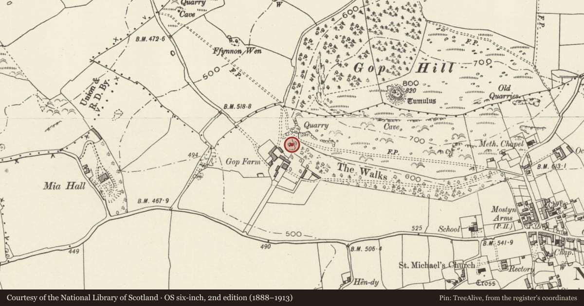
5 historical maps cover this location, the earliest the 1795 map "To Sir Watkin Williams-Wynn Bart ... the map of the six counties of North Wales is most humbly inscribed by his obedient humble servant" (Llyfrgell Genedlaethol Cymru – The National Library of Wales).
Historical maps covering this location
- 1795 · To Sir Watkin Williams-Wynn Bart ... the map of the six counties of North Wales is most… (Llyfrgell Genedlaethol Cymru – The National Library of Wales)
- 1883 · Watershed map England, Wales 3. (David Rumsey Map Collection, Stanford Libraries)
- 1898 · 95 Rhyl (Hills) (David Rumsey Map Collection, Stanford Libraries)
- 1901 · Sheet 9 and 10. (David Rumsey Map Collection, Stanford Libraries)
- 1930 · OS Popular Edition 1919-1947 (National Library of Scotland)
Cadw's description
Location
In a field on the N side of Gop Farm. Gop Farm is approximately 0.8km NW of Trelawnyd church and reached by farm road N of the A5151.
History
Said to be c1600, although it may have been built at least a quarter of a century later as a doorway in the garden wall of the farm is dated 1622 and belonged to a farmhouse of that date. In the C19 the area immediately E of the dovecote was woodland belonging to the Mostyn Estate and known as Gop Walk.
Exterior
A tall square dovecote of rubble stone with larger quoins, and stepped gables. The roof is now missing. Beneath eaves level is a projecting thin stone band. On the W side is a lintelled doorway (the lintel missing) and a former loft opening in the gable bricked up. The W wall has an inserted opening with brick jambs and wooden lintel.
Interior
The walls have stone ledges and nesting boxes up to the level of the eaves.
Reason for designation
Listed as a rare surviving C17 dovecote prominently sited at the foot of Gop Hill.
Nearby in the register
- The Gop CavesCaveunder 1 mi
- Gop CairnCairnunder 1 mi
- Barrow on E Slope of Gop HillRound Barrowunder 1 mi
- Hen-dy round barrowRound Barrowunder 1 mi
Other entries of the same register within about three miles of this one, by straight line.