Cof Cymru: National Historic Assets of Wales · Wales
Gatewen Hall
Broughton, Wrexham, Wales
A Grade II listed building in New Broughton, Broughton, Wrexham, designated on 13 October 1966.
The record
- Designation
- Listed building, Grade II
- Broad class
- Domestic
- Date of designation
- 13 October 1966
- Locality
- New Broughton
- Community
- Broughton
- Unitary authority
- Wrexham
- Country
- Wales
- Coordinates
- 53.05588, -3.02203
- Cadw reference
- 3176
Slide toward Today to fade the historical sheet and see the modern map underneath.
David Rumsey Map Collection, Stanford LibrariesDavid Rumsey Map Collection, Stanford LibrariesDavid Rumsey Map Collection, Stanford LibrariesLlyfrgell Genedlaethol Cymru – The National Library of WalesDavid Rumsey Map Collection, Stanford Libraries
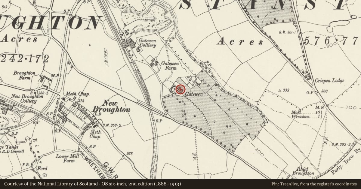
5 historical maps cover this location, the earliest the 1608 map "(13) Cambriae Typus." (David Rumsey Map Collection, Stanford Libraries).
Historical maps covering this location
- 1608 · (13) Cambriae Typus. (David Rumsey Map Collection, Stanford Libraries)
- 1795 · To Sir Watkin Williams-Wynn Bart ... the map of the six counties of North Wales is most… (Llyfrgell Genedlaethol Cymru – The National Library of Wales)
- 1883 · Watershed map England, Wales 3. (David Rumsey Map Collection, Stanford Libraries)
- 1898 · 121 Wrexham (Hills) (David Rumsey Map Collection, Stanford Libraries)
- 1901 · Sheet 9 and 10. (David Rumsey Map Collection, Stanford Libraries)
Cadw's description
Location
Set back from the main road and approached via a narrow lane.
History
A building is recorded here from the late C17. It was enlarged (for Thomas Hayes) between 1810 and 1830, and the character of the present building is largely determined by that period, with some later alteration. Latterly used as a school, but empty on inspection (June 1995).
Exterior
Roughcast render with hipped slate roof; axial stacks set towards rear. 3 storeys, 3-window range. Central entrance in added glazed porch, flanked by flush-framed floor length 12-pane sash windows to ground floor, 16 and 12-pane sashes above. Similar window detail in left-hand return elevation, which has a full height bow to centre.
Interior
Said to retain some original joinery (including panelled doors and windows shutters), together with some plasterwork and chimney pieces.
Reason for designation
The building retains its early C19 character, and is a good local example of a small country house.
Nearby in the register
- Gatewen Hall round barrowRound Barrowunder 1 mi
- Berse Drelincourt ChurchReligious, Ritual and Funeraryunder 1 mi
- OrphanageHealth and Welfareunder 1 mi
- Berse Vicarage with Flanking Walls to GardenDomesticunder 1 mi
Other entries of the same register within about three miles of this one, by straight line.