Cof Cymru: National Historic Assets of Wales · Wales
Bwthyn Rhyd
Caerhun, Conwy, Wales
A Grade II listed building in Rowen, Caerhun, Conwy, designated on 13 October 1966.
The record
- Designation
- Listed building, Grade II
- Broad class
- Religious, Ritual and Funerary
- Date of designation
- 13 October 1966
- Locality
- Rowen
- Community
- Caerhun
- Unitary authority
- Conwy
- Country
- Wales
- Coordinates
- 53.23001, -3.85956
- Cadw reference
- 3168
Slide toward Today to fade the historical sheet and see the modern map underneath.
David Rumsey Map Collection, Stanford LibrariesDavid Rumsey Map Collection, Stanford LibrariesDavid Rumsey Map Collection, Stanford LibrariesDavid Rumsey Map Collection, Stanford LibrariesDavid Rumsey Map Collection, Stanford Libraries
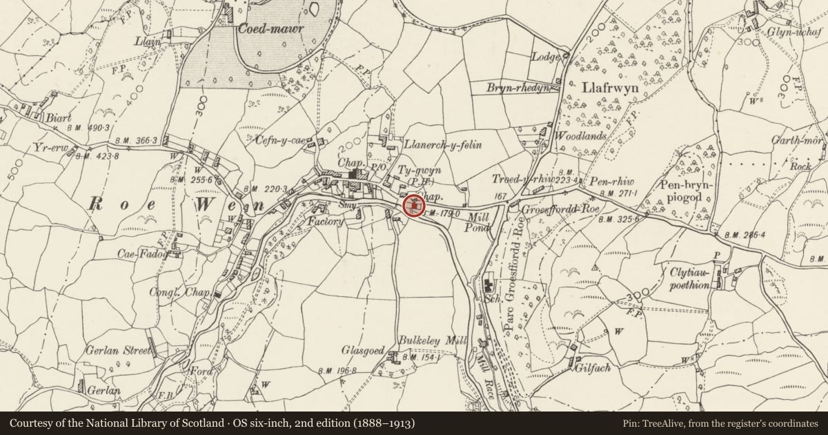
5 historical maps cover this location, the earliest the 1883 map "Watershed map England, Wales 3." (David Rumsey Map Collection, Stanford Libraries).
Historical maps covering this location
- 1883 · Watershed map England, Wales 3. (David Rumsey Map Collection, Stanford Libraries)
- 1896 · Sheet 7. Ordnance Survey of England and Wales. (David Rumsey Map Collection, Stanford Libraries)
- 1899 · 106 Bangor (Outline) (David Rumsey Map Collection, Stanford Libraries)
- 1899 · 106 Bangor (Hills) (David Rumsey Map Collection, Stanford Libraries)
- 1901 · Sheet 9 and 10. (David Rumsey Map Collection, Stanford Libraries)
Cadw's description
Location
Prominently sited on the S side of the main street at the approach to the village; behind a small rubble-walled forecourt with C19 decorative iron gate to N.
History
Formerly the Siloam Chapel. Probably built in 1819 as the Seion chapel, though rebuilt in 1841 and re-dedicated. Subsequently converted to a hall and used by the Women's Institute; presently a private house.
Exterior
Square building of rubble with hipped roof and half-hipped sides; plain, squat central stack. The E (entrance) front is symmetrical and has paired arched windows to the centre with small-pane sash glazing and radial heads; dressed sandstone voussoirs and projecting slate cills. Between them is an inset sandstone plaque inscribed 'Siloaem June 28th 1841: C'. Flanking outer entrances, arched as before and with radial fanlights; C19 6-panel door to R and similar to L, though here with (subsequently) glazed upper panels. 2 replaced 12-pane sash windows to first floor rear with further, similar window to ground floor centre. Flanking this are 2 modern French windows. The rear and W walls are rendered; all rear openings have plain modern stucco architraves. 3-bay modern veranda made up of re-used late C19 turned pine elements.
Interior
Plain, modernised interior.
Reason for designation
A mid C19 chapel with probable earlier origins retaining good external character in a prominent village location.
Nearby in the register
- Seion Welsh Presbyterian ChapelReligious, Ritual and Funeraryunder 1 mi
- FronfaDomesticunder 1 mi
- Llanerch-y-FelinDomesticunder 1 mi
- BodafonDomesticunder 1 mi
Other entries of the same register within about three miles of this one, by straight line.