Cof Cymru: National Historic Assets of Wales · Wales
Churchyard cross at the Church of Saint Michael and All Angels
Llantarnam, Torfaen, Wales
A Grade II listed building in Llantarnam, Cwmbran, Torfaen, designated on 1 May 1951.
The record
- Designation
- Listed building, Grade II
- Broad class
- Religious, Ritual and Funerary
- Date of designation
- 1 May 1951
- Locality
- Llantarnam
- Town
- Cwmbran
- Community
- Llantarnam
- Unitary authority
- Torfaen
- Country
- Wales
- Coordinates
- 51.63278, -3.00275
- Cadw reference
- 3122
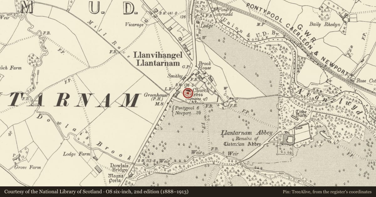
Slide toward Today to fade the historical sheet and see the modern map underneath.
David Rumsey Map Collection, Stanford LibrariesDavid Rumsey Map Collection, Stanford LibrariesDavid Rumsey Map Collection, Stanford LibrariesDavid Rumsey Map Collection, Stanford LibrariesDavid Rumsey Map Collection, Stanford Libraries
5 historical maps cover this location, the earliest the 1636 map "Cornubia : Devonia, Somersetus, Dorcestria, Wiltonia, Glocestria ..." (David Rumsey Map Collection, Stanford Libraries).
Historical maps covering this location
- 1636 · Cornubia : Devonia, Somersetus, Dorcestria, Wiltonia, Glocestria ... (David Rumsey Map Collection, Stanford Libraries)
- 1830 · V.3:11-15:XV.Britisches Reich. A. Kon: England. a. England ab sich: Shire:15-17, 33 (David Rumsey Map Collection, Stanford Libraries)
- 1895 · Sheet 11. Ordnance Survey of England and Wales. (David Rumsey Map Collection, Stanford Libraries)
- 1906 · 249 Newport (Hills) (David Rumsey Map Collection, Stanford Libraries)
- 1913 · Sheet 102. Newport. (David Rumsey Map Collection, Stanford Libraries)
Cadw's description
Location
In the churchyard just S of the Church of Saint Michael and All Angels.
History
Churchyard cross base with part of shaft of the cross, probably C15, on renewed steps and with late C19 cross. Scheduled Ancient Monument MM136(TOR).
Exterior
Churchyard cross, square base with rounded spurs at upper angles, carrying shaft square at base broached to octagonal. Late C19 cap to shaft with large ringed cross. Four renewed rubble stone steps with flagstone treads, some reused memorial stones.
Reason for designation
Included as a medieval churchyard cross. Scheduled Ancient Monument MM136(TOR).
Nearby in the register
- Churchyard CrossCrossunder 1 mi
- Church of St Michael and All AngelsReligious, Ritual and Funeraryunder 1 mi
- Memorial to T. Leadbetter in churchyard of Church of St Michael and All AngelsNo class recordedunder 1 mi
- The Greenhouse Public HouseCommercialunder 1 mi
Other entries of the same register within about three miles of this one, by straight line.