Cof Cymru: National Historic Assets of Wales · Wales
Raglan House, Raglan Barracks
Allt-yr-Yn, Newport, Wales
A Grade II listed building in Barrack Hill, Allt-yr-Yn, Newport, designated on 5 February 1993.
The record
- Designation
- Listed building, Grade II
- Broad class
- Domestic
- Date of designation
- 5 February 1993
- Locality
- Barrack Hill
- Community
- Allt-yr-Yn
- Unitary authority
- Newport
- Country
- Wales
- Coordinates
- 51.59452, -3.00829
- Cadw reference
- 3101
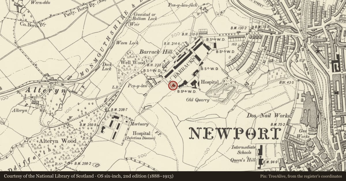
Slide toward Today to fade the historical sheet and see the modern map underneath.
David Rumsey Map Collection, Stanford LibrariesDavid Rumsey Map Collection, Stanford LibrariesDavid Rumsey Map Collection, Stanford LibrariesDavid Rumsey Map Collection, Stanford LibrariesDavid Rumsey Map Collection, Stanford Libraries
5 historical maps cover this location, the earliest the 1636 map "Cornubia : Devonia, Somersetus, Dorcestria, Wiltonia, Glocestria ..." (David Rumsey Map Collection, Stanford Libraries).
Historical maps covering this location
- 1636 · Cornubia : Devonia, Somersetus, Dorcestria, Wiltonia, Glocestria ... (David Rumsey Map Collection, Stanford Libraries)
- 1865 · England and Wales. England No. 6. (David Rumsey Map Collection, Stanford Libraries)
- 1895 · Sheet 11. Ordnance Survey of England and Wales. (David Rumsey Map Collection, Stanford Libraries)
- 1906 · 249 Newport (Hills) (David Rumsey Map Collection, Stanford Libraries)
- 1913 · Sheet 102. Newport. (David Rumsey Map Collection, Stanford Libraries)
Cadw's description
Location
Commanding hilltop site on N edge of Newport, approached up Barrack Hill. Building faces lawned site of former officers’ tennis court around which are situated the officer’s houses; linked at right angles to
History
The barracks was begun in 1843 and opened in 1845. The first phase of buildings, which included this range, was probably built by Colonel Ord, the Government Royal Engineer, and was designed to accommodate a cavalry regiment; it was also used by some infantry units and was variously known as Cavalry Barracks and Artillery Barracks. Renamed Raglan Barracks in 1963 when, following conversion, it became home to the Monmouthshire Territorial and Auxiliary Forces Association.
Raglan House was built as the home for the Commanding Officer.
Exterior
Symmetrical 2-storey, 5-bay front built of coursed and carefully cut local rubble with ‘sparrow-picked’ plinth and freestone dressings all in the manner of the original phase of building. Slate roof with wide boarded eaves and stone chimney stacks. 12-pane sashes; renewed central door. Gabled ends have roundel and pediment treatment; 2 windows to left end and 1 window to right end. Extension to rear.
Reason for designation
Listed for its special interest as one of the original ranges in this well preserved example of a mid C19 military barracks. Group value with other listed items at Raglan Barracks.
Nearby in the register
- Usk House, Raglan BarracksDomesticunder 1 mi
- Monmouth House, Raglan BarracksDomesticunder 1 mi
- Range to SW of Main Barrack Block (including Cadet Training Centre), Raglan BarracksDefenceunder 1 mi
- Sergeants' Mess, Raglan BarracksDefenceunder 1 mi
Other entries of the same register within about three miles of this one, by straight line.