Cof Cymru: National Historic Assets of Wales · Wales
Plas-yn-crwmp
Ysceifiog, Flintshire, Wales
A Grade II listed building in Ddol, Mold, Ysceifiog, Flintshire, designated on 6 November 1962.
The record
- Designation
- Listed building, Grade II
- Broad class
- Domestic
- Date of designation
- 6 November 1962
- Locality
- Ddol
- Town
- Mold
- Community
- Ysceifiog
- Unitary authority
- Flintshire
- Country
- Wales
- Coordinates
- 53.22898, -3.28861
- Cadw reference
- 309
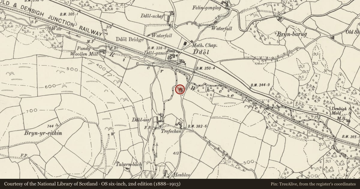
Slide toward Today to fade the historical sheet and see the modern map underneath.
David Rumsey Map Collection, Stanford LibrariesDavid Rumsey Map Collection, Stanford LibrariesDavid Rumsey Map Collection, Stanford LibrariesDavid Rumsey Map Collection, Stanford LibrariesLlyfrgell Genedlaethol Cymru – The National Library of Wales
5 historical maps cover this location, the earliest the 1795 map "To Sir Watkin Williams-Wynn Bart ... the map of the six counties of North Wales is most humbly inscribed by his obedient humble servant" (Llyfrgell Genedlaethol Cymru – The National Library of Wales).
Historical maps covering this location
- 1795 · To Sir Watkin Williams-Wynn Bart ... the map of the six counties of North Wales is most… (Llyfrgell Genedlaethol Cymru – The National Library of Wales)
- 1883 · Watershed map England, Wales 3. (David Rumsey Map Collection, Stanford Libraries)
- 1898 · 108 Flint (Hills) (David Rumsey Map Collection, Stanford Libraries)
- 1898 · 108 Flint (Outline) (David Rumsey Map Collection, Stanford Libraries)
- 1901 · Sheet 9 and 10. (David Rumsey Map Collection, Stanford Libraries)
Cadw's description
Location
Set back on the W side of a minor road between Ddol and Colomendy, immediately S of Afon Chwiler and E of Afon Disgynfa.
History
A C16 cruck-framed house later rebuilt in stone, probably in the C17. Two cruck trusses survived because they were incorporated into timber-framed partitions, creating a 3-unit house. Additional wings were added in the C20.
Exterior
A single-storey house of limewashed rubble stone walls and slate roof with C19 rendered end stacks, replacing a C17 stack on the L side. The front has 3 windows renewed in earlier openings and a fourth inserted L of centre. A small light is at the L end. Set back to the R gable end is a link to an added N wing. An added W wing is also at the rear.
Interior
Not inspected, but said to retain 2 timber-framed partitions incorporating some wattle and daub panels and 2 cruck trusses. A fireplace in the L end wall has a timber lintel.
Reason for designation
Listed as a rare surviving small single-storeyed C16 cruck-framed house.
Nearby in the register
- Ddol Afon CottageDomesticunder 1 mi
- Plas GwynDomesticunder 1 mi
- Swan CottageDomesticunder 1 mi
- Lower House at Bron FadogDomesticunder 1 mi
Other entries of the same register within about three miles of this one, by straight line.