Cof Cymru: National Historic Assets of Wales · Wales
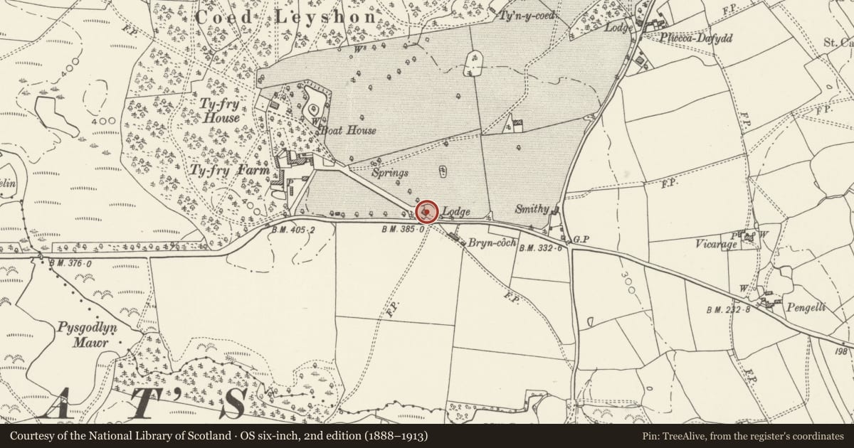
Ty Fry Lodge
Pendoylan, Vale of Glamorgan, Wales
A Grade II listed building in Ty Fry, Pendoylan, Vale of Glamorgan, designated on 18 May 1995.
The record
- Designation
- Listed building, Grade II
- Broad class
- Domestic
- Date of designation
- 18 May 1995
- Locality
- Ty Fry
- Community
- Pendoylan
- Unitary authority
- Vale of Glamorgan
- Country
- Wales
- Coordinates
- 51.47816, -3.37104
- Cadw reference
- 3027
Slide toward Today to fade the historical sheet and see the modern map underneath.
David Rumsey Map Collection, Stanford LibrariesDavid Rumsey Map Collection, Stanford LibrariesDavid Rumsey Map Collection, Stanford LibrariesDavid Rumsey Map Collection, Stanford LibrariesDavid Rumsey Map Collection, Stanford Libraries
5 historical maps cover this location, the earliest the 1636 map "Cornubia : Devonia, Somersetus, Dorcestria, Wiltonia, Glocestria ..." (David Rumsey Map Collection, Stanford Libraries).
Historical maps covering this location
- 1636 · Cornubia : Devonia, Somersetus, Dorcestria, Wiltonia, Glocestria ... (David Rumsey Map Collection, Stanford Libraries)
- 1637 · The fourth table of England. Cornub. Devonia, Somerset etc. (David Rumsey Map Collection, Stanford Libraries)
- 1865 · England and Wales. England No. 6. (David Rumsey Map Collection, Stanford Libraries)
- 1895 · Sheet 11. Ordnance Survey of England and Wales. (David Rumsey Map Collection, Stanford Libraries)
- 1897 · 262 Pontypridd (Hills) (David Rumsey Map Collection, Stanford Libraries)
Cadw's description
Location
On eastern edge of Hensol Forest and to south-west of Tre-Dodridge.
History
Late C19th lodge to the Ty Fry Estate, situated adjacent to the entrance driveway to Ty Fry Farm and House. The property was the lodge to the country estate of the Insole family of The Court, Llandaff.
Exterior
One and a half storeys, constructed of local random rubble with Bathstone dressings and quoins, beneath a pitched roof of picturesque composition, comprising an oversailing gable, full hip and apsidal hipped, front projection. The roof is clad in original orange, clay, fishscale tiles with moulded terracotta ridge pieces. Two stacks of lias limestone with Bathstone dressings, single, corbelled, gabled dormer, with scalloped bargeboard to front and pair to side, of mullioned and transom form with leaded upper lights and pediments, and painted timber glazing bars beneath, forming a lozenge pattern. Ground floor, south elevation with projecting, corbelled oriel beneath clay tiled, lean-to roof, comprising four lights of mullion and transom form. Again, lights to upper windows are leaded with glazing bars in lozenge arrangement beneath. Lean-to porch with original Tudor Revival traceried door, with light above. The door having applied, ribbed mouldings, forming blind tracery with a band of quatrefoils at mid-height. Scalloped bargeboard with applied Tudor roses. Original railings to front boundary with cusped, Gothic fleur-de-lys finials set upon a plinth.
Reason for designation
Listed Grade II as a good example of an eclectic, picturesque lodge, retaining original fenestration and with definite architectural character.
Nearby in the register
- Pigsty at Ty-drawAgriculture and Subsistenceunder 1 mi
- Church of St Cadoc (St Cattwg)Religious, Ritual and Funeraryunder 1 mi
- Telephone Call-boxCommunicationsunder 1 mi
- Pendoylan CottagesEducationunder 1 mi
Other entries of the same register within about three miles of this one, by straight line.