Cof Cymru: National Historic Assets of Wales · Wales
98 Mill Street
Caerleon, Newport, Wales
A Grade II listed building in Caerleon, Newport, designated on 1 August 1974.
The record
- Designation
- Listed building, Grade II
- Broad class
- Domestic
- Date of designation
- 1 August 1974
- Locality
- Caerleon
- Town
- Newport
- Community
- Caerleon
- Unitary authority
- Newport
- Country
- Wales
- Coordinates
- 51.61036, -2.95053
- Cadw reference
- 2989
Slide toward Today to fade the historical sheet and see the modern map underneath.
David Rumsey Map Collection, Stanford LibrariesDavid Rumsey Map Collection, Stanford LibrariesDavid Rumsey Map Collection, Stanford LibrariesDavid Rumsey Map Collection, Stanford LibrariesDavid Rumsey Map Collection, Stanford Libraries
5 historical maps cover this location, the earliest the 1636 map "Cornubia : Devonia, Somersetus, Dorcestria, Wiltonia, Glocestria ..." (David Rumsey Map Collection, Stanford Libraries).
Historical maps covering this location
- 1636 · Cornubia : Devonia, Somersetus, Dorcestria, Wiltonia, Glocestria ... (David Rumsey Map Collection, Stanford Libraries)
- 1830 · V.3:11-15:XV.Britisches Reich. A. Kon: England. a. England ab sich: Shire:15-17, 33 (David Rumsey Map Collection, Stanford Libraries)
- 1895 · Sheet 11. Ordnance Survey of England and Wales. (David Rumsey Map Collection, Stanford Libraries)
- 1906 · 249 Newport (Hills) (David Rumsey Map Collection, Stanford Libraries)
- 1913 · Sheet 102. Newport. (David Rumsey Map Collection, Stanford Libraries)
Cadw's description
Location
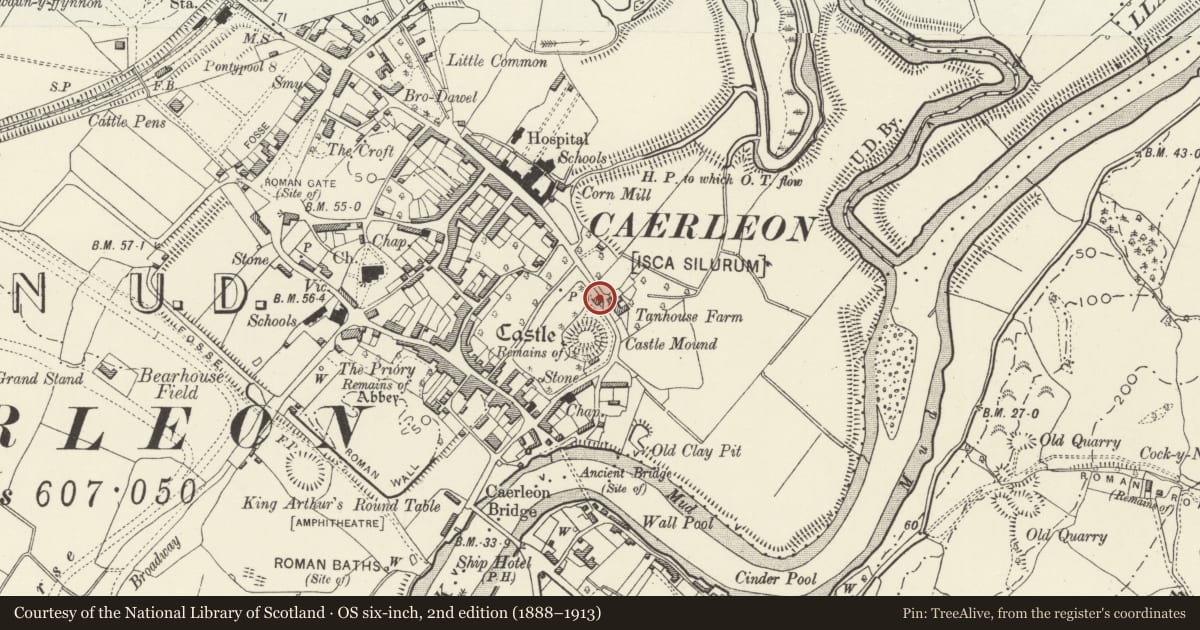
About 350m east of the Church of St.Cadoc to the north of Castle Mound.
Exterior
This house has the window to the left and the door to the right.
Interior
Not inspected at time of resurvey.
Reason for designation
Included as an early/mid C19 Tudor Revival cottage having group value with the closely associated wall of The Mynde.
Nearby in the register
- 96 Mill StreetDomesticunder 1 mi
- Garden Wall of Pen-y-myndeDomesticunder 1 mi
- Garden Wall of Castle AcreDomesticunder 1 mi
- Garden Wall of Pen-y-myndeDomesticunder 1 mi
Other entries of the same register within about three miles of this one, by straight line.