Cof Cymru: National Historic Assets of Wales · Wales
27 High Street
Caerleon, Newport, Wales
A Grade II listed building in Caerleon, Newport, designated on 1 August 1974.
The record
- Designation
- Listed building, Grade II
- Broad class
- Commercial
- Date of designation
- 1 August 1974
- Locality
- Caerleon
- Town
- Newport
- Community
- Caerleon
- Unitary authority
- Newport
- Country
- Wales
- Coordinates
- 51.60923, -2.95318
- Cadw reference
- 2975
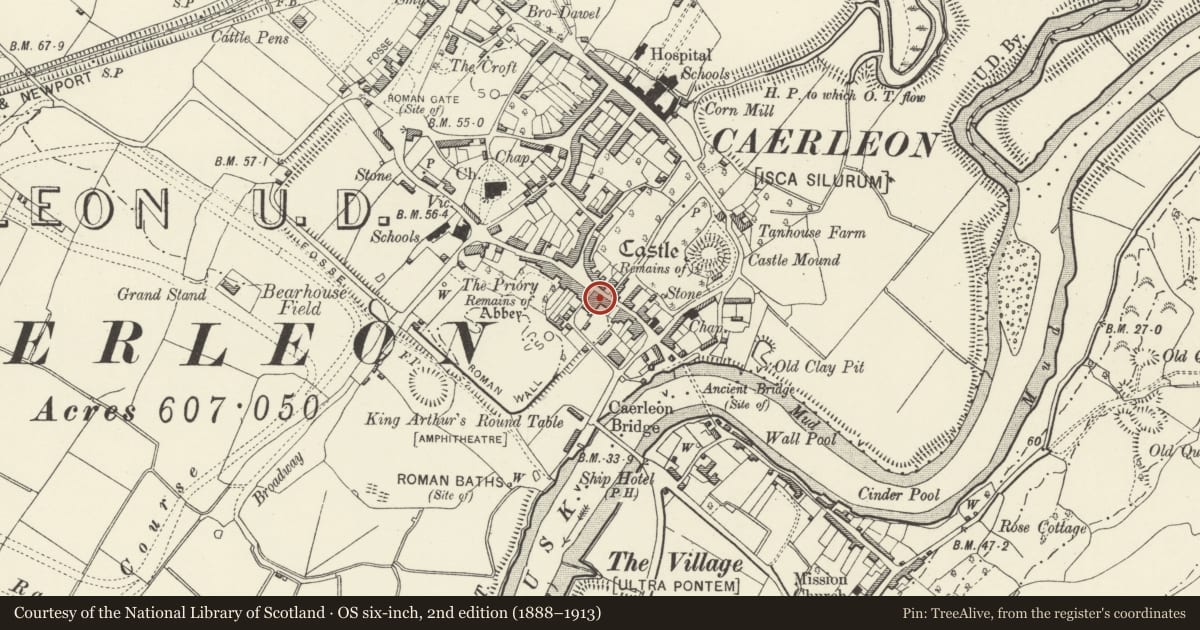
Slide toward Today to fade the historical sheet and see the modern map underneath.
David Rumsey Map Collection, Stanford LibrariesDavid Rumsey Map Collection, Stanford LibrariesDavid Rumsey Map Collection, Stanford LibrariesDavid Rumsey Map Collection, Stanford LibrariesDavid Rumsey Map Collection, Stanford Libraries
5 historical maps cover this location, the earliest the 1636 map "Cornubia : Devonia, Somersetus, Dorcestria, Wiltonia, Glocestria ..." (David Rumsey Map Collection, Stanford Libraries).
Historical maps covering this location
- 1636 · Cornubia : Devonia, Somersetus, Dorcestria, Wiltonia, Glocestria ... (David Rumsey Map Collection, Stanford Libraries)
- 1830 · V.3:11-15:XV.Britisches Reich. A. Kon: England. a. England ab sich: Shire:15-17, 33 (David Rumsey Map Collection, Stanford Libraries)
- 1895 · Sheet 11. Ordnance Survey of England and Wales. (David Rumsey Map Collection, Stanford Libraries)
- 1906 · 249 Newport (Hills) (David Rumsey Map Collection, Stanford Libraries)
- 1913 · Sheet 102. Newport. (David Rumsey Map Collection, Stanford Libraries)
Cadw's description
Location
On the southern approach to the Market Place at the centre of Caerleon.
History
A house built together with No 28 in the mid C19 and unaltered since.
Exterior
The house is rendered, presumably over local rubble stone and has a Welsh slate roof with red ridge tiles and a red brick stack. Two storeys, two windows, sashes with marginal glazing, in moulded architraves. Doorway to the right of the ground floor with a shallow hood on ornate console brackets. Plank door with decorative planted detail. Paired brackets to overhanging eaves, low pitch roof, ridge stack to left. The rear elevation is also rendered.
Interior
Not inspected at time of resurvey.
Reason for designation
Included as a probably mid C19 house retaining significant historic character and having strong group value with the surrounding historic buildings in the centre of Caerleon.
Nearby in the register
- 28 High StreetDomesticunder 1 mi
- 10 High StreetDomesticunder 1 mi
- Caerleon Legionary Fortress: Area behind Caerleon HouseLegionary Fortressunder 1 mi
- 29 High StreetDomesticunder 1 mi
Other entries of the same register within about three miles of this one, by straight line.