Cof Cymru: National Historic Assets of Wales · Wales
5 Backhall Street
Caerleon, Newport, Wales
A Grade II listed building in Caerleon, Newport, designated on 1 August 1974.
The record
- Designation
- Listed building, Grade II
- Broad class
- Domestic
- Date of designation
- 1 August 1974
- Locality
- Caerleon
- Town
- Newport
- Community
- Caerleon
- Unitary authority
- Newport
- Country
- Wales
- Coordinates
- 51.61176, -2.95364
- Cadw reference
- 2950
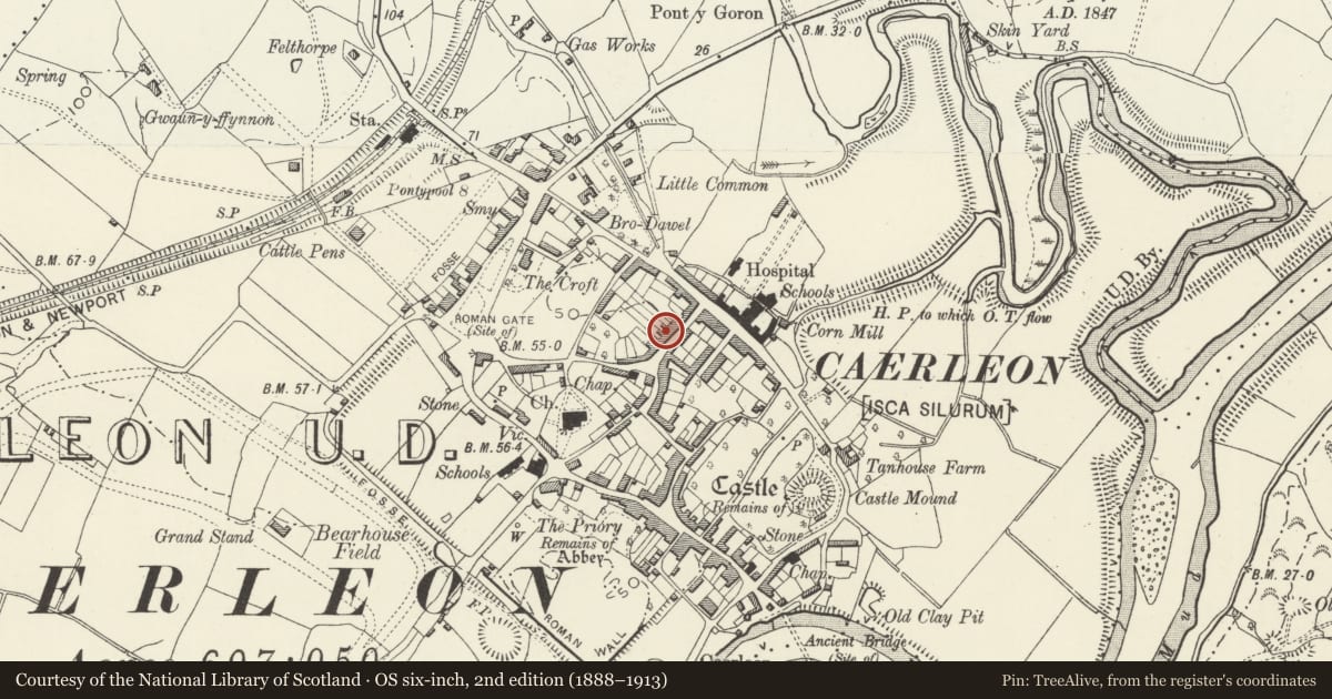
Slide toward Today to fade the historical sheet and see the modern map underneath.
David Rumsey Map Collection, Stanford LibrariesDavid Rumsey Map Collection, Stanford LibrariesDavid Rumsey Map Collection, Stanford LibrariesDavid Rumsey Map Collection, Stanford LibrariesDavid Rumsey Map Collection, Stanford Libraries
5 historical maps cover this location, the earliest the 1636 map "Cornubia : Devonia, Somersetus, Dorcestria, Wiltonia, Glocestria ..." (David Rumsey Map Collection, Stanford Libraries).
Historical maps covering this location
- 1636 · Cornubia : Devonia, Somersetus, Dorcestria, Wiltonia, Glocestria ... (David Rumsey Map Collection, Stanford Libraries)
- 1830 · V.3:11-15:XV.Britisches Reich. A. Kon: England. a. England ab sich: Shire:15-17, 33 (David Rumsey Map Collection, Stanford Libraries)
- 1895 · Sheet 11. Ordnance Survey of England and Wales. (David Rumsey Map Collection, Stanford Libraries)
- 1906 · 249 Newport (Hills) (David Rumsey Map Collection, Stanford Libraries)
- 1913 · Sheet 102. Newport. (David Rumsey Map Collection, Stanford Libraries)
Cadw's description
Location
About 150m north east of the Church of St Cadoc.
History
An early/mid C19 house which externally has been little altered since building.
Exterior
The building is roughcast rendered throughout, presumably over local rubble stone, with Welsh slate roofs, pantiles to the kitchen wing, red ridge tiles and red brick stack. Two storey central entrance plan with rear wing projecting to form an L-shape. The street elevation has a central panelled door with pilastered surround and blocked semi-circular fanlight. Three plain sash windows with 6 over 6 pane sashes. Plain roof with gable ends and ridge stack on left hand gable. The right hand return gable has a modern window with top light on the ground floor. The rear wing has another modern window on the ground floor but is otherwise blind. The single storey kitchen wing projecting beyond that is also blind and has a stack on the end gable.
Interior
Not inspected at time of resurvey.
Reason for designation
Included as an early/mid C19 house which forms a group with Nos 6 and 7.
Nearby in the register
- 6&7 Backhall StreetDomesticunder 1 mi
- The Red Lion PHDomesticunder 1 mi
- 27 Backhall StreetDomesticunder 1 mi
- The HallEducationunder 1 mi
Other entries of the same register within about three miles of this one, by straight line.