Cof Cymru: National Historic Assets of Wales · Wales
Old Turnpike Cottage
Llanvaches, Newport, Wales
A Grade II listed building in Llanvaches, Newport, designated on 1 March 1963.
The record
- Designation
- Listed building, Grade II
- Broad class
- Transport
- Date of designation
- 1 March 1963
- Locality
- Llanvaches
- Community
- Llanvaches
- Unitary authority
- Newport
- Country
- Wales
- Coordinates
- 51.61688, -2.82698
- Cadw reference
- 2925
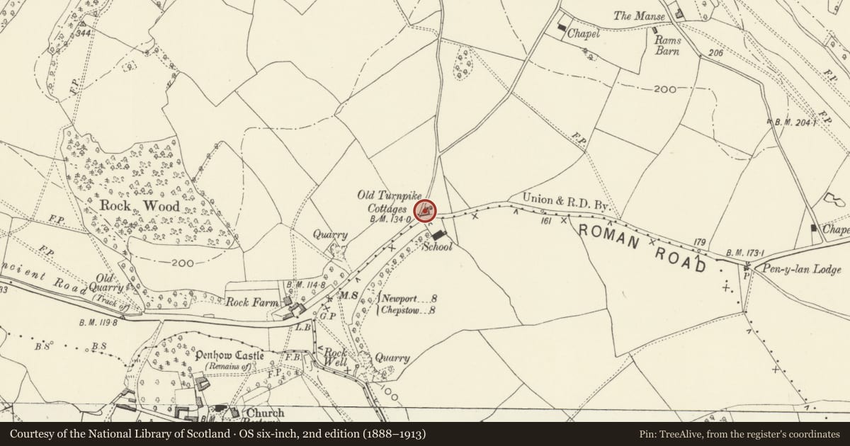
Slide toward Today to fade the historical sheet and see the modern map underneath.
David Rumsey Map Collection, Stanford LibrariesDavid Rumsey Map Collection, Stanford LibrariesDavid Rumsey Map Collection, Stanford LibrariesDavid Rumsey Map Collection, Stanford LibrariesDavid Rumsey Map Collection, Stanford Libraries
5 historical maps cover this location, the earliest the 1636 map "Cornubia : Devonia, Somersetus, Dorcestria, Wiltonia, Glocestria ..." (David Rumsey Map Collection, Stanford Libraries).
Historical maps covering this location
- 1636 · Cornubia : Devonia, Somersetus, Dorcestria, Wiltonia, Glocestria ... (David Rumsey Map Collection, Stanford Libraries)
- 1895 · Sheet 11. Ordnance Survey of England and Wales. (David Rumsey Map Collection, Stanford Libraries)
- 1897 · 250 Chepstow (Outline) (David Rumsey Map Collection, Stanford Libraries)
- 1905 · 250 Chepstow (Hills) (David Rumsey Map Collection, Stanford Libraries)
- 1913 · Sheet 102. Newport. (David Rumsey Map Collection, Stanford Libraries)
Cadw's description
Location
Prominently located at road junction of Pike Road and the lane leading NE from the A48 to the village of Llanvaches.
Exterior
Early C19 two storey cottage, formerly a turnpike house with Picturesque Gothick treatment to the front. White painted, rendered elevations, slated, hipped roof with wide overhanging eaves and brick chimney stack at junction of the hipped and ridged roof on the E side. Projecting two storey range to S elevation, breaking forward of the adjoining terrace, comprising a two storey, canted bay beneath hipped slated roof. Single lancets, one per floor on each splayed face, with timber two-centred doorway set in S face. Blank rendered wall above the pointed doorway would formerly have carried a noticeboard advertising the toll charges. Two small square-headed timber casements to W elevation. To rear, lean-to and later flat roofed extension with small casement to first floor.
Interior
Not available for inspection at time of resurvey ( July 1995).
Reason for designation
Included notwithstanding modern alterations as a surviving example of an early C19 toll cottage.
Nearby in the register
- Former Stables to The Rock and Fountain Inn PHDomesticunder 1 mi
- The Rock and Fountain Inn PHCommercialunder 1 mi
- Penhow CastleDefenceunder 1 mi
- Parish Church of St John the BaptistReligious, Ritual and Funeraryunder 1 mi
Other entries of the same register within about three miles of this one, by straight line.