Cof Cymru: National Historic Assets of Wales · Wales
34 Brecon Road
Abergavenny, Monmouthshire, Wales
A Grade II listed building in Abergavenny, Monmouthshire, designated on 10 October 1988.
The record
- Designation
- Listed building, Grade II
- Broad class
- Commercial
- Date of designation
- 10 October 1988
- Locality
- Abergavenny
- Town
- Abergavenny
- Community
- Abergavenny
- Unitary authority
- Monmouthshire
- Country
- Wales
- Coordinates
- 51.82489, -3.02556
- Cadw reference
- 2796
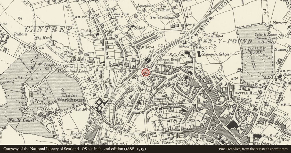
Slide toward Today to fade the historical sheet and see the modern map underneath.
David Rumsey Map Collection, Stanford LibrariesDavid Rumsey Map Collection, Stanford LibrariesDavid Rumsey Map Collection, Stanford LibrariesDavid Rumsey Map Collection, Stanford LibrariesDavid Rumsey Map Collection, Stanford Libraries
5 historical maps cover this location, the earliest the 1636 map "Cornubia : Devonia, Somersetus, Dorcestria, Wiltonia, Glocestria ..." (David Rumsey Map Collection, Stanford Libraries).
Historical maps covering this location
- 1636 · Cornubia : Devonia, Somersetus, Dorcestria, Wiltonia, Glocestria ... (David Rumsey Map Collection, Stanford Libraries)
- 1856 · 42. Brecon. (David Rumsey Map Collection, Stanford Libraries)
- 1898 · 232 Abergavenny (Hills) (David Rumsey Map Collection, Stanford Libraries)
- 1898 · 232 Abergavenny (Outline) (David Rumsey Map Collection, Stanford Libraries)
- 1901 · Sheet 14. (David Rumsey Map Collection, Stanford Libraries)
Cadw's description
Location
Set at an angle at the junction of Commercial Street with Brecon Road.
History
Early to mid C19 house with shop. The difference in the arrangement of the windows suggests that the house was built in two parts, but clearly closely contemporary. It is not shown on Wood's map of 1834 and does not appear to be shown on the 1844 Tithe Map.
Exterior
Wholly rendered and painted with a natural slate roof with red brick chimneys. Double depth plan with shop to right and house to left and over. Two storeys, four windows. The ground floor has a double shop front to right with overall cornice, simple pilasters, 6-pane shop windows and recessed centre 6-panel door with four panels glazed. Similar pilastered surround to recessed 6-panel house door on left, with a 6 over 6 pane sash to left of this. Four 6 over 6 pane sash windows in plain reveals above. The left hand windows are set both deeper and more closely together. Plain eaves, moderately pitched roof with rebuilt gable stacks. Right return has first floor rear window.
Rear elevation not inspected.
Interior
Interior not inspected at resurvey.
Reason for designation
Included for its special interest as a prominently sited example of late Georgian style domestic building which has retained its character.
Nearby in the register
- Telephone Call-box at junction with Chapel RoadCommunicationsunder 1 mi
- 24 Brecon RoadDomesticunder 1 mi
- 22 Brecon RoadDomesticunder 1 mi
- 20 Brecon RoadCommercialunder 1 mi
Other entries of the same register within about three miles of this one, by straight line.