Cof Cymru: National Historic Assets of Wales · Wales
26 Lower Church Street
Chepstow, Monmouthshire, Wales
A Grade II listed building in Chepstow, Monmouthshire, designated on 23 November 1983.
The record
- Designation
- Listed building, Grade II
- Broad class
- Domestic
- Date of designation
- 23 November 1983
- Locality
- Chepstow
- Town
- Chepstow
- Community
- Chepstow
- Unitary authority
- Monmouthshire
- Country
- Wales
- Coordinates
- 51.64426, -2.67046
- Cadw reference
- 2764
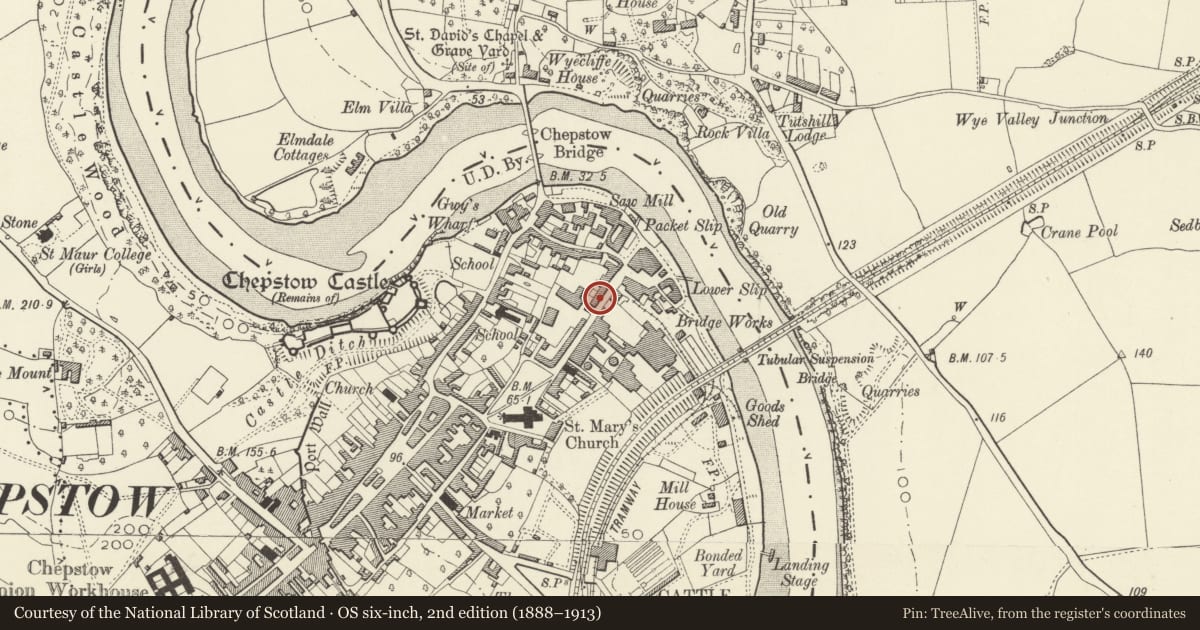
Slide toward Today to fade the historical sheet and see the modern map underneath.
David Rumsey Map Collection, Stanford LibrariesDavid Rumsey Map Collection, Stanford LibrariesDavid Rumsey Map Collection, Stanford LibrariesDavid Rumsey Map Collection, Stanford LibrariesDavid Rumsey Map Collection, Stanford Libraries
5 historical maps cover this location, the earliest the 1636 map "Cornubia : Devonia, Somersetus, Dorcestria, Wiltonia, Glocestria ..." (David Rumsey Map Collection, Stanford Libraries).
Historical maps covering this location
- 1636 · Cornubia : Devonia, Somersetus, Dorcestria, Wiltonia, Glocestria ... (David Rumsey Map Collection, Stanford Libraries)
- 1830 · V.3:11-15:XV.Britisches Reich. A. Kon: England. a. England ab sich: Shire:15-17, 33 (David Rumsey Map Collection, Stanford Libraries)
- 1895 · Sheet 11. Ordnance Survey of England and Wales. (David Rumsey Map Collection, Stanford Libraries)
- 1897 · 250 Chepstow (Outline) (David Rumsey Map Collection, Stanford Libraries)
- 1905 · 250 Chepstow (Hills) (David Rumsey Map Collection, Stanford Libraries)
Cadw's description
Location
Within the bottom terrace in the lower part of the street.
History
Early C19. Original list description (1975) refers to vestiges of pilaster round door.
Exterior
Terraced cottage, the upper end of the lowest group of 4; attached at upper end to a separate range with lower ridge line. Rendered and painted; Welsh slate roof, shared brick end stack. Two storeys, single window range, a 12-pane horizontal sliding sash with cambered head over a 12-pane double-hung sash with exposed frame; to left is 6-panelled door in bead-mould frame.
Interior
Interior reported as retaining tight spiral stair, original doors and gas light in kitchen.
Reason for designation
Listed as retaining its original early C19 design in the context of similar buildings which have been more extensively modified.
Nearby in the register
- Telephone Call-box opposite No. 26 Lower Church StreetCommunicationsunder 1 mi
- Nos. 13&14 Lower Church Street including forecourt railingsDomesticunder 1 mi
- Comice HouseCommercialunder 1 mi
- 12 Lower Church Street including railingsDomesticunder 1 mi
Other entries of the same register within about three miles of this one, by straight line.