Cof Cymru: National Historic Assets of Wales · Wales
The King's Head PH
Chepstow, Monmouthshire, Wales
A Grade II listed building in Chepstow, Monmouthshire, designated on 12 November 2002.
The record
- Designation
- Listed building, Grade II
- Broad class
- Commercial
- Date of designation
- 12 November 2002
- Locality
- Chepstow
- Town
- Chepstow
- Community
- Chepstow
- Unitary authority
- Monmouthshire
- Country
- Wales
- Coordinates
- 51.64098, -2.67710
- Cadw reference
- 27102
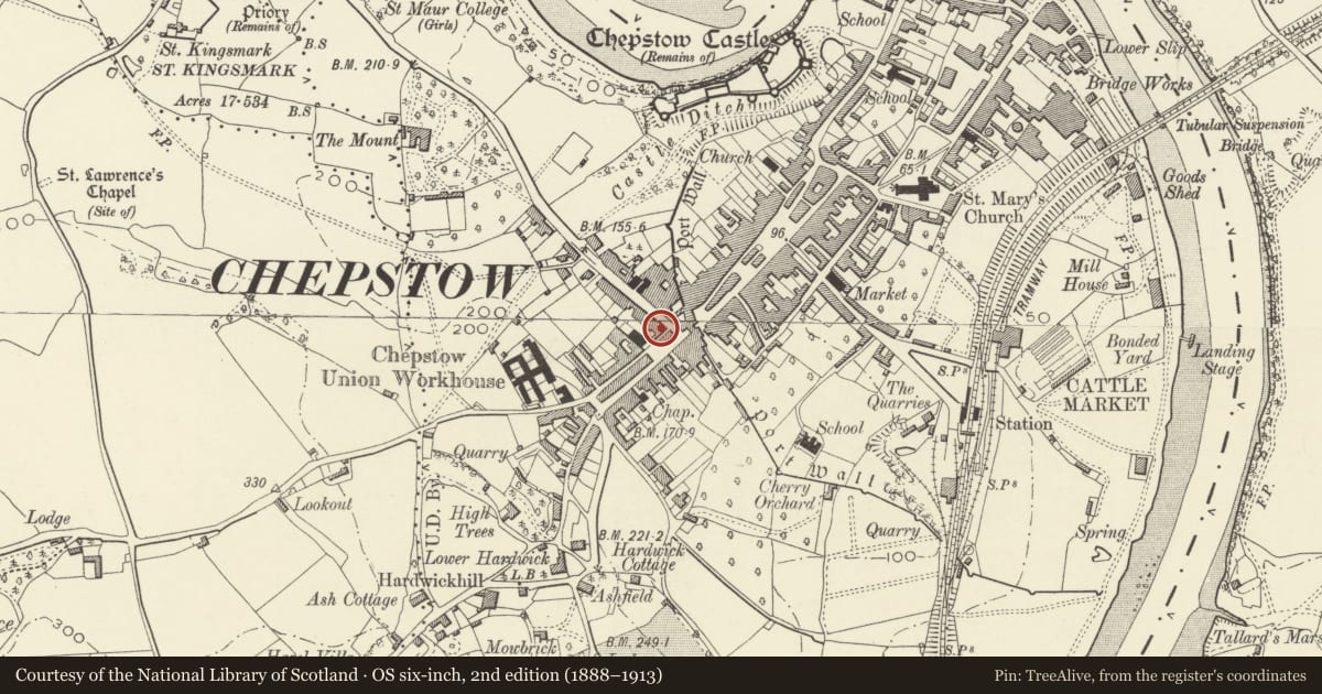
Slide toward Today to fade the historical sheet and see the modern map underneath.
David Rumsey Map Collection, Stanford LibrariesDavid Rumsey Map Collection, Stanford LibrariesDavid Rumsey Map Collection, Stanford LibrariesDavid Rumsey Map Collection, Stanford LibrariesDavid Rumsey Map Collection, Stanford Libraries
5 historical maps cover this location, the earliest the 1636 map "Cornubia : Devonia, Somersetus, Dorcestria, Wiltonia, Glocestria ..." (David Rumsey Map Collection, Stanford Libraries).
Historical maps covering this location
- 1636 · Cornubia : Devonia, Somersetus, Dorcestria, Wiltonia, Glocestria ... (David Rumsey Map Collection, Stanford Libraries)
- 1830 · V.3:11-15:XV.Britisches Reich. A. Kon: England. a. England ab sich: Shire:15-17, 33 (David Rumsey Map Collection, Stanford Libraries)
- 1895 · Sheet 11. Ordnance Survey of England and Wales. (David Rumsey Map Collection, Stanford Libraries)
- 1897 · 250 Chepstow (Outline) (David Rumsey Map Collection, Stanford Libraries)
- 1905 · 250 Chepstow (Hills) (David Rumsey Map Collection, Stanford Libraries)
Cadw's description
Location
Very near Town Gate and adjacent to the listed range on the corner of Moor Street.
History
Rebuilt 1907 after a fire.
Exterior
Hotel, public house in baroque style. Walls of stone and some brick roughcast rendered to front and painted black and white; hipped slate roof with tall brick off-ridge stack; overhanging eaves with modillion cornice. Three storeys. 4-window front. Top floor has 6-pane sashes with painted plain architrave and continuous moulded sillband; first floor has 12-pane sashes with painted corniced surround and continuous sillband. Ground floor is black painted with channelled rustication; a central entrance with eared doorway and coat of arms above in a foliated frame; heavy moulded and swept hood supported on enriched Ionic columns and surmounted on either side by large cartouches. Recessed semicircular windows either side with small-pane upper lights; sash window end left; very deep plinth.
Reason for designation
Listed as a major town-centre building in a particularly prominent position. Group value with other listed buildings round the Town Gate.
Nearby in the register
- 22, 23&23aCommercialunder 1 mi
- 21 Welsh StreetCommercialunder 1 mi
- Chepstow Methodist ChurchReligious, Ritual and Funeraryunder 1 mi
- Town Gate HouseDomesticunder 1 mi
Other entries of the same register within about three miles of this one, by straight line.