Cof Cymru: National Historic Assets of Wales · Wales
Lime Kilns
Llansteffan, Carmarthenshire, Wales
A Grade II listed building in Laques, Carmarthen, Llansteffan, Carmarthenshire, designated on 5 November 2002.
The record
- Designation
- Listed building, Grade II
- Broad class
- Industrial
- Date of designation
- 5 November 2002
- Locality
- Laques
- Town
- Carmarthen
- Community
- Llansteffan
- Unitary authority
- Carmarthenshire
- Country
- Wales
- Coordinates
- 51.76495, -4.42683
- Cadw reference
- 27082
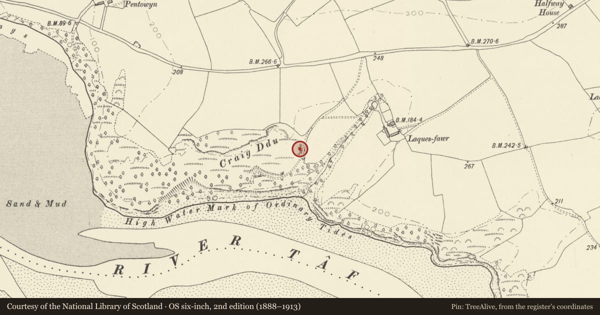
Slide toward Today to fade the historical sheet and see the modern map underneath.
David Rumsey Map Collection, Stanford LibrariesDavid Rumsey Map Collection, Stanford LibrariesDavid Rumsey Map Collection, Stanford LibrariesDavid Rumsey Map Collection, Stanford LibrariesDavid Rumsey Map Collection, Stanford Libraries
5 historical maps cover this location, the earliest the 1636 map "Cornubia : Devonia, Somersetus, Dorcestria, Wiltonia, Glocestria ..." (David Rumsey Map Collection, Stanford Libraries).
Historical maps covering this location
- 1636 · Cornubia : Devonia, Somersetus, Dorcestria, Wiltonia, Glocestria ... (David Rumsey Map Collection, Stanford Libraries)
- 1860 · 41. Caermathen. (David Rumsey Map Collection, Stanford Libraries)
- 1891 · Sheet 10. Ordnance Survey of England and Wales. . (David Rumsey Map Collection, Stanford Libraries)
- 1898 · 229 Carmarthen (Hills) (David Rumsey Map Collection, Stanford Libraries)
- 1920 · Sheet 100. Llanelly. (David Rumsey Map Collection, Stanford Libraries)
Cadw's description
Location
On an overgrown terrace overlooking the sea, some 0.25km S of the Llansteffan-Pentowyn Road, and approximately 0.25km SW of Laques Fawr Farm.
History
Set of three connected coastal limekilns, probably earlier to mid C19, an indication with the other surviving lime-kiln of the scale of lime production in the area.
Exterior
Series of three connected rubble stone limekilns, built into terrace bank, of probable C19 date. Two kilns arranged on a single line, with a projecting third kiln to the N. Battered walls with cut stone voussoirs to arched headed openings - one to each kiln on the flat wall, one to N and S side of the projecting, rounded kiln. Main crucible still open, but densely overgrown and in a state of collapse at the time of inspection.
Reason for designation
Included for the unusual form and arrangement of three attached kilns, with unblocked crucible.
Nearby in the register
- LaquesDomesticunder 1 mi
- Lord's ParkDomesticunder 1 mi
- St Anthony's WellReligious, Ritual and Funerary1 mi
- Fron Ucha Burial ChamberChambered Tomb1 mi
Other entries of the same register within about three miles of this one, by straight line.