Cof Cymru: National Historic Assets of Wales · Wales
Milestone
Llansteffan, Carmarthenshire, Wales
A Grade II listed building in Llansteffan, Carmarthen, Carmarthenshire, designated on 5 November 2002.
The record
- Designation
- Listed building, Grade II
- Broad class
- Miscellaneous
- Date of designation
- 5 November 2002
- Locality
- Llansteffan
- Town
- Carmarthen
- Community
- Llansteffan
- Unitary authority
- Carmarthenshire
- Country
- Wales
- Coordinates
- 51.77278, -4.39024
- Cadw reference
- 27077
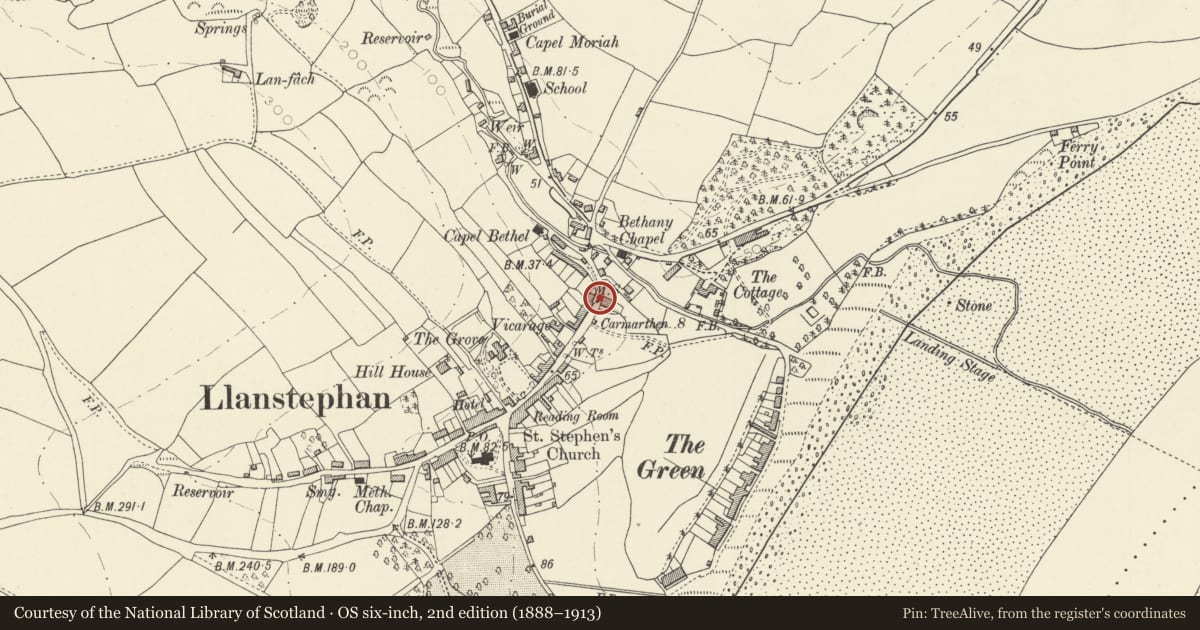
Slide toward Today to fade the historical sheet and see the modern map underneath.
David Rumsey Map Collection, Stanford LibrariesDavid Rumsey Map Collection, Stanford LibrariesDavid Rumsey Map Collection, Stanford LibrariesDavid Rumsey Map Collection, Stanford LibrariesDavid Rumsey Map Collection, Stanford Libraries
5 historical maps cover this location, the earliest the 1636 map "Cornubia : Devonia, Somersetus, Dorcestria, Wiltonia, Glocestria ..." (David Rumsey Map Collection, Stanford Libraries).
Historical maps covering this location
- 1636 · Cornubia : Devonia, Somersetus, Dorcestria, Wiltonia, Glocestria ... (David Rumsey Map Collection, Stanford Libraries)
- 1860 · 41. Caermathen. (David Rumsey Map Collection, Stanford Libraries)
- 1891 · Sheet 10. Ordnance Survey of England and Wales. . (David Rumsey Map Collection, Stanford Libraries)
- 1898 · 229 Carmarthen (Hills) (David Rumsey Map Collection, Stanford Libraries)
- 1920 · Sheet 100. Llanelly. (David Rumsey Map Collection, Stanford Libraries)
Cadw's description
Location
Set in retaining wall at the NW side of High Street, opposite Melrose House.
History
Late C18 or early C19 cast-iron mileplate reset into stone retaining wall.
Exterior
Cast iron mileplate, reset into modern cut stone retaining wall. Painted cast plate inscribed 'To Carmarthen 8' in crude lettering. Benchmark beneath lettering.
Reason for designation
Included for its special historic interest as a good early cast-iron milepost.
Nearby in the register
- Nolands, including forecourt railings.Domesticunder 1 mi
- Albion House, including forecourt railingsDomesticunder 1 mi
- CartrefDomesticunder 1 mi
- The StoresCommercialunder 1 mi
Other entries of the same register within about three miles of this one, by straight line.