Cof Cymru: National Historic Assets of Wales · Wales
Plas-y-Coed
Llansteffan, Carmarthenshire, Wales
A Grade II listed building in Llansteffan, Carmarthen, Carmarthenshire, designated on 5 November 2002.
The record
- Designation
- Listed building, Grade II
- Broad class
- Domestic
- Date of designation
- 5 November 2002
- Locality
- Llansteffan
- Town
- Carmarthen
- Community
- Llansteffan
- Unitary authority
- Carmarthenshire
- Country
- Wales
- Coordinates
- 51.77015, -4.39248
- Cadw reference
- 27065
Slide toward Today to fade the historical sheet and see the modern map underneath.
David Rumsey Map Collection, Stanford LibrariesDavid Rumsey Map Collection, Stanford LibrariesDavid Rumsey Map Collection, Stanford LibrariesDavid Rumsey Map Collection, Stanford LibrariesDavid Rumsey Map Collection, Stanford Libraries
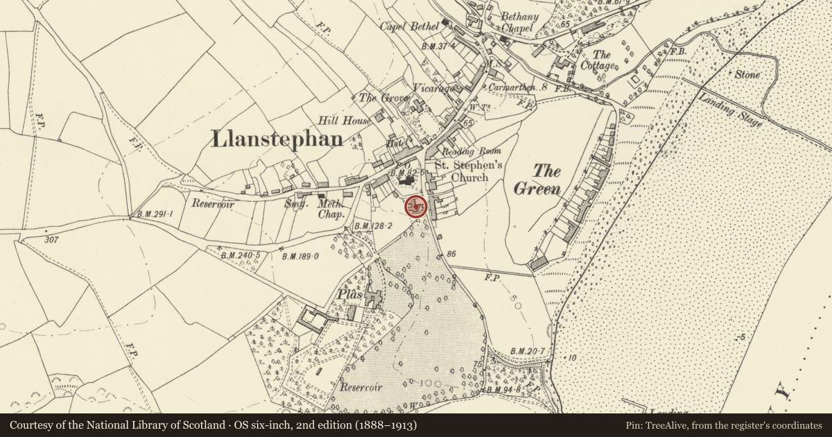
5 historical maps cover this location, the earliest the 1636 map "Cornubia : Devonia, Somersetus, Dorcestria, Wiltonia, Glocestria ..." (David Rumsey Map Collection, Stanford Libraries).
Historical maps covering this location
- 1636 · Cornubia : Devonia, Somersetus, Dorcestria, Wiltonia, Glocestria ... (David Rumsey Map Collection, Stanford Libraries)
- 1860 · 41. Caermathen. (David Rumsey Map Collection, Stanford Libraries)
- 1891 · Sheet 10. Ordnance Survey of England and Wales. . (David Rumsey Map Collection, Stanford Libraries)
- 1898 · 229 Carmarthen (Hills) (David Rumsey Map Collection, Stanford Libraries)
- 1920 · Sheet 100. Llanelly. (David Rumsey Map Collection, Stanford Libraries)
Cadw's description
Location
Set well back from the street, situated beyond a lawned forecourt with decorative railings, immediately S of Park Villa.
History
Later C19 detached house possibly built by David Jenkins, builder, of Llansteffan in 1874. It was probably occupied by Mary James, farmer, in 1881. One of a pair of villas with Park House adjoining.
Exterior
House, unpainted roughcast and stucco with hipped slate eaves roof and red brick end stacks. Two storeys, three-window facade with channelled piers to angles and matching jambs to first floors windows, the heads with incised voussoirs. Sash windows with marginal glazing bars and slate sills. Ground floor 4-panel door with rectangular overlight in wide timber doorcase with cornice on console brackets. Flanking ground floor bays have 3-sided canted bay windows with dwarf stucco walls beneath continuous stone sills and sashes with marginal glazing bars. Hipped slate roofs.
Interior
Not inspected.
Reason for designation
Included as a good late C19 villa of definite quality and character forming a pair with Park View.
Nearby in the register
- Park VillaDomesticunder 1 mi
- Railings and area walls at Plas-y-Coed and Park Villa.Domesticunder 1 mi
- Cyncoed, including area railings.Domesticunder 1 mi
- Osbourne House, including area railings.Domesticunder 1 mi
Other entries of the same register within about three miles of this one, by straight line.