Cof Cymru: National Historic Assets of Wales · Wales
Buarth-bachog
Llanfihangel, Powys, Wales
A Grade II listed building in Capel Saron, Llanfihangel, Powys, designated on 25 October 2002.
The record
- Designation
- Listed building, Grade II
- Broad class
- Agriculture and Subsistence
- Date of designation
- 25 October 2002
- Locality
- Capel Saron
- Community
- Llanfihangel
- Unitary authority
- Powys
- Country
- Wales
- Coordinates
- 52.69768, -3.38222
- Cadw reference
- 27034
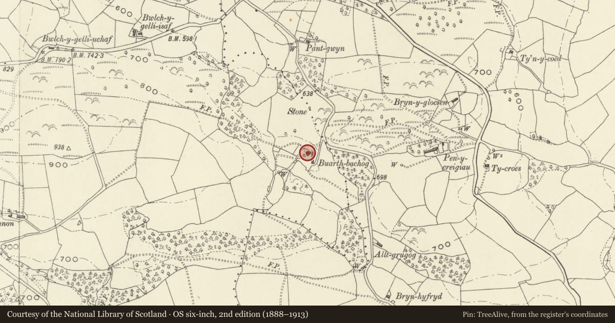
Slide toward Today to fade the historical sheet and see the modern map underneath.
David Rumsey Map Collection, Stanford LibrariesDavid Rumsey Map Collection, Stanford LibrariesLlyfrgell Genedlaethol Cymru – The National Library of WalesDavid Rumsey Map Collection, Stanford LibrariesDavid Rumsey Map Collection, Stanford Libraries
5 historical maps cover this location, the earliest the 1637 map "Particular description of Wales. Cambria seu Wallia" (David Rumsey Map Collection, Stanford Libraries).
Historical maps covering this location
- 1637 · Particular description of Wales. Cambria seu Wallia (David Rumsey Map Collection, Stanford Libraries)
- 1795 · To Sir Watkin Williams-Wynn Bart ... the map of the six counties of North Wales is most… (Llyfrgell Genedlaethol Cymru – The National Library of Wales)
- 1883 · Watershed map England, Wales 3. (David Rumsey Map Collection, Stanford Libraries)
- 1899 · 150 Dinas-Mawddwy (Hills) (David Rumsey Map Collection, Stanford Libraries)
- 1901 · Sheet 9 and 10. (David Rumsey Map Collection, Stanford Libraries)
Cadw's description
Location
In a small farmyard to west side of a minor road about ½ km south of the village of Dolanog. Small enclosure at front with rubble drystone wall and gate.
History
An C18 or possibly early C19 farmhouse; in 1849 Buarth-bachog was recorded as a farm of about 70 acres (28 hectares) tenanted by Thomas Hughes, the property of the Rev. John Meredith Williams.
Exterior
A two-storey, two-window farmhouse of lobby-entry plan type, built in local axe-dressed uncoursed masonry, with roof of small slates, tile ridge, and single stone chimney, facing south-east to its farmyard. The small slates survive on the front elevation and the upper part of the rear. Single storey rear lean-to added in similar materials but with tall brick chimney stack; small porch in the angle between this extension and the original house. Sheds at left end, overgrown.
The front elevation has the main door at left against the chimney, and three-light windows with iron opening lights. Segmental brick arches to the lower openings.
The rear and right gable are painted cream. Two two-light windows in the gable elevation; three-light small-pane windows in the rear extension.
Interior
Two-unit plan typical of many small farmhouses and cottages in Montgomeryshire, with lobby entrance against its end-chimney.
Reason for designation
A good example of a small farmhouse of typical local type which has retained its character, and is accompanied by its farm range.
Nearby in the register
- Buarth-bachog Agricultural RangeAgriculture and Subsistenceunder 1 mi
- Old Pont DolanogTransportunder 1 mi
- Ty Efyrnwy (former Vicarage) including Coach HouseDomesticunder 1 mi
- Cowhouse Range at Mill Farm (Felin Dolanog)Agriculture and Subsistenceunder 1 mi
Other entries of the same register within about three miles of this one, by straight line.