Cof Cymru: National Historic Assets of Wales · Wales
Dovecote at Glyn Arthur
Llandyrnog, Denbighshire, Wales
A Grade II listed building in Llangwyfan, Llandyrnog, Denbighshire, designated on 22 October 2002.
The record
- Designation
- Listed building, Grade II
- Broad class
- Domestic
- Date of designation
- 22 October 2002
- Locality
- Llangwyfan
- Community
- Llandyrnog
- Unitary authority
- Denbighshire
- Country
- Wales
- Coordinates
- 53.18109, -3.29534
- Cadw reference
- 27022
Slide toward Today to fade the historical sheet and see the modern map underneath.
David Rumsey Map Collection, Stanford LibrariesDavid Rumsey Map Collection, Stanford LibrariesDavid Rumsey Map Collection, Stanford LibrariesLlyfrgell Genedlaethol Cymru – The National Library of WalesDavid Rumsey Map Collection, Stanford Libraries
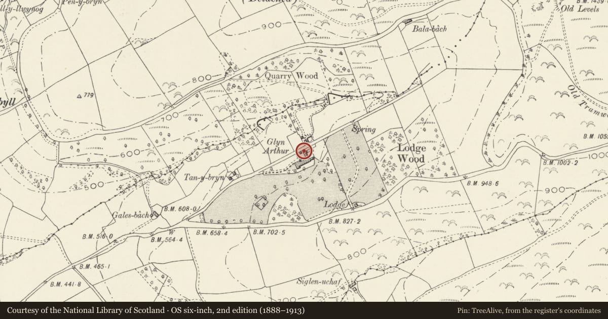
5 historical maps cover this location, the earliest the 1795 map "To Sir Watkin Williams-Wynn Bart ... the map of the six counties of North Wales is most humbly inscribed by his obedient humble servant" (Llyfrgell Genedlaethol Cymru – The National Library of Wales).
Historical maps covering this location
- 1795 · To Sir Watkin Williams-Wynn Bart ... the map of the six counties of North Wales is most… (Llyfrgell Genedlaethol Cymru – The National Library of Wales)
- 1883 · Watershed map England, Wales 3. (David Rumsey Map Collection, Stanford Libraries)
- 1898 · 108 Flint (Hills) (David Rumsey Map Collection, Stanford Libraries)
- 1898 · 108 Flint (Outline) (David Rumsey Map Collection, Stanford Libraries)
- 1901 · Sheet 9 and 10. (David Rumsey Map Collection, Stanford Libraries)
Cadw's description
Location
At north side of the domestic yard adjacent to Glyn Arthur
History
probably C19.
Exterior
A brick dovecote about 5 m square with a pryamidical slate roof surmounted by an iron weathervane. Beneath is an arch allowing the yard to drain into the lane to the north. In the face towards the farmyard there is a central window with a pointed brickwork arch and 2 lights separated by a Y mullion. Boarded door to right, small flight holes. Lean-to trailer shelter at right.
Reason for designation
Listed for group value with Glyn Arthur
Nearby in the register
- Cartshed at Glyn ArthurDomesticunder 1 mi
- Domestic outbuilding at Glyn ArthurDomesticunder 1 mi
- Barn at Glyn ArthurDomesticunder 1 mi
- Glyn ArthurDomesticunder 1 mi
Other entries of the same register within about three miles of this one, by straight line.