Cof Cymru: National Historic Assets of Wales · Wales
Pen-yr-erw
Nannerch, Flintshire, Wales
A Grade II listed building in Pen-y-felin, Nannerch, Flintshire, designated on 30 August 2002.
The record
- Designation
- Listed building, Grade II
- Broad class
- Domestic
- Date of designation
- 30 August 2002
- Locality
- Pen-y-felin
- Community
- Nannerch
- Unitary authority
- Flintshire
- Country
- Wales
- Coordinates
- 53.22081, -3.26675
- Cadw reference
- 26918
Slide toward Today to fade the historical sheet and see the modern map underneath.
David Rumsey Map Collection, Stanford LibrariesDavid Rumsey Map Collection, Stanford LibrariesDavid Rumsey Map Collection, Stanford LibrariesDavid Rumsey Map Collection, Stanford LibrariesLlyfrgell Genedlaethol Cymru – The National Library of Wales
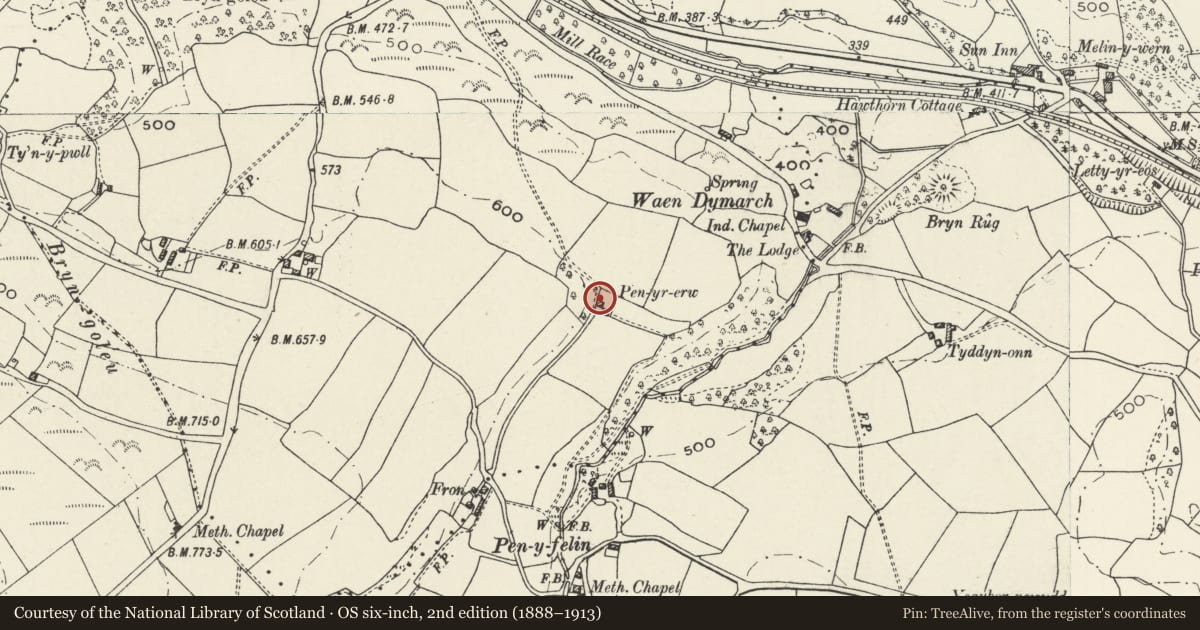
5 historical maps cover this location, the earliest the 1795 map "To Sir Watkin Williams-Wynn Bart ... the map of the six counties of North Wales is most humbly inscribed by his obedient humble servant" (Llyfrgell Genedlaethol Cymru – The National Library of Wales).
Historical maps covering this location
- 1795 · To Sir Watkin Williams-Wynn Bart ... the map of the six counties of North Wales is most… (Llyfrgell Genedlaethol Cymru – The National Library of Wales)
- 1883 · Watershed map England, Wales 3. (David Rumsey Map Collection, Stanford Libraries)
- 1898 · 108 Flint (Hills) (David Rumsey Map Collection, Stanford Libraries)
- 1898 · 108 Flint (Outline) (David Rumsey Map Collection, Stanford Libraries)
- 1901 · Sheet 9 and 10. (David Rumsey Map Collection, Stanford Libraries)
Cadw's description
Location
An isolated cottage approximately 1.2km WNW of Nannerch village, reached by public footpath N of Pen-y-felin.
History
An early C19 labourer's cottage shown on the 1849 Tithe map. The attached outbuilding is first shown in its present form on the 1899 Ordnance Survey.
Exterior
A single-unit cube-plan cottage with integral rear outshut under a catslide roof, of whitened rubble stone and slate roof with a stone stack to the L heightened in brick. The doorway to the R has a boarded door. To its L a casement window under a segmental head replaced in an original opening. The upper storey has a 4-pane horizontal sliding sash window beneath the eaves. In the L gable end is segmental-headed opening to the outshut, with shutter. In the R gable end is an L-shaped outbuilding continuous with the outshut, of rubble stone with slate and corrugated iron roof. The rear of the cottage is built into the bank.
Reason for designation
Listed as a rare surviving cube-plan rural labourer's cottage, a type once familiar in Wales, retaining C19 character and detail.
Nearby in the register
- Pen-y-GarneddDomesticunder 1 mi
- Melin-y-wernIndustrialunder 1 mi
- Swan CottageDomesticunder 1 mi
- GledlomDomesticunder 1 mi
Other entries of the same register within about three miles of this one, by straight line.