Cof Cymru: National Historic Assets of Wales · Wales
Mold Lodge
Nannerch, Flintshire, Wales
A Grade II listed building in Penbedw, Nannerch, Flintshire, designated on 30 August 2002.
The record
- Designation
- Listed building, Grade II
- Broad class
- Domestic
- Date of designation
- 30 August 2002
- Locality
- Penbedw
- Community
- Nannerch
- Unitary authority
- Flintshire
- Country
- Wales
- Coordinates
- 53.20182, -3.23881
- Cadw reference
- 26914
Slide toward Today to fade the historical sheet and see the modern map underneath.
David Rumsey Map Collection, Stanford LibrariesDavid Rumsey Map Collection, Stanford LibrariesDavid Rumsey Map Collection, Stanford LibrariesDavid Rumsey Map Collection, Stanford LibrariesLlyfrgell Genedlaethol Cymru – The National Library of Wales
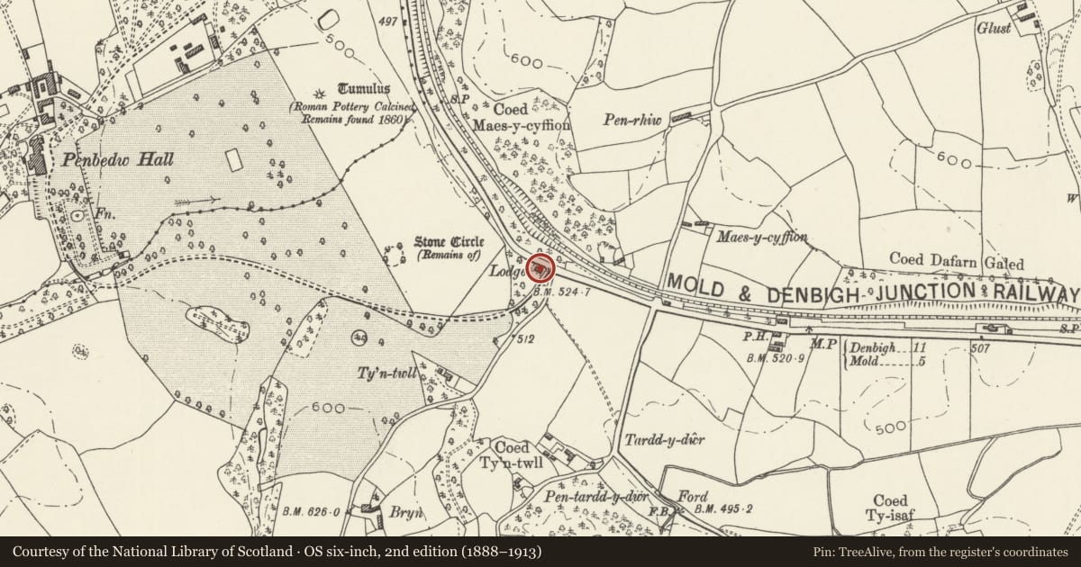
5 historical maps cover this location, the earliest the 1795 map "To Sir Watkin Williams-Wynn Bart ... the map of the six counties of North Wales is most humbly inscribed by his obedient humble servant" (Llyfrgell Genedlaethol Cymru – The National Library of Wales).
Historical maps covering this location
- 1795 · To Sir Watkin Williams-Wynn Bart ... the map of the six counties of North Wales is most… (Llyfrgell Genedlaethol Cymru – The National Library of Wales)
- 1883 · Watershed map England, Wales 3. (David Rumsey Map Collection, Stanford Libraries)
- 1898 · 108 Flint (Hills) (David Rumsey Map Collection, Stanford Libraries)
- 1898 · 108 Flint (Outline) (David Rumsey Map Collection, Stanford Libraries)
- 1901 · Sheet 9 and 10. (David Rumsey Map Collection, Stanford Libraries)
Cadw's description
Location
Set back from the road at the SE corner of the park at Penbedw, N of a junction with a minor road to Llandyrnog.
History
Penbedw was a Georgian country house purchased by William Barber Buddicom, an established railway engineer, in 1852. Improvements were made to the park soon after, including Mold Lodge and its adjacent gateway, which formed one of the main entrances to the park. The lodge is shown on the 1871 Ordnance Survey. The main house was demolished in 1958.
Exterior
A single-storey lodge with basement, comprising an L-shaped plan of main range with wing to the L, with porch clasped in the angle of the 2, and a short rear wing. Of snecked dressed stone and slate roof with stone stacks to the L-hand and rear wings. The asymmetrical porch has a splayed entrance and a parapet raised up above a round tablet with the Buddicom monogram 'WMB' in raised letters. The entrance has a shouldered lintel, and inside is a boarded door to the wing. On the wider R-hand facet is a small lintelled window, with a 2-pane sash window to the main range further R. The L-hand wing has, in its gable end, a canted bay window incorporating a pair of 2-pane sashes. The R gable end of the main range and the gable end of the rear wing also have paired 2-pane sash windows. At the rear, a lean-to in the angle with the main range has a boarded door in its end wall, to the R of which the main range has a segmental-headed basement door.
Interior
Not inspected.
Reason for designation
Listed as a well-preserved C19 lodge retaining original character in a prominent location.
Nearby in the register
- Gate piers, gate and flanking walls at Mold LodgeGardens, Parks and Urban Spacesunder 1 mi
- Penbedw Park Stone Circle & Standing StoneStone Circleunder 1 mi
- Round Barrow 450m E of Penbedw HallRound Barrowunder 1 mi
- Ty IsaDomesticunder 1 mi
Other entries of the same register within about three miles of this one, by straight line.