Cof Cymru: National Historic Assets of Wales · Wales
Old Cider House at Great Manson Farm
Monmouth, Monmouthshire, Wales
A Grade II listed building in Buckholt, Monmouth, Monmouthshire, designated on 28 August 2002.
The record
- Designation
- Listed building, Grade II
- Broad class
- Agriculture and Subsistence
- Date of designation
- 28 August 2002
- Locality
- Buckholt
- Town
- Monmouth
- Community
- Monmouth
- Unitary authority
- Monmouthshire
- Country
- Wales
- Coordinates
- 51.83649, -2.72867
- Cadw reference
- 26903
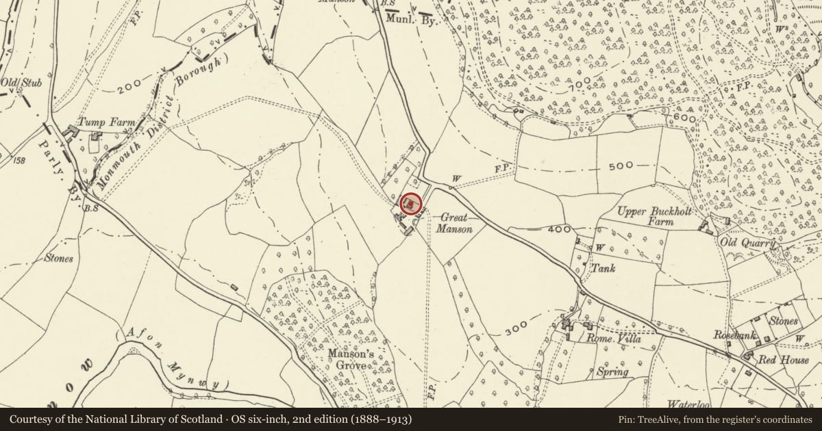
Slide toward Today to fade the historical sheet and see the modern map underneath.
David Rumsey Map Collection, Stanford LibrariesDavid Rumsey Map Collection, Stanford LibrariesDavid Rumsey Map Collection, Stanford LibrariesDavid Rumsey Map Collection, Stanford LibrariesDavid Rumsey Map Collection, Stanford Libraries
5 historical maps cover this location, the earliest the 1636 map "Cornubia : Devonia, Somersetus, Dorcestria, Wiltonia, Glocestria ..." (David Rumsey Map Collection, Stanford Libraries).
Historical maps covering this location
- 1636 · Cornubia : Devonia, Somersetus, Dorcestria, Wiltonia, Glocestria ... (David Rumsey Map Collection, Stanford Libraries)
- 1830 · V.3:11-15:XV.Britisches Reich. A. Kon: England. a. England ab sich: Shire:15-17, 33 (David Rumsey Map Collection, Stanford Libraries)
- 1895 · Sheet 11. Ordnance Survey of England and Wales. (David Rumsey Map Collection, Stanford Libraries)
- 1896 · 233 Monmouth (Hills) (David Rumsey Map Collection, Stanford Libraries)
- 1901 · Sheet 14. (David Rumsey Map Collection, Stanford Libraries)
Cadw's description
Location
Opposite front of farmhouse, about 2.5 km north of Monmouth, on south-west side of Manson Lane.
History
Datestone on gable end with letter 'C' and date '1763'. Perhaps formerly stables and later a granary. In use as a cider house until mid C20, and retains a circular stone and timber cider mill.
Exterior
Lofted cider house/granary. Coursed red sandstone rubble; roof covering mainly corrugated asbestos sheeting. Central camber-headed doorway (boarded door with strap hinges); camber-headed window to each side. Moderately pitched roof with catslide dormer to centre. Right gable end has stone steps up to camber-headed doorway with small window to its left. Coped gable. Small block with lower roof line at left end has tiled roof.
Interior
On ground floor, stone and timber cider mill. This was not seen at resurvey.
Reason for designation
Included for its special interest as an C18 cider house retaining rare cider mill, with group value with Great Manson farmhouse.
Nearby in the register
- Great Manson FarmhouseNo class recordedunder 1 mi
- Large Barn at Great Manson FarmAgriculture and Subsistenceunder 1 mi
- Buckholt Wood Hilltop EnclosureEnclosureunder 1 mi
- Buckholt Neolithic EnclosureEnclosureunder 1 mi
Other entries of the same register within about three miles of this one, by straight line.