Cof Cymru: National Historic Assets of Wales · Wales
Gates and railings at Capel Moriah
Llwchwr, Swansea, Wales
A Grade II listed building in Llwchwr, Swansea, designated on 6 August 2002.
The record
- Designation
- Listed building, Grade II
- Broad class
- Religious, Ritual and Funerary
- Date of designation
- 6 August 2002
- Locality
- Llwchwr
- Town
- Swansea
- Community
- Llwchwr
- Unitary authority
- Swansea
- Country
- Wales
- Coordinates
- 51.66362, -4.05880
- Cadw reference
- 26849
Slide toward Today to fade the historical sheet and see the modern map underneath.
David Rumsey Map Collection, Stanford LibrariesDavid Rumsey Map Collection, Stanford LibrariesDavid Rumsey Map Collection, Stanford LibrariesDavid Rumsey Map Collection, Stanford LibrariesDavid Rumsey Map Collection, Stanford Libraries
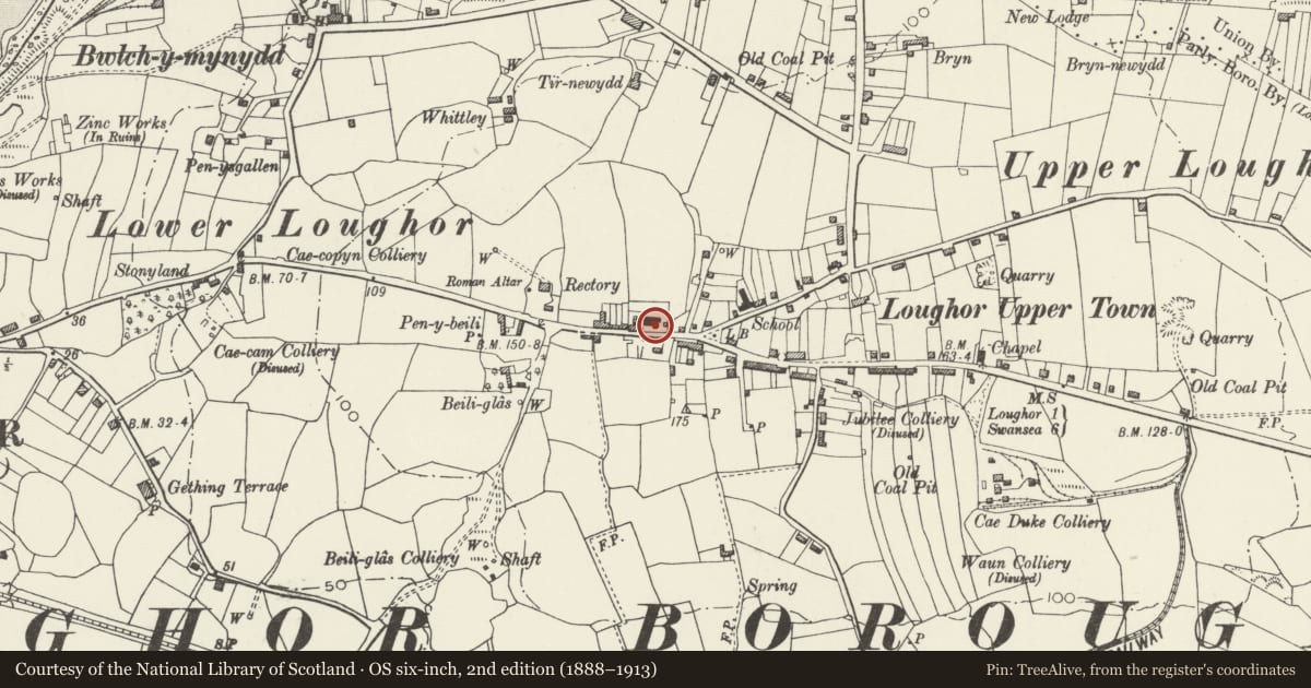
5 historical maps cover this location, the earliest the 1636 map "Cornubia : Devonia, Somersetus, Dorcestria, Wiltonia, Glocestria ..." (David Rumsey Map Collection, Stanford Libraries).
Historical maps covering this location
- 1636 · Cornubia : Devonia, Somersetus, Dorcestria, Wiltonia, Glocestria ... (David Rumsey Map Collection, Stanford Libraries)
- 1637 · The fourth table of England. Cornub. Devonia, Somerset etc. (David Rumsey Map Collection, Stanford Libraries)
- 1891 · Sheet 10. Ordnance Survey of England and Wales. . (David Rumsey Map Collection, Stanford Libraries)
- 1897 · 247 Swansea (Hills) (David Rumsey Map Collection, Stanford Libraries)
- 1920 · Sheet 100. Llanelly. (David Rumsey Map Collection, Stanford Libraries)
Cadw's description
Location
Situated on the N side of Glebe Road in front of Capel Moriah and the schoolroom.
History
Gates and railings to Moriah chapel and schoolroom, 1898, probably by William Griffiths of Llanelli, but incorporating 2 earlier gatepiers to the earlier chapel, now schoolroom.
Exterior
Gates, piers and railings. Rockfaced-brown stone low walls with sandstone ashlar copings and spearhead iron railings with horseshoe motif under top rail between each pair of rails. Rails in front of the chapel curve in to 2 stone gatepiers with sandstone pyramid caps and have 2 similar piers each end. The rails are continued in similar style a short length to right and in front of schoolroom to left, out to simple outer piers. In front of schoolroom are incorporated 2 earlier tooled stone piers with simpler caps. Chapel and schoolroom gates are similar, with spear-head dog-bars, horseshoes under top-rail, no top spearheads but scrolls ramped up to meeting stiles.
Reason for designation
Included for group value with the chapel and schoolroom.
Nearby in the register
- Capel MoriahReligious, Ritual and Funeraryunder 1 mi
- Schoolroom at Capel MoriahReligious, Ritual and Funeraryunder 1 mi
- The War MemorialCommemorativeunder 1 mi
- Catholic Church of the Blessed SacramentReligious, Ritual and Funeraryunder 1 mi
Other entries of the same register within about three miles of this one, by straight line.