Cof Cymru: National Historic Assets of Wales · Wales
Outbuilding to N of Treffgarne Hall
Wolfscastle, Pembrokeshire, Wales
A Grade II listed building in Treffgarne, Haverfordwest, Wolfscastle, Pembrokeshire, designated on 7 August 2002.
The record
- Designation
- Listed building, Grade II
- Broad class
- Agriculture and Subsistence
- Date of designation
- 7 August 2002
- Locality
- Treffgarne
- Town
- Haverfordwest
- Community
- Wolfscastle
- Unitary authority
- Pembrokeshire
- Country
- Wales
- Coordinates
- 51.87302, -4.97745
- Cadw reference
- 26842
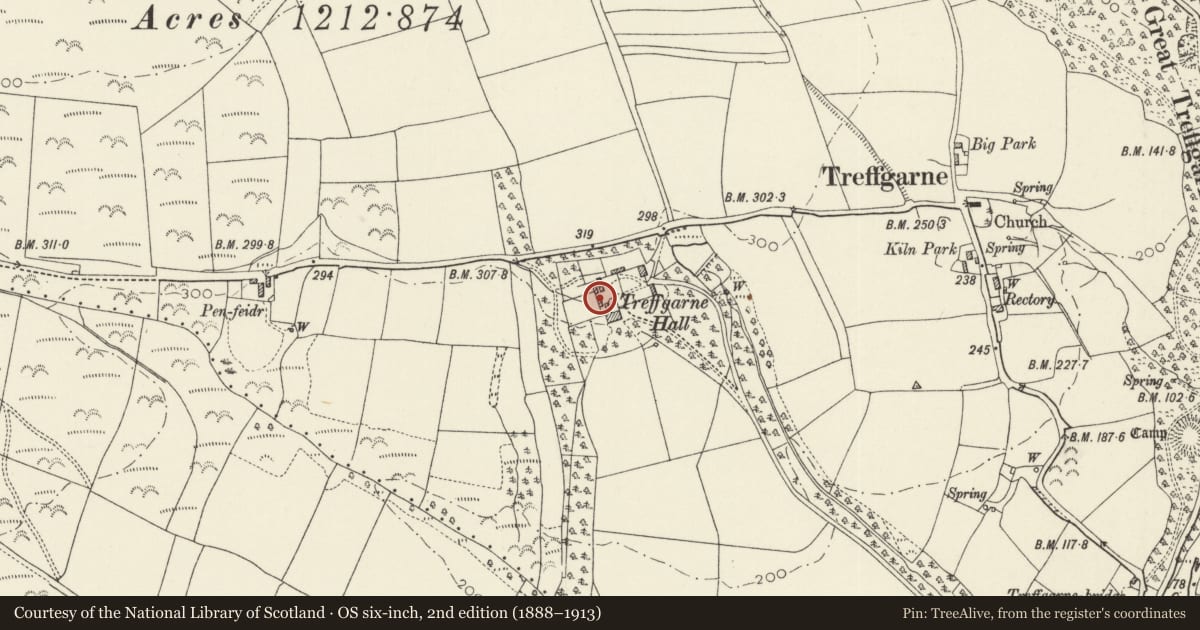
Slide toward Today to fade the historical sheet and see the modern map underneath.
David Rumsey Map Collection, Stanford LibrariesDavid Rumsey Map Collection, Stanford LibrariesDavid Rumsey Map Collection, Stanford LibrariesDavid Rumsey Map Collection, Stanford LibrariesDavid Rumsey Map Collection, Stanford Libraries
5 historical maps cover this location, the earliest the 1636 map "Cornubia : Devonia, Somersetus, Dorcestria, Wiltonia, Glocestria ..." (David Rumsey Map Collection, Stanford Libraries).
Historical maps covering this location
- 1636 · Cornubia : Devonia, Somersetus, Dorcestria, Wiltonia, Glocestria ... (David Rumsey Map Collection, Stanford Libraries)
- 1891 · Sheet 10. Ordnance Survey of England and Wales. . (David Rumsey Map Collection, Stanford Libraries)
- 1898 · 210 Cardigan (Hills) (David Rumsey Map Collection, Stanford Libraries)
- 1898 · 210 Cardigan (Outline) (David Rumsey Map Collection, Stanford Libraries)
- 1901 · Sheet 13. (David Rumsey Map Collection, Stanford Libraries)
Cadw's description
Location
Situated just N of rear wing at Treffgarne Hall.
History
Lofted earlier C19 outbuilding to Treffgarne Hall, the Hall rebuilt by David Evans in 1824.
Exterior
Outbuilding, rubble stone with slate roof of small slates. Chamfered stone eaves course. Two storeys with stone outside steps on front wall to centre loft door. Square loft window under eaves to left, tiny square opening to right. Ground floor door with brick head to left of steps, broad double doors with cambered brick head to right. S end wall has small loft light over course of projecting slates.
Reason for designation
Included as an earlier C19 lofted outbuilding, of group value with Treffgarne Hall.
Nearby in the register
- Treffgarne HallDomesticunder 1 mi
- Church Hill HouseDomesticunder 1 mi
- Great Treffgarne Wood CampEnclosure - Defensiveunder 1 mi
- Treffgarne LodgeDomesticunder 1 mi
Other entries of the same register within about three miles of this one, by straight line.