Cof Cymru: National Historic Assets of Wales · Wales
Tramroad causeway and bridge at Hirwaun Ironworks
Hirwaun, Rhondda Cynon Taff, Wales
A Grade II listed building in Hirwaun, Rhondda Cynon Taff, designated on 6 August 2002.
The record
- Designation
- Listed building, Grade II
- Broad class
- Transport
- Date of designation
- 6 August 2002
- Locality
- Hirwaun
- Town
- Hirwaun
- Community
- Hirwaun
- Unitary authority
- Rhondda Cynon Taff
- Country
- Wales
- Coordinates
- 51.74056, -3.50984
- Cadw reference
- 26827
Slide toward Today to fade the historical sheet and see the modern map underneath.
David Rumsey Map Collection, Stanford LibrariesDavid Rumsey Map Collection, Stanford LibrariesDavid Rumsey Map Collection, Stanford LibrariesDavid Rumsey Map Collection, Stanford LibrariesDavid Rumsey Map Collection, Stanford Libraries
5 historical maps cover this location, the earliest the 1608 map "(13) Cambriae Typus." (David Rumsey Map Collection, Stanford Libraries).
Historical maps covering this location
- 1608 · (13) Cambriae Typus. (David Rumsey Map Collection, Stanford Libraries)
- 1636 · Cornubia : Devonia, Somersetus, Dorcestria, Wiltonia, Glocestria ... (David Rumsey Map Collection, Stanford Libraries)
- 1637 · The fourth table of England. Cornub. Devonia, Somerset etc. (David Rumsey Map Collection, Stanford Libraries)
- 1830 · V.3:11-15:XV. Britisches Reich. A. Kon: England. b. Frstenthum Wales: Shire: 37-40 (David Rumsey Map Collection, Stanford Libraries)
- 1898 · 231 Merthyr Tydfil (Hills) (David Rumsey Map Collection, Stanford Libraries)
Cadw's description
Location
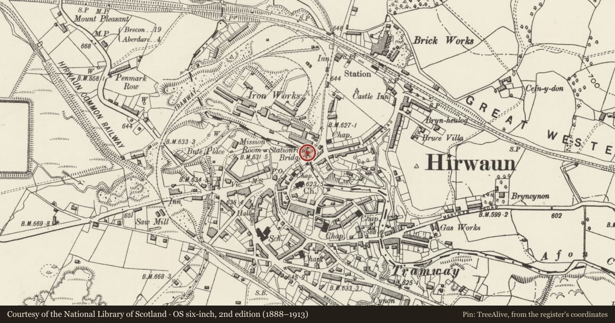
Crossing the Afon Cynon approximately 100m NE of St Lleurwg's church, on the N side of Station Road and S side of the former Hirwaun Ironworks.
History
Built 1806-8 by the engineer George Overton to replace an earlier bridge, sited immediately S of the present bridge, of a tramroad built in 1793, upon which raw materials were carried to the furnaces of Hirwaun ironworks and limestone was brought from the quarries at Penderyn.
Exterior
A high single-track causeway approximately 100m in length, of snecked rubble, in parts rebuilt in coursed rubble. It crosses the Afon Cynon in a single span with segmental arch and narrow dressed-stone voussoirs. It is abutted on the R bank by coursed rubble revetments. The flat deck is a footpath retaining some stone sleeper blocks (overgrown at the time of inspection).
Reason for designation
Listed for its industrial archaeological importance as an early example of railway engineering.
Scheduled Ancient Monument BR157
Nearby in the register
- Hirwaun war memorial clock towerCommemorativeunder 1 mi
- Site of Hirwaun IronworksIronworksunder 1 mi
- Nebo Independent ChapelReligious, Ritual and Funeraryunder 1 mi
- 44 Swansea Road, including forecourt wall & piersDomesticunder 1 mi
Other entries of the same register within about three miles of this one, by straight line.