Cof Cymru: National Historic Assets of Wales · Wales
Tredafydd Uchaf
Cwm Gwaun, Pembrokeshire, Wales
A Grade II listed building in Llanychlwydog, Fishguard, Cwm Gwaun, Pembrokeshire, designated on 30 July 2002.
The record
- Designation
- Listed building, Grade II
- Broad class
- Domestic
- Date of designation
- 30 July 2002
- Locality
- Llanychlwydog
- Town
- Fishguard
- Community
- Cwm Gwaun
- Unitary authority
- Pembrokeshire
- Country
- Wales
- Coordinates
- 51.97631, -4.88117
- Cadw reference
- 26814
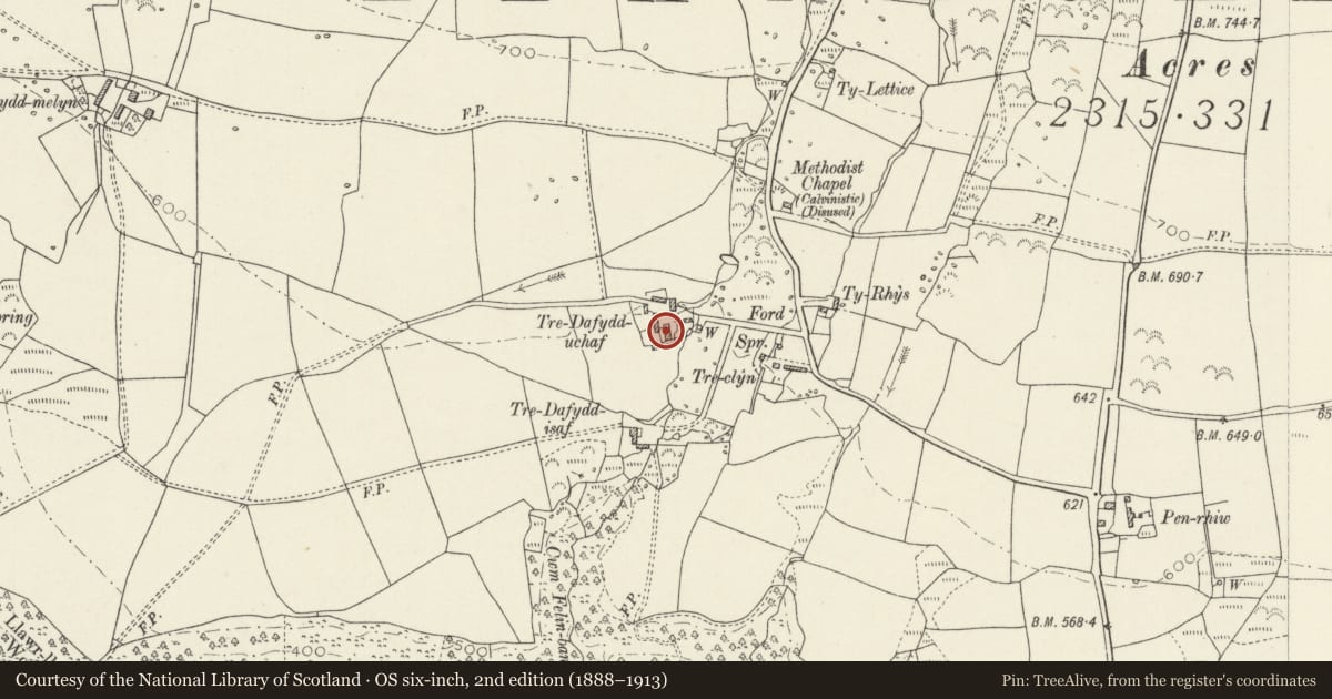
Slide toward Today to fade the historical sheet and see the modern map underneath.
David Rumsey Map Collection, Stanford LibrariesDavid Rumsey Map Collection, Stanford LibrariesDavid Rumsey Map Collection, Stanford LibrariesDavid Rumsey Map Collection, Stanford LibrariesDavid Rumsey Map Collection, Stanford Libraries
5 historical maps cover this location, the earliest the 1608 map "(13) Cambriae Typus." (David Rumsey Map Collection, Stanford Libraries).
Historical maps covering this location
- 1608 · (13) Cambriae Typus. (David Rumsey Map Collection, Stanford Libraries)
- 1891 · Sheet 10. Ordnance Survey of England and Wales. . (David Rumsey Map Collection, Stanford Libraries)
- 1898 · 210 Cardigan (Hills) (David Rumsey Map Collection, Stanford Libraries)
- 1898 · 210 Cardigan (Outline) (David Rumsey Map Collection, Stanford Libraries)
- 1901 · Sheet 13. (David Rumsey Map Collection, Stanford Libraries)
Cadw's description
Location
Situated about 800m NW of Dyffryn Arms inn, down drive running W off road to Dinas.
History
Farmhouse, probably C18 small lofted farmhouse with large kitchen chimney, extended to S by a range of similar size.
Exterior
Farmhouse, roughcast with slate close-eaved roof, one storey and attic. Large stone ridge stack, square right end stack and smaller left end stack all with dripstones. Two sections, one each side of ridge stack. Right part, probably the older, has 2 eaves-breaking 4-pane sashes to left under shallow gables, and ground floor C20 metal window each side of part-glazed door. Left window and the door are aligned each slightly left of dormer above. Rear has 2 narrow similar dormers, one on eaves to left, the other on roof slope of a long outshut. Outshut has 12-pane sash in N end wall.
Outbuilding attached to N end has asbestos roof, roughcast front wall forward of house front has one small window. Door in S return. Rubble stone N end wall and rear are rubble stone, rear door with oak lintel.
Left range of similar size downhill of original house has slight step in front wall. Similar eaves breaking window to right with sash and shallow gable, and one stair window to left with tiny understair light below. Small outbuilding at right angles. Rear has one dormer on eaves and no outshut. Door and C20 ground floor window.
Interior
Not inspected.
Reason for designation
Included as a small traditional farmhouse of well-preserved regional character.
Nearby in the register
- Ty Cwrdd BachDomesticunder 1 mi
- Church of St BrynachReligious, Ritual and Funeraryunder 1 mi
- Two Pillar-Crosses in ChurchyardCrossunder 1 mi
- Pontfaen House (Plas Pontfaen and Pontfaen Farmouse)Domesticunder 1 mi
Other entries of the same register within about three miles of this one, by straight line.