Cof Cymru: National Historic Assets of Wales · Wales
The Drim
Fishguard and Goodwick, Pembrokeshire, Wales
A Grade II listed building in Goodwick, Fishguard and Goodwick, Pembrokeshire, designated on 22 July 2002.
The record
- Designation
- Listed building, Grade II
- Broad class
- Domestic
- Date of designation
- 22 July 2002
- Locality
- Goodwick
- Community
- Fishguard and Goodwick
- Unitary authority
- Pembrokeshire
- Country
- Wales
- Coordinates
- 51.99504, -4.99700
- Cadw reference
- 26791
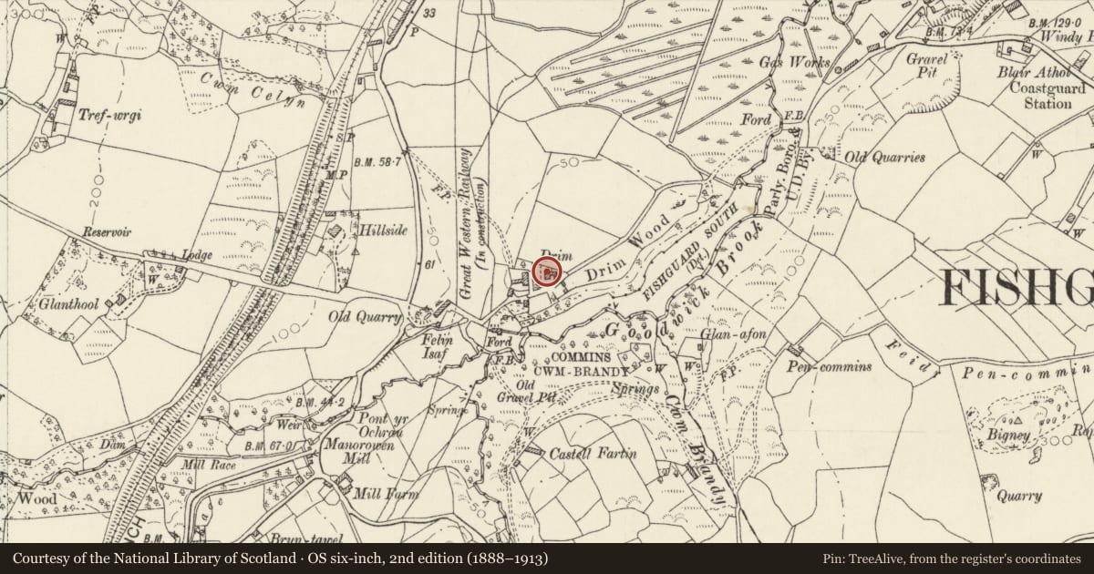
Slide toward Today to fade the historical sheet and see the modern map underneath.
David Rumsey Map Collection, Stanford LibrariesDavid Rumsey Map Collection, Stanford LibrariesDavid Rumsey Map Collection, Stanford LibrariesDavid Rumsey Map Collection, Stanford LibrariesDavid Rumsey Map Collection, Stanford Libraries
5 historical maps cover this location, the earliest the 1608 map "(13) Cambriae Typus." (David Rumsey Map Collection, Stanford Libraries).
Historical maps covering this location
- 1608 · (13) Cambriae Typus. (David Rumsey Map Collection, Stanford Libraries)
- 1891 · Sheet 10. Ordnance Survey of England and Wales. . (David Rumsey Map Collection, Stanford Libraries)
- 1898 · 210 Cardigan (Hills) (David Rumsey Map Collection, Stanford Libraries)
- 1898 · 210 Cardigan (Outline) (David Rumsey Map Collection, Stanford Libraries)
- 1901 · Sheet 13. (David Rumsey Map Collection, Stanford Libraries)
Cadw's description
Location
Situated in wooded valley to S of Goodwick reached by track off Heol y Felin under railway.
History
Detached house apparently early C19, but with earlier origins. Marked on 1840 Llanwnda tithe map. Some alterations of circa 1911, including bay windows to front.
Exterior
House, stone with slate roof and stone end stacks. Two storeys, 3-window range with 2 late C19 or early C20 ground floor timber square bay windows with small-paned top-lights, and 3 first floor 4-pane horned sashes with brick heads. Six-panel centre door. Right end wall has 4-pane sash with brick head. To rear is a small yard enclosed on 3 sides by a tiny single-storey range with roof hipped at angle. Back range has 4 red-brick arches, short left link to house has window and right end terminates in hipped roof.
Interior
Early C19 stair with turned newels and stick balusters. Retains several 6-panelled doors.
Reason for designation
A substantial farmhouse or small gentry house of the early C19 possibly with earlier origins.
Nearby in the register
- Outbuilding at The DrimAgriculture and Subsistenceunder 1 mi
- Dyffryn HouseDomesticunder 1 mi
- Bridge CottagesDomesticunder 1 mi
- Church of St PeterReligious, Ritual and Funeraryunder 1 mi
Other entries of the same register within about three miles of this one, by straight line.