Cof Cymru: National Historic Assets of Wales · Wales
Gatepiers at Upper Lodge driveway to Plas Tregayan
Llanddyfnan, Isle of Anglesey, Wales
A Grade II listed building in Tregaian, Llanddyfnan, Isle of Anglesey, designated on 11 June 2002.
The record
- Designation
- Listed building, Grade II
- Broad class
- Domestic
- Date of designation
- 11 June 2002
- Locality
- Tregaian
- Community
- Llanddyfnan
- Unitary authority
- Isle of Anglesey
- Country
- Wales
- Coordinates
- 53.28988, -4.32040
- Cadw reference
- 26732
Slide toward Today to fade the historical sheet and see the modern map underneath.
David Rumsey Map Collection, Stanford LibrariesDavid Rumsey Map Collection, Stanford LibrariesDavid Rumsey Map Collection, Stanford LibrariesDavid Rumsey Map Collection, Stanford LibrariesDavid Rumsey Map Collection, Stanford Libraries
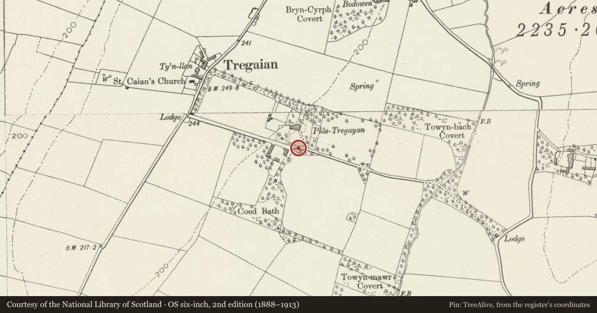
5 historical maps cover this location, the earliest the 1883 map "Watershed map England, Wales 3." (David Rumsey Map Collection, Stanford Libraries).
Historical maps covering this location
- 1883 · Watershed map England, Wales 3. (David Rumsey Map Collection, Stanford Libraries)
- 1896 · Sheet 7. Ordnance Survey of England and Wales. (David Rumsey Map Collection, Stanford Libraries)
- 1899 · 93 Holyhead (Hills) (David Rumsey Map Collection, Stanford Libraries)
- 1901 · Sheet 9 and 10. (David Rumsey Map Collection, Stanford Libraries)
- 1919 · Sheet 41. Anglesey. (David Rumsey Map Collection, Stanford Libraries)
Cadw's description
Location
In an isolated rural location within private grounds, set back from the E side a country road leading N off the B5111. The gatepiers flank the main driveway to Upper Lodge.
History
C19, probably contemporary with the development of the adjacent house and estate buildings; built for Admiral Lloyd, the owner and occupier in the Tithe Apportionment of 1839.
Exterior
Square gate piers of coursed dressed stone, with pyramidal capping and surmounted by an urn finial. Flanking the main driveway to the house on the approach from Upper Lodge.
Reason for designation
Included as a pair of C19 gatepiers which forms an important component part of the estate at Plas Tregayan. Built to a coherent design and echoing the C19 character of the house for which they were built; a reflection of the expanding fortunes of the estate at that time.
Nearby in the register
- Gatepiers to main driveway to Plas TregayanDomesticunder 1 mi
- Garage/coach house range at Plas TregayanDomesticunder 1 mi
- Plas TregayanDomesticunder 1 mi
- Barn at Plas TregayanAgriculture and Subsistenceunder 1 mi
Other entries of the same register within about three miles of this one, by straight line.