Cof Cymru: National Historic Assets of Wales · Wales
Front Wall, Gatepiers and Gate of No 88 (Bridge House)
Whitchurch, Cardiff, Wales
A Grade II listed building in Whitchurch, Cardiff, designated on 31 May 2002.
The record
- Designation
- Listed building, Grade II
- Broad class
- Domestic
- Date of designation
- 31 May 2002
- Locality
- Whitchurch
- Town
- Cardiff
- Community
- Whitchurch
- Unitary authority
- Cardiff
- Country
- Wales
- Coordinates
- 51.51115, -3.21703
- Cadw reference
- 26713
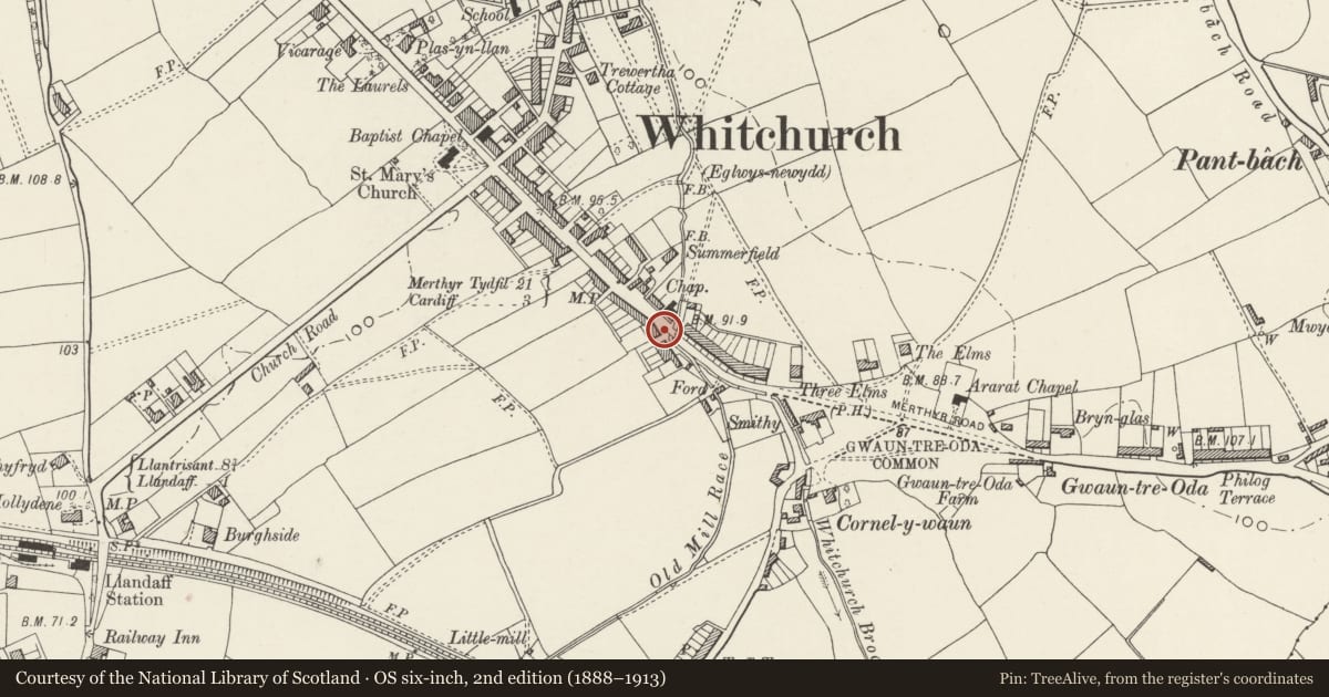
Slide toward Today to fade the historical sheet and see the modern map underneath.
David Rumsey Map Collection, Stanford LibrariesDavid Rumsey Map Collection, Stanford LibrariesDavid Rumsey Map Collection, Stanford LibrariesDavid Rumsey Map Collection, Stanford LibrariesDavid Rumsey Map Collection, Stanford Libraries
5 historical maps cover this location, the earliest the 1636 map "Cornubia : Devonia, Somersetus, Dorcestria, Wiltonia, Glocestria ..." (David Rumsey Map Collection, Stanford Libraries).
Historical maps covering this location
- 1636 · Cornubia : Devonia, Somersetus, Dorcestria, Wiltonia, Glocestria ... (David Rumsey Map Collection, Stanford Libraries)
- 1637 · The fourth table of England. Cornub. Devonia, Somerset etc. (David Rumsey Map Collection, Stanford Libraries)
- 1865 · England and Wales. England No. 6. (David Rumsey Map Collection, Stanford Libraries)
- 1898 · 263 Cardiff (Hills) (David Rumsey Map Collection, Stanford Libraries)
- 1913 · Sheet 110. Cardiff & Mouth of the Severn. (David Rumsey Map Collection, Stanford Libraries)
Cadw's description
Location
Immediately outside the front of Bridge House.
History
Contemporary with the house at c1800.
Exterior
Rubble dwarf wall with coping, square piers with conical iron caps at either end. Central square gate piers with iron urn finials. Wrought Iron gate.
Reason for designation
Included for their group value with No 88 and with Tabernacle Chapel opposite.
Nearby in the register
- Bridge HouseDomesticunder 1 mi
- Tabernacle ChapelReligious, Ritual and Funeraryunder 1 mi
- Church of St. MaryReligious, Ritual and Funeraryunder 1 mi
- Six GablesDomesticunder 1 mi
Other entries of the same register within about three miles of this one, by straight line.