Cof Cymru: National Historic Assets of Wales · Wales
Lower terrace revetment and gates in garden to S of Maes Manor
Blackwood, Caerphilly, Wales
A Grade II listed building in Maes Manor, Blackwood, Caerphilly, designated on 31 May 2002.
The record
- Designation
- Listed building, Grade II
- Broad class
- Gardens, Parks and Urban Spaces
- Date of designation
- 31 May 2002
- Locality
- Maes Manor
- Town
- Blackwood
- Community
- Blackwood
- Unitary authority
- Caerphilly
- Country
- Wales
- Coordinates
- 51.68157, -3.19525
- Cadw reference
- 26703
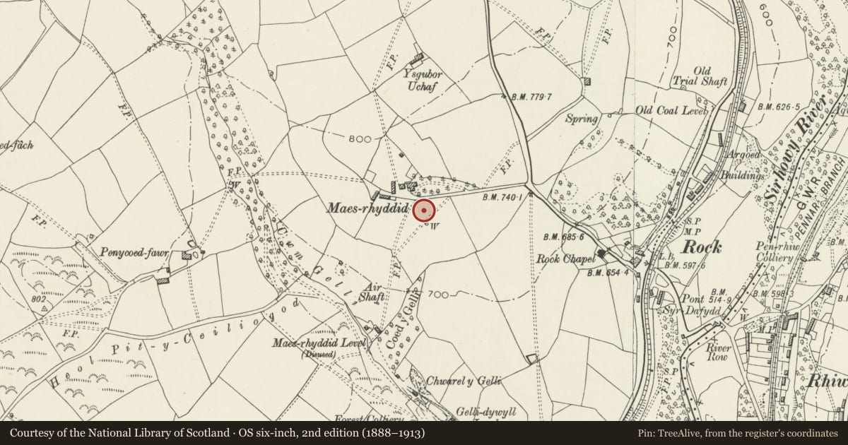
Slide toward Today to fade the historical sheet and see the modern map underneath.
David Rumsey Map Collection, Stanford LibrariesDavid Rumsey Map Collection, Stanford LibrariesDavid Rumsey Map Collection, Stanford LibrariesDavid Rumsey Map Collection, Stanford LibrariesDavid Rumsey Map Collection, Stanford Libraries
5 historical maps cover this location, the earliest the 1636 map "Cornubia : Devonia, Somersetus, Dorcestria, Wiltonia, Glocestria ..." (David Rumsey Map Collection, Stanford Libraries).
Historical maps covering this location
- 1636 · Cornubia : Devonia, Somersetus, Dorcestria, Wiltonia, Glocestria ... (David Rumsey Map Collection, Stanford Libraries)
- 1637 · The fourth table of England. Cornub. Devonia, Somerset etc. (David Rumsey Map Collection, Stanford Libraries)
- 1895 · Sheet 11. Ordnance Survey of England and Wales. (David Rumsey Map Collection, Stanford Libraries)
- 1906 · 249 Newport (Hills) (David Rumsey Map Collection, Stanford Libraries)
- 1913 · Sheet 102. Newport. (David Rumsey Map Collection, Stanford Libraries)
Cadw's description
Location
Forming the boundary of the formal garden on the S side of the house.
History
Originally known as Maesruddud, Maes Manor was built in 1900 as an addition to an earlier house and extended in 1907 when the original house was demolished. The second phase was added for L. Brewer Williams by E.P. Warren, architect of London. Between 1907 and 1914 a number of ancillary buildings and garden structures were built by Warren in collaboration with Thomas Mawson, who designed the garden. The lower terrace forms one of 2 concentric terraces in the formal garden to the S of the house.
Exterior
Central steps have flanking walls and a gate at the lower end with square freestone piers and ball finials. Double wooden gates incorporate wooden panels and iron bars and are swept up to the outer sides. The rubble-stone revetment forms a convex semi-circle.
Reason for designation
Listed as an integral component of an Edwardian garden by one of the foremost contemporary garden designers, and for its contribution to the setting of the house.
Nearby in the register
- Upper terrace revetment and steps in garden to S of Maes ManorGardens, Parks and Urban Spacesunder 1 mi
- Maes Manor HotelDomesticunder 1 mi
- Gate piers and flanking walls to forecourt of Maes ManorGardens, Parks and Urban Spacesunder 1 mi
- Kitchen garden walls, pavilion and terrace at Maes ManorGardens, Parks and Urban Spacesunder 1 mi
Other entries of the same register within about three miles of this one, by straight line.