Cof Cymru: National Historic Assets of Wales · Wales
10 Eastgate Street
Caernarfon, Gwynedd, Wales
A Grade II listed building in Caernarfon, Gwynedd, designated on 3 May 2002.
The record
- Designation
- Listed building, Grade II
- Broad class
- Commercial
- Date of designation
- 3 May 2002
- Locality
- Caernarfon
- Town
- Caernarfon
- Community
- Caernarfon
- Unitary authority
- Gwynedd
- Country
- Wales
- Coordinates
- 53.14071, -4.27480
- Cadw reference
- 26591
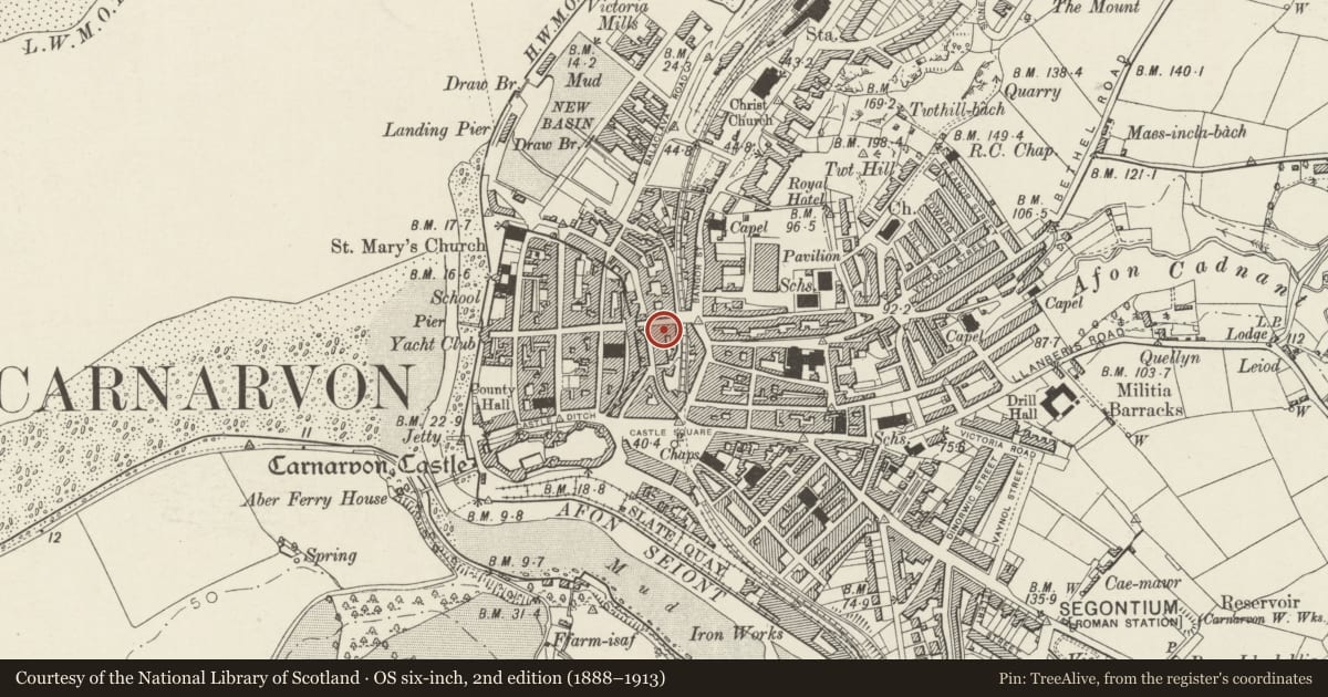
Slide toward Today to fade the historical sheet and see the modern map underneath.
David Rumsey Map Collection, Stanford LibrariesDavid Rumsey Map Collection, Stanford LibrariesDavid Rumsey Map Collection, Stanford LibrariesDavid Rumsey Map Collection, Stanford LibrariesDavid Rumsey Map Collection, Stanford Libraries
5 historical maps cover this location, the earliest the 1883 map "Watershed map England, Wales 3." (David Rumsey Map Collection, Stanford Libraries).
Historical maps covering this location
- 1883 · Watershed map England, Wales 3. (David Rumsey Map Collection, Stanford Libraries)
- 1896 · Sheet 7. Ordnance Survey of England and Wales. (David Rumsey Map Collection, Stanford Libraries)
- 1899 · 105 Carnarvon (Hills) (David Rumsey Map Collection, Stanford Libraries)
- 1901 · Sheet 9 and 10. (David Rumsey Map Collection, Stanford Libraries)
- 1919 · Sheet 41. Anglesey. (David Rumsey Map Collection, Stanford Libraries)
Cadw's description
Location
Set into a row of frontages.
History
Built in the third quarter of the C19 and first shown on the 1890 Ordnance Survey. In 1895 it was occupied by a boot maker.
Exterior
Belongs to a group of 4-14 Eastgate Street.
A block of shops with dwellings above in eclectic classical style, stucco front walls with slate roofs, slightly lower and hipped to No 4, and roughcast stacks. 3 storeyed details to the middle and upper storeys are consistent although the number of windows in each property is varied. Each property is framed by angle pilasters in middle and upper storeys and articulated by a frieze and deeply moulded cornice forming a sill band to the upper storey. The middle storey windows have moulded architraves with sill band. The upper storey has segmental-headed windows in plain architraves. A moulded eaves cornice comprises brackets alternating with raised quatrefoil panels.
A 3-window range with shop front in the lower storey. The shop front has plate glass windows with central double doors and a deepened fascia beneath the cornice of the original fascia. The middle and upper storeys retain original 2-light casements beneath fixed lights in the middle storey, and 4-pane sash windows in the upper storey.
Reason for designation
Listed as a strongly detailed late C19 commercial terrace, and for its contribution to the historic townscape of Eastgate Street, Bangor Street and Bridge Street, which retains a distinctive late C19 commercial character.
Nearby in the register
- 12 Eastgate StreetCommercialunder 1 mi
- 8 Eastgate StreetCommercialunder 1 mi
- 6 Eastgate StreetCommercialunder 1 mi
- 14 Eastgate StreetCommercialunder 1 mi
Other entries of the same register within about three miles of this one, by straight line.