Cof Cymru: National Historic Assets of Wales · Wales
11 Castle Ditch
Caernarfon, Gwynedd, Wales
A Grade II listed building in Walled town, Caernarfon, Gwynedd, designated on 22 May 1967.
The record
- Designation
- Listed building, Grade II
- Broad class
- Commercial
- Date of designation
- 22 May 1967
- Locality
- Walled town
- Town
- Caernarfon
- Community
- Caernarfon
- Unitary authority
- Gwynedd
- Country
- Wales
- Coordinates
- 53.13986, -4.27633
- Cadw reference
- 26533
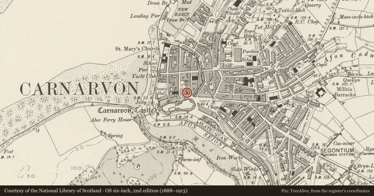
Slide toward Today to fade the historical sheet and see the modern map underneath.
David Rumsey Map Collection, Stanford LibrariesDavid Rumsey Map Collection, Stanford LibrariesDavid Rumsey Map Collection, Stanford LibrariesDavid Rumsey Map Collection, Stanford LibrariesDavid Rumsey Map Collection, Stanford Libraries
5 historical maps cover this location, the earliest the 1883 map "Watershed map England, Wales 3." (David Rumsey Map Collection, Stanford Libraries).
Historical maps covering this location
- 1883 · Watershed map England, Wales 3. (David Rumsey Map Collection, Stanford Libraries)
- 1896 · Sheet 7. Ordnance Survey of England and Wales. (David Rumsey Map Collection, Stanford Libraries)
- 1899 · 105 Carnarvon (Hills) (David Rumsey Map Collection, Stanford Libraries)
- 1901 · Sheet 9 and 10. (David Rumsey Map Collection, Stanford Libraries)
- 1919 · Sheet 41. Anglesey. (David Rumsey Map Collection, Stanford Libraries)
Cadw's description
Location
In a row of frontages directly opposite Caernarfon Castle.
History
Probably an C18 house and one of the buildings indicated here on the 1810 town map. It was converted to business use in the late C19 and in 1895 housed an auctioneer's office and a wine and spirit merchant.
Exterior
A Georgian house and shop of 2 bays and 3 storeys with attic, of roughcast walls and slate roof on a moulded wooden eaves cornice. In the lower storey is a mid C20 shop front comprising 2 segmental-headed windows replaced in original openings and a dentilled cornice. Replaced double doors are to the L under a plain segmental-headed overlight. The middle and upper storeys have small renewed 4-pane sash windows in original openings, those to the left not quite aligned (Louvres to the attic are rendered over and not visible from the exterior.)
The rear is rubble stone and has a 2-storey roughcast lean-to and a single-storey L-shaped link to 16 Palace Street. The rear is built on a stone boundary wall defining earlier burgage plots.
Interior
Original stairs, in parallel flights, survive partly in the upper storeys. The 2-bay roof has an early C19 collar-beam truss, but with re-used collar and renewed purlins. The attic has louvres to the front elevation.
Reason for designation
Listed as a late C18 building contrasting with its later neighbours in retaining urban vernacular character, including notably smaller window openings. Part of a town centre group contributing to the setting of Caernarfon Castle.
Nearby in the register
- 9-10 Castle DitchCommercialunder 1 mi
- Palace VaultsCommercialunder 1 mi
- 8 Castle DitchCommercialunder 1 mi
- 18 Palace StreetCommercialunder 1 mi
Other entries of the same register within about three miles of this one, by straight line.