Cof Cymru: National Historic Assets of Wales · Wales
War Memorial
Dinas Powys, Vale of Glamorgan, Wales
A Grade II listed building in Dinas Powys, Vale of Glamorgan, designated on 3 May 2002.
The record
- Designation
- Listed building, Grade II
- Broad class
- Commemorative
- Date of designation
- 3 May 2002
- Locality
- Dinas Powys
- Community
- Dinas Powys
- Unitary authority
- Vale of Glamorgan
- Country
- Wales
- Coordinates
- 51.43428, -3.21960
- Cadw reference
- 26506
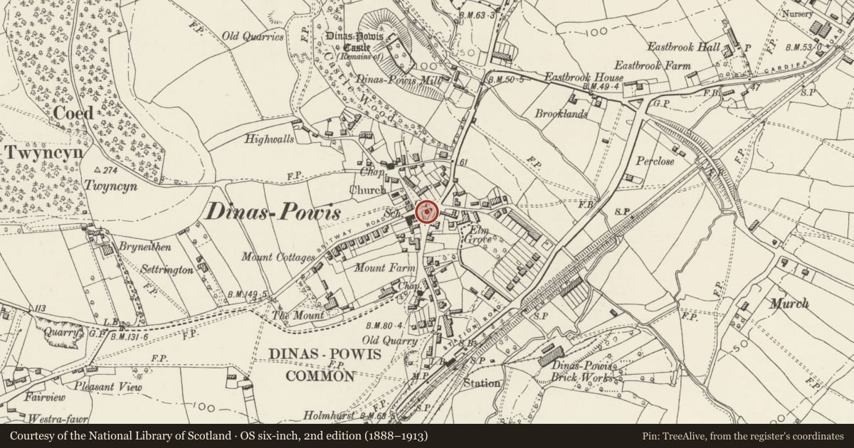
Slide toward Today to fade the historical sheet and see the modern map underneath.
David Rumsey Map Collection, Stanford LibrariesDavid Rumsey Map Collection, Stanford LibrariesDavid Rumsey Map Collection, Stanford LibrariesDavid Rumsey Map Collection, Stanford LibrariesDavid Rumsey Map Collection, Stanford Libraries
5 historical maps cover this location, the earliest the 1636 map "Cornubia : Devonia, Somersetus, Dorcestria, Wiltonia, Glocestria ..." (David Rumsey Map Collection, Stanford Libraries).
Historical maps covering this location
- 1636 · Cornubia : Devonia, Somersetus, Dorcestria, Wiltonia, Glocestria ... (David Rumsey Map Collection, Stanford Libraries)
- 1637 · The fourth table of England. Cornub. Devonia, Somerset etc. (David Rumsey Map Collection, Stanford Libraries)
- 1865 · England and Wales. England No. 6. (David Rumsey Map Collection, Stanford Libraries)
- 1898 · 263 Cardiff (Hills) (David Rumsey Map Collection, Stanford Libraries)
- 1913 · Sheet 110. Cardiff & Mouth of the Severn. (David Rumsey Map Collection, Stanford Libraries)
Cadw's description
Location
In the middle of the triangular green at the centre of the village on paving enclosed by chain fencing hung from stone piers.
History
Commemorating the dead of the First and (later) Second World Wars. First dedicated in 1935 following controversy over the form the memorial should take, in particular whether a hospital should be built. Original design was for a cross. Earlier photograph confirms the 'crazy paving' surface to the plinth to be a later insertion; the original design provided the traditional step/ledge for wreaths. Other nearby features on the Green are a stone trough incorporating a stone engraved with a lion's head and a fountain erected to commemorate reign of Edward VII.
Exterior
War Memorial. Plain tapered pier of coursed rock-faced stone on a wide plinth with an upper surface of random-set stone. Cast metal plaques record the names of the dead, surmounted by a metal wreath on the main S elevation.
Reason for designation
Included as a village war memorial in prominent village centre position. Group value with the Old Court.
Nearby in the register
- Old CourtDomesticunder 1 mi
- Dinas Powys Parish HallRecreationalunder 1 mi
- Church of St PeterReligious, Ritual and Funeraryunder 1 mi
- The MountDomesticunder 1 mi
Other entries of the same register within about three miles of this one, by straight line.