Cof Cymru: National Historic Assets of Wales · Wales
Bargoed & Gilfach war memorial
Bargoed, Caerphilly, Wales
A Grade II listed building in Bargoed, Caerphilly, designated on 29 April 2002.
The record
- Designation
- Listed building, Grade II
- Broad class
- Commemorative
- Date of designation
- 29 April 2002
- Locality
- Bargoed
- Town
- Bargoed
- Community
- Bargoed
- Unitary authority
- Caerphilly
- Country
- Wales
- Coordinates
- 51.69210, -3.23048
- Cadw reference
- 26491
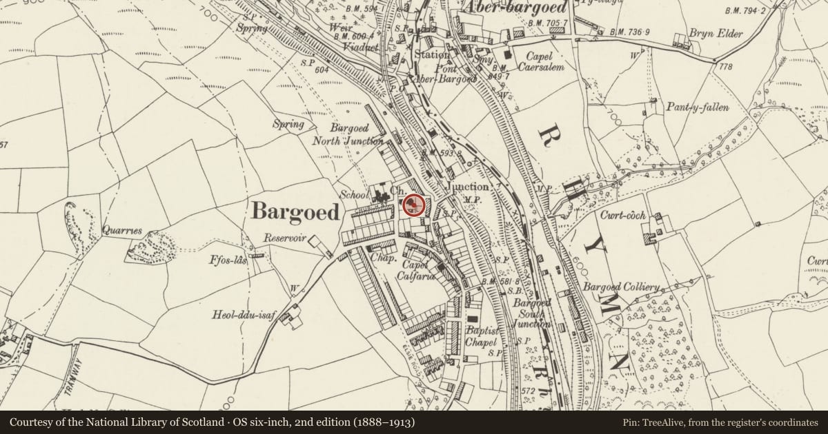
Slide toward Today to fade the historical sheet and see the modern map underneath.
David Rumsey Map Collection, Stanford LibrariesDavid Rumsey Map Collection, Stanford LibrariesDavid Rumsey Map Collection, Stanford LibrariesDavid Rumsey Map Collection, Stanford LibrariesDavid Rumsey Map Collection, Stanford Libraries
5 historical maps cover this location, the earliest the 1636 map "Cornubia : Devonia, Somersetus, Dorcestria, Wiltonia, Glocestria ..." (David Rumsey Map Collection, Stanford Libraries).
Historical maps covering this location
- 1636 · Cornubia : Devonia, Somersetus, Dorcestria, Wiltonia, Glocestria ... (David Rumsey Map Collection, Stanford Libraries)
- 1637 · The fourth table of England. Cornub. Devonia, Somerset etc. (David Rumsey Map Collection, Stanford Libraries)
- 1895 · Sheet 11. Ordnance Survey of England and Wales. (David Rumsey Map Collection, Stanford Libraries)
- 1906 · 249 Newport (Hills) (David Rumsey Map Collection, Stanford Libraries)
- 1913 · Sheet 102. Newport. (David Rumsey Map Collection, Stanford Libraries)
Cadw's description
Location
Standing within St Gwladys Gardens, having been relocated from Bargoed Park. To SE of St Gwladys Church.
History
Unveiled in 1923, the memorial originally stood in The Square at the S end of Hanbury Road, but was moved to its former Bargoed Park location in the second half of the C20 and relocated to its present position adjacent to St Gwladys Church, Bargoed in Spring 2002.
Exterior
A sculpted figure on a tall pedestal, all of polished granite, on a battered rock-faced plinth set into paved surround. It also stands on a second stepped plinth dating from its removal to its present location. The pedestal has fielded panels, of which the front (facing E) has an inscription in raised black letters and a wreath below it in relief. Above a moulded cornice is a full-length figure of an infantryman.
Reason for designation
Listed for its social-historical interest and as a well-detailed war memorial.
Nearby in the register
- Hanbury Road Baptist Chapel and Schoolrooms, including gates and gatepiersReligious, Ritual and Funeraryunder 1 mi
- Railway viaduct over Factory RoadTransportunder 1 mi
- Police Court and Police Station, including forecourt walls, gates & railingsCivilunder 1 mi
- Aberbargoed war memorial gatesCommemorativeunder 1 mi
Other entries of the same register within about three miles of this one, by straight line.