Cof Cymru: National Historic Assets of Wales · Wales
Amroth Cottage
Tenby, Pembrokeshire, Wales
A Grade II listed building in Tenby, Pembrokeshire, designated on 28 March 2002.
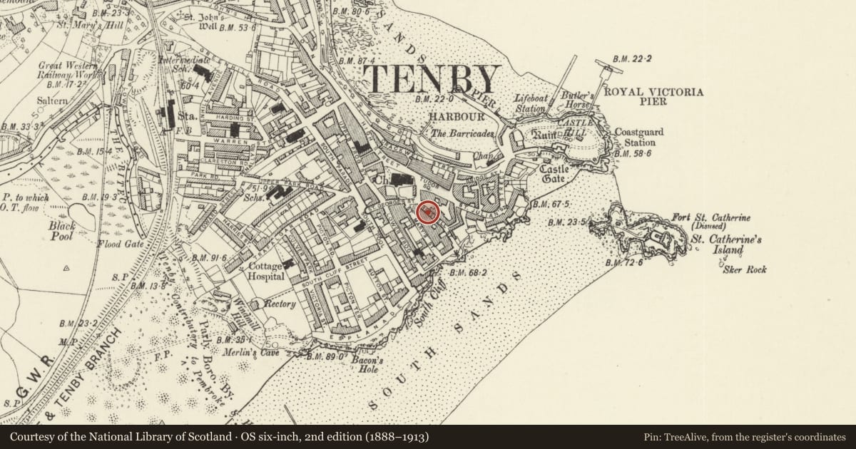
The record
- Designation
- Listed building, Grade II
- Broad class
- Domestic
- Date of designation
- 28 March 2002
- Town
- Tenby
- Community
- Tenby
- Unitary authority
- Pembrokeshire
- Country
- Wales
- Coordinates
- 51.67107, -4.69887
- Cadw reference
- 26407
Slide toward Today to fade the historical sheet and see the modern map underneath.
David Rumsey Map Collection, Stanford LibrariesDavid Rumsey Map Collection, Stanford LibrariesDavid Rumsey Map Collection, Stanford LibrariesDavid Rumsey Map Collection, Stanford LibrariesDavid Rumsey Map Collection, Stanford Libraries
5 historical maps cover this location, the earliest the 1636 map "Cornubia : Devonia, Somersetus, Dorcestria, Wiltonia, Glocestria ..." (David Rumsey Map Collection, Stanford Libraries).
Historical maps covering this location
- 1636 · Cornubia : Devonia, Somersetus, Dorcestria, Wiltonia, Glocestria ... (David Rumsey Map Collection, Stanford Libraries)
- 1865 · England and Wales. England No. 6. (David Rumsey Map Collection, Stanford Libraries)
- 1891 · Sheet 10. Ordnance Survey of England and Wales. . (David Rumsey Map Collection, Stanford Libraries)
- 1898 · 245 Pembroke (Hills) (David Rumsey Map Collection, Stanford Libraries)
- 1901 · Sheet 13. (David Rumsey Map Collection, Stanford Libraries)
Cadw's description
Location
On the SW side of Cresswell Street some 30m from the junction with Church Street and St George's Street.
History
Cottage mid to later C19, built with The Restings adjoining as a single 3-window range with the two doors set between the windows, Amroth cottage being therefore larger, two-room plan.
Exterior
House, painted stucco with slate close-eaved roof with C20 brick end stacks, two storeys, double-fronted with 4-pane horned sashes each floor each side of door with overlight.
Reason for designation
Included with The Restings as a later C19 cottage pair of group value.
Nearby in the register
- The RestingsDomesticunder 1 mi
- No 1 Cresswell CottagesDomesticunder 1 mi
- No 2 Cresswell CottagesDomesticunder 1 mi
- Guild HouseDomesticunder 1 mi
Other entries of the same register within about three miles of this one, by straight line.