Cof Cymru: National Historic Assets of Wales · Wales
No 2 Bellevue Cottages (Shellback)
Tenby, Pembrokeshire, Wales
A Grade II listed building in Tenby, Pembrokeshire, designated on 28 March 2002.
The record
- Designation
- Listed building, Grade II
- Broad class
- Domestic
- Date of designation
- 28 March 2002
- Town
- Tenby
- Community
- Tenby
- Unitary authority
- Pembrokeshire
- Country
- Wales
- Coordinates
- 51.67240, -4.69975
- Cadw reference
- 26358
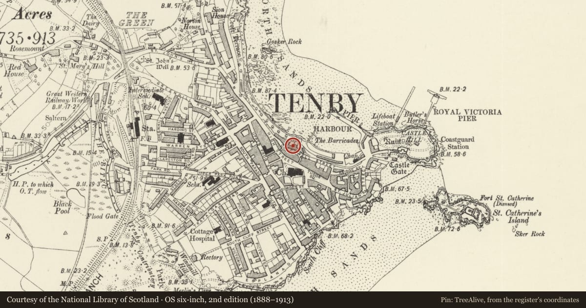
Slide toward Today to fade the historical sheet and see the modern map underneath.
David Rumsey Map Collection, Stanford LibrariesDavid Rumsey Map Collection, Stanford LibrariesDavid Rumsey Map Collection, Stanford LibrariesDavid Rumsey Map Collection, Stanford LibrariesDavid Rumsey Map Collection, Stanford Libraries
5 historical maps cover this location, the earliest the 1636 map "Cornubia : Devonia, Somersetus, Dorcestria, Wiltonia, Glocestria ..." (David Rumsey Map Collection, Stanford Libraries).
Historical maps covering this location
- 1636 · Cornubia : Devonia, Somersetus, Dorcestria, Wiltonia, Glocestria ... (David Rumsey Map Collection, Stanford Libraries)
- 1865 · England and Wales. England No. 6. (David Rumsey Map Collection, Stanford Libraries)
- 1891 · Sheet 10. Ordnance Survey of England and Wales. . (David Rumsey Map Collection, Stanford Libraries)
- 1898 · 245 Pembroke (Hills) (David Rumsey Map Collection, Stanford Libraries)
- 1901 · Sheet 13. (David Rumsey Map Collection, Stanford Libraries)
Cadw's description
Location
On the NE side of Crackwell Street some 25m W of the junction with Crackwell Lane.
History
Formerly a pair of back-to-back cottages of uncertain date, apparently C19 but including in front wall an eroded lancet that could be medieval and another rendered over.
Exterior
Pair of cottages, unpainted roughcast with stucco ground floor and slate close-eaved roof. Low 2-storey, 3-window range with 3 plate glass sashes above and stucco sill band over ground floor with door to through passage to extreme left, plate glass sash to left of centre, narrow window to centre, both with minimal raised surrounds, blocked door to right of centre and plate glass sash to right, aligned with sash above. Each side of centre window is blank pointed recess, all rendered to left, with exposed stone eroded chamfered surround to right. Raised plinth. Doorway at extreme left against corner of No 7 has white painted raised pier to right carrying cemented hood.
Interior
Said to be much modernised.
Reason for designation
Included as one of an unusual pair of back-to-back cottages possibly including medieval stone work.
Nearby in the register
- No 1 Bellevue Cottages (Oyster Cottage)Domesticunder 1 mi
- No 8 Bellevue (Hafod y Mor)Domesticunder 1 mi
- No 9 Bellevue (Bellevue House)Domesticunder 1 mi
- No 10 Bellevue (Etnam House) and area railingsDomesticunder 1 mi
Other entries of the same register within about three miles of this one, by straight line.