Cof Cymru: National Historic Assets of Wales · Wales
Railings, gates and piers, and retaining wall along cliff edge.
Tenby, Pembrokeshire, Wales
A Grade II listed building in Tenby, Pembrokeshire, designated on 28 March 2002.
The record
- Designation
- Listed building, Grade II
- Broad class
- Civil
- Date of designation
- 28 March 2002
- Town
- Tenby
- Community
- Tenby
- Unitary authority
- Pembrokeshire
- Country
- Wales
- Coordinates
- 51.67017, -4.69842
- Cadw reference
- 26339
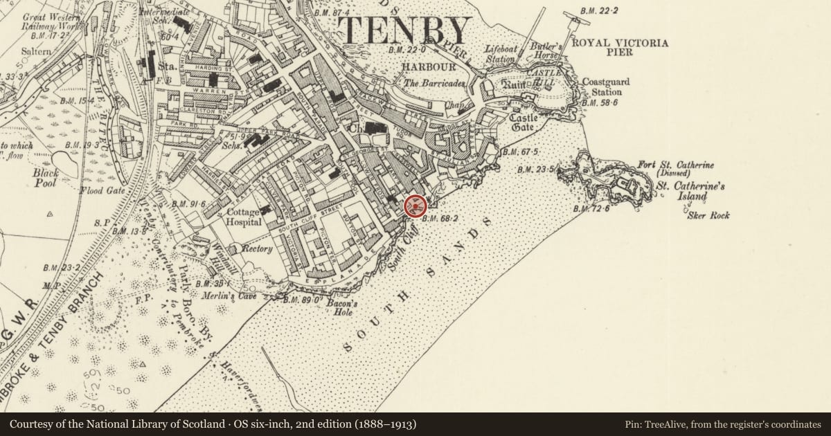
Slide toward Today to fade the historical sheet and see the modern map underneath.
David Rumsey Map Collection, Stanford LibrariesDavid Rumsey Map Collection, Stanford LibrariesDavid Rumsey Map Collection, Stanford LibrariesDavid Rumsey Map Collection, Stanford LibrariesDavid Rumsey Map Collection, Stanford Libraries
5 historical maps cover this location, the earliest the 1636 map "Cornubia : Devonia, Somersetus, Dorcestria, Wiltonia, Glocestria ..." (David Rumsey Map Collection, Stanford Libraries).
Historical maps covering this location
- 1636 · Cornubia : Devonia, Somersetus, Dorcestria, Wiltonia, Glocestria ... (David Rumsey Map Collection, Stanford Libraries)
- 1865 · England and Wales. England No. 6. (David Rumsey Map Collection, Stanford Libraries)
- 1891 · Sheet 10. Ordnance Survey of England and Wales. . (David Rumsey Map Collection, Stanford Libraries)
- 1898 · 245 Pembroke (Hills) (David Rumsey Map Collection, Stanford Libraries)
- 1901 · Sheet 13. (David Rumsey Map Collection, Stanford Libraries)
Cadw's description
Location
Railings run along seafront of the Paragon from foot of Cresswell Street to the Imperial Hotel.
History
Cast-iron railings and stone piers along cliff-edge between the Imperial Hotel and the steps to the beach at the end of Cresswell Street. Probably late C19, of similar type to those at The Croft. Marked on top rail and on the gate 'George Smith & Co, Sun Foundry, Glasgow'.
Exterior
Piers and railings. Piers of rockfaced grey limestone with plinths, bull-nosed cornices and chamfered capstones. Cast-iron railings in long panels of an intersecting pattern of circles and rectangles with half-round upper and lower ends. Rails are set into low stone coping above bull-nosed stone string course and with corbels below which hold wrought iron scrolled supports. Six stone piers, 2 cast-iron gates.
Reason for designation
Included as decorative C19 railings, of group value with the buildings along the Paragon.
Nearby in the register
- The Paragon Private HotelCommercialunder 1 mi
- Paragon CourtDomesticunder 1 mi
- Swn y DonDomesticunder 1 mi
- Scarborough House and Gunfort MansionsDomesticunder 1 mi
Other entries of the same register within about three miles of this one, by straight line.