Cof Cymru: National Historic Assets of Wales · Wales
Periwinkle Cottage
Tenby, Pembrokeshire, Wales
A Grade II listed building in Tenby, Pembrokeshire, designated on 28 March 2002.
The record
- Designation
- Listed building, Grade II
- Broad class
- Domestic
- Date of designation
- 28 March 2002
- Town
- Tenby
- Community
- Tenby
- Unitary authority
- Pembrokeshire
- Country
- Wales
- Coordinates
- 51.67216, -4.69968
- Cadw reference
- 26332
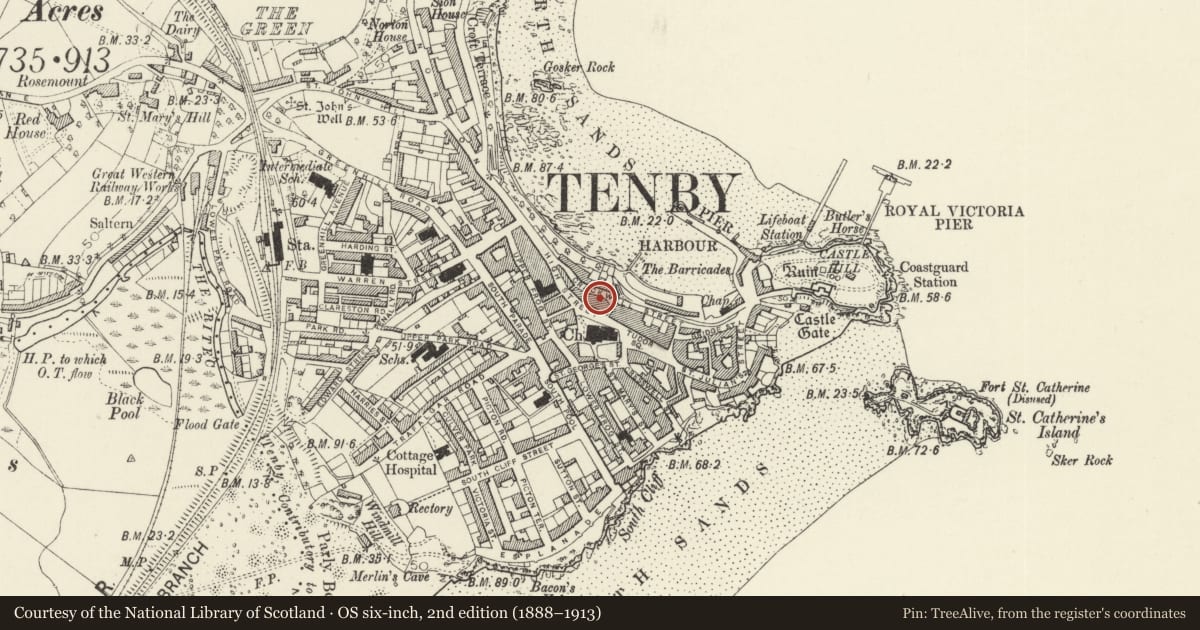
Slide toward Today to fade the historical sheet and see the modern map underneath.
David Rumsey Map Collection, Stanford LibrariesDavid Rumsey Map Collection, Stanford LibrariesDavid Rumsey Map Collection, Stanford LibrariesDavid Rumsey Map Collection, Stanford LibrariesDavid Rumsey Map Collection, Stanford Libraries
5 historical maps cover this location, the earliest the 1636 map "Cornubia : Devonia, Somersetus, Dorcestria, Wiltonia, Glocestria ..." (David Rumsey Map Collection, Stanford Libraries).
Historical maps covering this location
- 1636 · Cornubia : Devonia, Somersetus, Dorcestria, Wiltonia, Glocestria ... (David Rumsey Map Collection, Stanford Libraries)
- 1865 · England and Wales. England No. 6. (David Rumsey Map Collection, Stanford Libraries)
- 1891 · Sheet 10. Ordnance Survey of England and Wales. . (David Rumsey Map Collection, Stanford Libraries)
- 1898 · 245 Pembroke (Hills) (David Rumsey Map Collection, Stanford Libraries)
- 1901 · Sheet 13. (David Rumsey Map Collection, Stanford Libraries)
Cadw's description
Location
On the SW side of Crackwell Street some 10m W of the junction with Crackwell Lane.
History
Earlier C19 three-storey house apparently built with Anchorage, the 2-storey house to the left. The sloped right side wall suggests that this may be an older building remodelled.
Exterior
House, white-painted stucco with asbestos-sheet close-eaved hipped roof and very large red brick stack to right. Tall three-storey, single window range with door to ground floor extreme left paired with doorway to Anchorage to left. Second floor has 12-pane hornless sash, first floor has canted oriel with timber cornice, 4-12-4-pane hornless sashes and deep apron. Ground floor has shop window aligned slightly to right, C20 glazing, and arched doorway to left with 6-panel door and plain fanlight. Rendered unpainted left side wall. Right side wall is slightly battered in profile, suggesting an older building remodelled.
Reason for designation
Included as a late Georgian style town house, a pair with Anchorage to left.
Nearby in the register
- AnchorageDomesticunder 1 mi
- Jasperley HouseCommercialunder 1 mi
- No 2 Lancaster BuildingsNo class recordedunder 1 mi
- The LanternCommercialunder 1 mi
Other entries of the same register within about three miles of this one, by straight line.