Cof Cymru: National Historic Assets of Wales · Wales
Ivy House
Mostyn, Flintshire, Wales
A Grade II listed building in Rhewl Mostyn, Mostyn, Flintshire, designated on 28 March 2002.
The record
- Designation
- Listed building, Grade II
- Broad class
- Domestic
- Date of designation
- 28 March 2002
- Locality
- Rhewl Mostyn
- Community
- Mostyn
- Unitary authority
- Flintshire
- Country
- Wales
- Coordinates
- 53.31307, -3.27173
- Cadw reference
- 26284
Slide toward Today to fade the historical sheet and see the modern map underneath.
David Rumsey Map Collection, Stanford LibrariesDavid Rumsey Map Collection, Stanford LibrariesDavid Rumsey Map Collection, Stanford LibrariesLlyfrgell Genedlaethol Cymru – The National Library of WalesNational Library of Scotland
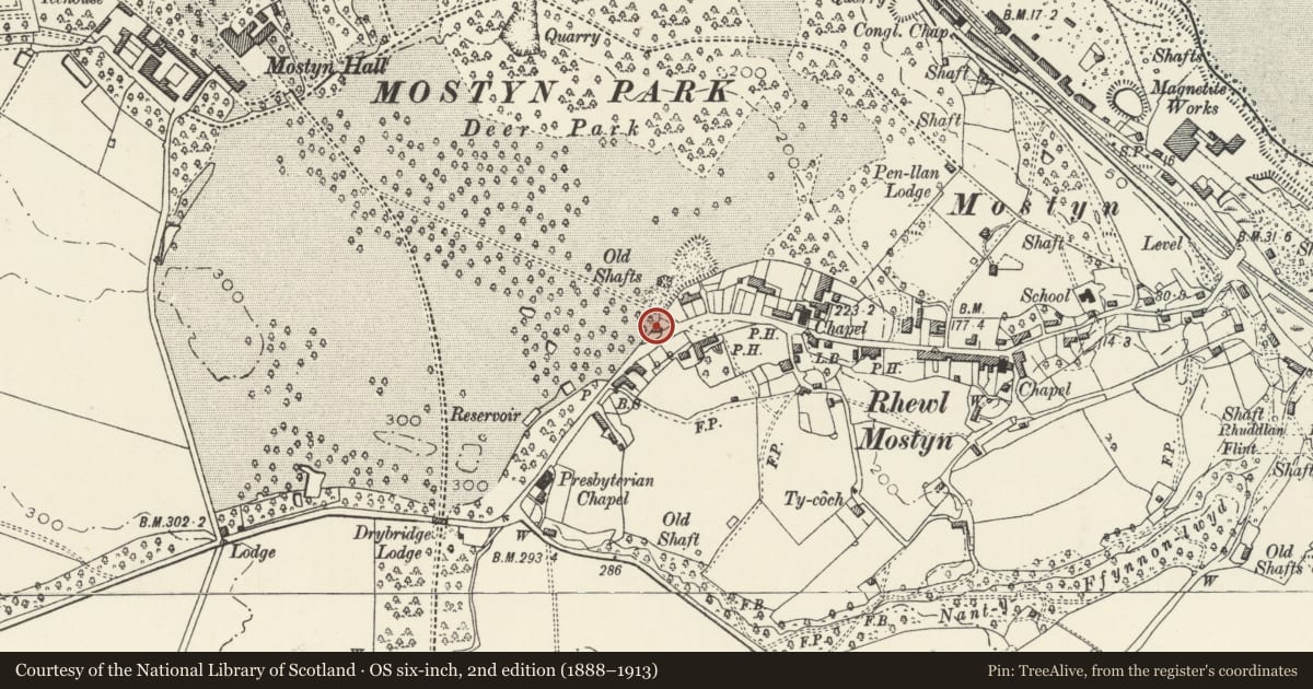
5 historical maps cover this location, the earliest the 1795 map "To Sir Watkin Williams-Wynn Bart ... the map of the six counties of North Wales is most humbly inscribed by his obedient humble servant" (Llyfrgell Genedlaethol Cymru – The National Library of Wales).
Historical maps covering this location
- 1795 · To Sir Watkin Williams-Wynn Bart ... the map of the six counties of North Wales is most… (Llyfrgell Genedlaethol Cymru – The National Library of Wales)
- 1883 · Watershed map England, Wales 3. (David Rumsey Map Collection, Stanford Libraries)
- 1896 · 96 Liverpool (Hills) (David Rumsey Map Collection, Stanford Libraries)
- 1901 · Sheet 9 and 10. (David Rumsey Map Collection, Stanford Libraries)
- 1930 · OS Popular Edition 1919-1947 (National Library of Scotland)
Cadw's description
Location
Set back on the N side of the main road through Rhewl Mostyn NW of The Swan public house.
History
A Mostyn Estate cottage built in the first half of the C19 beside the main entrance to Mostyn Park from Rhewl Mostyn, and shown on the 1849 Tithe map.
Exterior
A 2-storey, 2-window cottage of rubble stone and slate roof with coped gables, and brick stack to the R, rendered stack to the L. Openings are offset to the L side. The off-centre doorway has a stone segmental head and a boarded door with iron studs, and with a small glazed panel inserted. The flanking windows have wedge lintels in the lower storey and are beneath the eaves in the upper storey. They have 2-light casements. Against the L gable end is a single-storey rendered projection. The 2-window rear has casements similar to the front.
Reason for designation
Listed as an estate cottage retaining early C19 character.
Nearby in the register
- Gate piers and gates at rear of Ivy HouseGardens, Parks and Urban Spacesunder 1 mi
- Drybridge LodgeDomesticunder 1 mi
- Penlan LodgeDomesticunder 1 mi
- Gate piers, gates and railings at Penlan LodgeGardens, Parks and Urban Spacesunder 1 mi
Other entries of the same register within about three miles of this one, by straight line.