Cof Cymru: National Historic Assets of Wales · Wales
Britannia Inn
Halkyn, Flintshire, Wales
A Grade II listed building in Halkyn, Holywell, Flintshire, designated on 31 January 2002.
The record
- Designation
- Listed building, Grade II
- Broad class
- Commercial
- Date of designation
- 31 January 2002
- Locality
- Halkyn
- Town
- Holywell
- Community
- Halkyn
- Unitary authority
- Flintshire
- Country
- Wales
- Coordinates
- 53.23119, -3.18310
- Cadw reference
- 26210
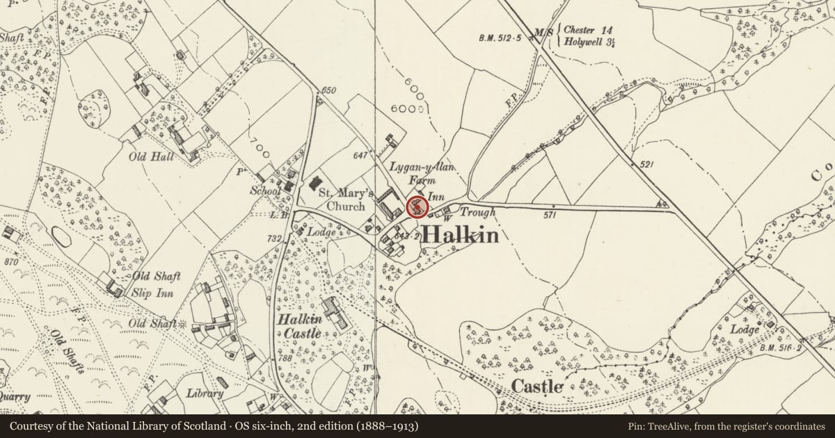
Slide toward Today to fade the historical sheet and see the modern map underneath.
David Rumsey Map Collection, Stanford LibrariesDavid Rumsey Map Collection, Stanford LibrariesDavid Rumsey Map Collection, Stanford LibrariesDavid Rumsey Map Collection, Stanford LibrariesLlyfrgell Genedlaethol Cymru – The National Library of Wales
5 historical maps cover this location, the earliest the 1795 map "To Sir Watkin Williams-Wynn Bart ... the map of the six counties of North Wales is most humbly inscribed by his obedient humble servant" (Llyfrgell Genedlaethol Cymru – The National Library of Wales).
Historical maps covering this location
- 1795 · To Sir Watkin Williams-Wynn Bart ... the map of the six counties of North Wales is most… (Llyfrgell Genedlaethol Cymru – The National Library of Wales)
- 1883 · Watershed map England, Wales 3. (David Rumsey Map Collection, Stanford Libraries)
- 1898 · 108 Flint (Hills) (David Rumsey Map Collection, Stanford Libraries)
- 1898 · 108 Flint (Outline) (David Rumsey Map Collection, Stanford Libraries)
- 1901 · Sheet 9 and 10. (David Rumsey Map Collection, Stanford Libraries)
Cadw's description
Location
Approximately 200m E of the parish church, opposite Lygan-y-llan farm.
History
The Britannia Inn was purchased by the Grosvenor Estate in 1807 and was a coaching inn on the Holyhead to Chester road. It is shown on the 1839 Tithe map but was rebuilt in the mid C19 in estate style, and is shown in its present form on the 1870 Ordnance Survey. The Grosvenor family owned an extensive estate and mineral rights in the Halkyn area. Halkyn Castle was built for the second Earl Grosvenor in 1824-7 and was used as an occasional residence. The Earl was later made Duke of Westminster.
Exterior
A 2-storey 3-window inn facing S, of rubble stone with bigger quoins, slate roof behind coped gables on moulded kneelers, and coursed stone stacks L of centre and to each end. Small-pane windows are replaced in original openings with hood moulds and stone sills. The castellated porch is R of centre and has a Tudor-headed doorway in a freestone surround. Within is a half-lit door. The rear has 5 replaced small-pane windows in the upper storey under hood moulds, beneath which is an added lean-to attached to a single-storey wing on the W side. Rear windows with hood moulds are retained in the lean-to at the rear.
Interior
The interior has been altered by removal of a partition wall, but the central room retains a fireplace with timber lintel.
Reason for designation
Listed, notwithstanding replacement of windows, as a public house retaining estate character and with interesting earlier origins as a coaching inn, and for its important contribution to the historic character of Halkyn village.
Nearby in the register
- Lygan y Llan Farmhouse including Forecourt Walls and RailingsDomesticunder 1 mi
- RosemountDomesticunder 1 mi
- HillsideDomesticunder 1 mi
- Former Shippon at RosemountAgriculture and Subsistenceunder 1 mi
Other entries of the same register within about three miles of this one, by straight line.