Cof Cymru: National Historic Assets of Wales · Wales
Cart House and Stable at Bryn Awel
Halkyn, Flintshire, Wales
A Grade II listed building in Pentre Halkyn, Holywell, Halkyn, Flintshire, designated on 31 January 2002.
The record
- Designation
- Listed building, Grade II
- Broad class
- Agriculture and Subsistence
- Date of designation
- 31 January 2002
- Locality
- Pentre Halkyn
- Town
- Holywell
- Community
- Halkyn
- Unitary authority
- Flintshire
- Country
- Wales
- Coordinates
- 53.24398, -3.19950
- Cadw reference
- 26159
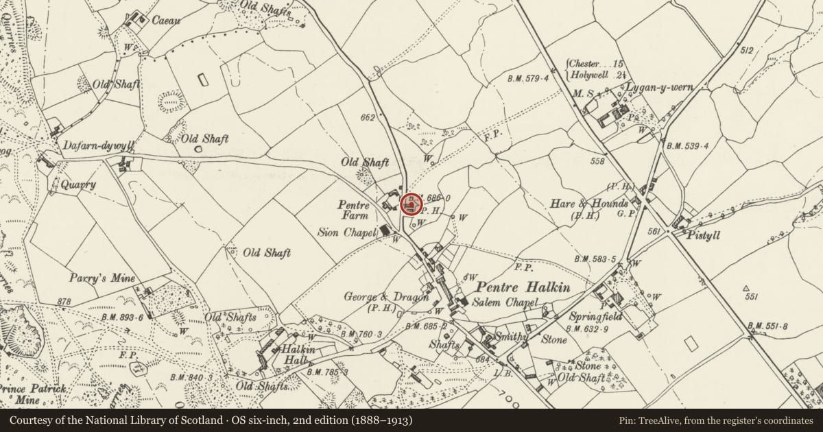
Slide toward Today to fade the historical sheet and see the modern map underneath.
David Rumsey Map Collection, Stanford LibrariesDavid Rumsey Map Collection, Stanford LibrariesDavid Rumsey Map Collection, Stanford LibrariesDavid Rumsey Map Collection, Stanford LibrariesLlyfrgell Genedlaethol Cymru – The National Library of Wales
5 historical maps cover this location, the earliest the 1795 map "To Sir Watkin Williams-Wynn Bart ... the map of the six counties of North Wales is most humbly inscribed by his obedient humble servant" (Llyfrgell Genedlaethol Cymru – The National Library of Wales).
Historical maps covering this location
- 1795 · To Sir Watkin Williams-Wynn Bart ... the map of the six counties of North Wales is most… (Llyfrgell Genedlaethol Cymru – The National Library of Wales)
- 1883 · Watershed map England, Wales 3. (David Rumsey Map Collection, Stanford Libraries)
- 1898 · 108 Flint (Hills) (David Rumsey Map Collection, Stanford Libraries)
- 1898 · 108 Flint (Outline) (David Rumsey Map Collection, Stanford Libraries)
- 1901 · Sheet 9 and 10. (David Rumsey Map Collection, Stanford Libraries)
Cadw's description
Location
At the back of the house.
History
A mid C19 cart house and stable belonging to the former Red Lion Inn and first shown on the 1870 Ordnance Survey.
Exterior
A cart house and stable of rubble stone with bigger quoins and freestone dressings, and slate roof. Facing the house are 2 pitching eyes to the loft. Below, on the L side, is a segmental-headed doorway to the cart shed, partly infilled and with a replaced door. On the R side is a narrower doorway to the stable with a window to its L slightly widened from its original segmental head. A lean-to is against the R gable end. At the rear are attached corrugated iron sheds, and a pitching eye to the R end.
Reason for designation
Listed as a well-preserved C19 outbuilding and for group value with Bryn Awel.
Nearby in the register
- Bryn AwelDomesticunder 1 mi
- Shippon at Pentre FarmAgriculture and Subsistenceunder 1 mi
- Old House at Pentre FarmDomesticunder 1 mi
- Dovecote at Lygan-y-wernDomesticunder 1 mi
Other entries of the same register within about three miles of this one, by straight line.