Cof Cymru: National Historic Assets of Wales · Wales
Lewis Rogers Almhouses outbuilding range (S)
Penmynydd, Isle of Anglesey, Wales
A Grade II listed building in Penmynydd, Llanfairpwllgwyngyll, Isle of Anglesey, designated on 5 February 1952.
The record
- Designation
- Listed building, Grade II
- Broad class
- Domestic
- Date of designation
- 5 February 1952
- Locality
- Penmynydd
- Town
- Llanfairpwllgwyngyll
- Community
- Penmynydd
- Unitary authority
- Isle of Anglesey
- Country
- Wales
- Coordinates
- 53.24402, -4.22896
- Cadw reference
- 26145
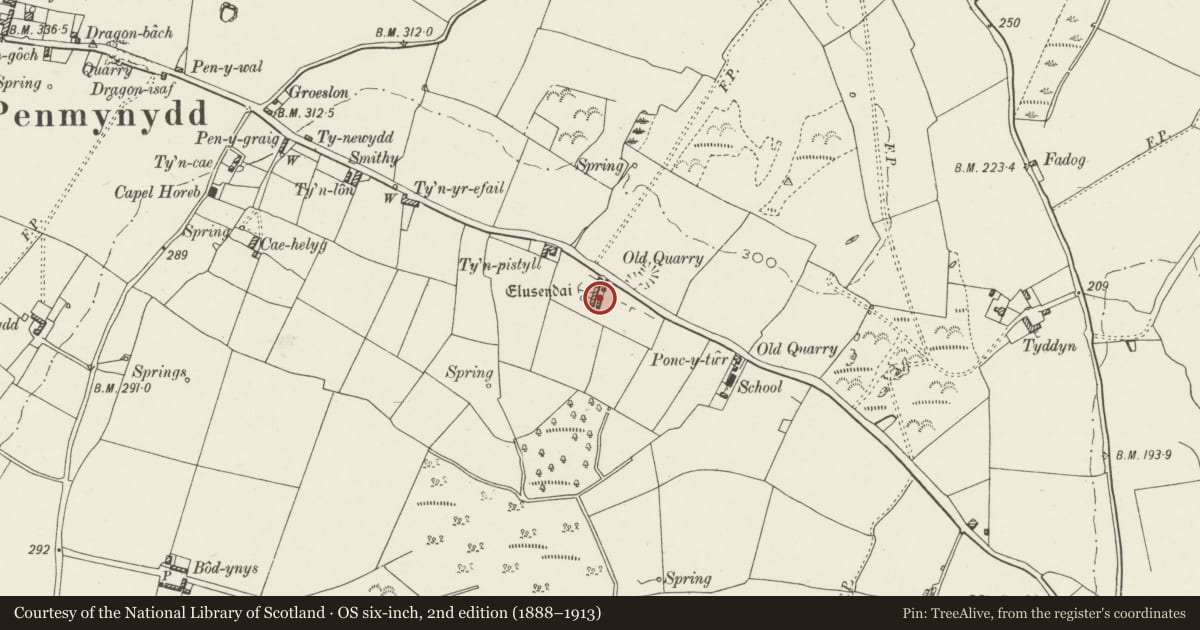
Slide toward Today to fade the historical sheet and see the modern map underneath.
David Rumsey Map Collection, Stanford LibrariesDavid Rumsey Map Collection, Stanford LibrariesDavid Rumsey Map Collection, Stanford LibrariesDavid Rumsey Map Collection, Stanford LibrariesDavid Rumsey Map Collection, Stanford Libraries
5 historical maps cover this location, the earliest the 1883 map "Watershed map England, Wales 3." (David Rumsey Map Collection, Stanford Libraries).
Historical maps covering this location
- 1883 · Watershed map England, Wales 3. (David Rumsey Map Collection, Stanford Libraries)
- 1896 · Sheet 7. Ordnance Survey of England and Wales. (David Rumsey Map Collection, Stanford Libraries)
- 1899 · 105 Carnarvon (Hills) (David Rumsey Map Collection, Stanford Libraries)
- 1901 · Sheet 9 and 10. (David Rumsey Map Collection, Stanford Libraries)
- 1919 · Sheet 41. Anglesey. (David Rumsey Map Collection, Stanford Libraries)
Cadw's description
Location
Set at right angles to the S side of the B5420 in the centre of the village of Penmynydd. The outbuilding ranges are directly opposite the almshouses for which they were built and this is the southernmost of the two.
History
Probably contemporary with the late C19 restoration work carried out at the adjacent range of tenements for which they were built.
Exterior
Single storey range of 5 outbuildings, erected for 5 of the tenements for which they were built. Rubble masonry with large boulder quoins; modern slate roof. The range has 5 doorways each to the L of each of the 5 units and a small window to the rear; modern boarded doors and shutters to openings.
Interior
Interior not inspected at the time of the survey.
Reason for designation
Included for its importance as part of a coherent group of tenement dwellings with the early C17 almshouses range and the adjacent outbuilding range to the N.
Nearby in the register
- Lewis Rogers AlmshousesHealth and Welfareunder 1 mi
- Lewis Rogers AlmshouseHealth and Welfareunder 1 mi
- Lewis Rogers AlmshousesHealth and Welfareunder 1 mi
- Lewis Rogers AlmshousesHealth and Welfareunder 1 mi
Other entries of the same register within about three miles of this one, by straight line.