Cof Cymru: National Historic Assets of Wales · Wales
Quay Wall and Slip at the Hanbury Arms
Caerleon, Newport, Wales
A Grade II listed building in Caerleon, Newport, designated on 18 January 2002.
The record
- Designation
- Listed building, Grade II
- Broad class
- Transport
- Date of designation
- 18 January 2002
- Locality
- Caerleon
- Town
- Newport
- Community
- Caerleon
- Unitary authority
- Newport
- Country
- Wales
- Coordinates
- 51.60815, -2.95213
- Cadw reference
- 26127
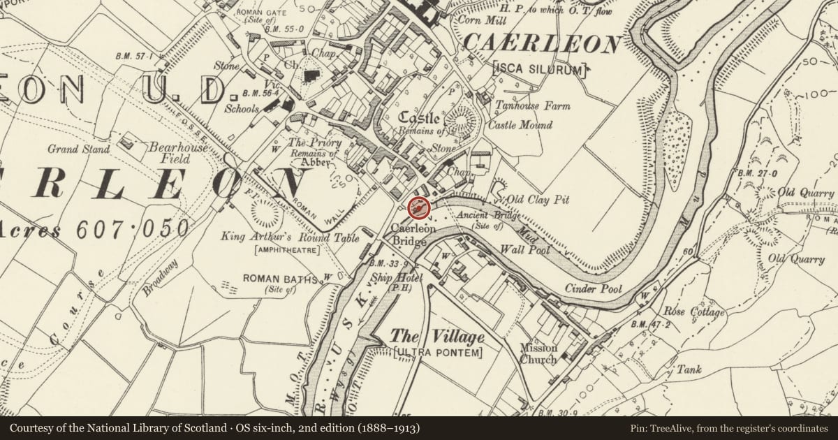
Slide toward Today to fade the historical sheet and see the modern map underneath.
David Rumsey Map Collection, Stanford LibrariesDavid Rumsey Map Collection, Stanford LibrariesDavid Rumsey Map Collection, Stanford LibrariesDavid Rumsey Map Collection, Stanford LibrariesDavid Rumsey Map Collection, Stanford Libraries
5 historical maps cover this location, the earliest the 1636 map "Cornubia : Devonia, Somersetus, Dorcestria, Wiltonia, Glocestria ..." (David Rumsey Map Collection, Stanford Libraries).
Historical maps covering this location
- 1636 · Cornubia : Devonia, Somersetus, Dorcestria, Wiltonia, Glocestria ... (David Rumsey Map Collection, Stanford Libraries)
- 1830 · V.3:11-15:XV.Britisches Reich. A. Kon: England. a. England ab sich: Shire:15-17, 33 (David Rumsey Map Collection, Stanford Libraries)
- 1895 · Sheet 11. Ordnance Survey of England and Wales. (David Rumsey Map Collection, Stanford Libraries)
- 1906 · 249 Newport (Hills) (David Rumsey Map Collection, Stanford Libraries)
- 1913 · Sheet 102. Newport. (David Rumsey Map Collection, Stanford Libraries)
Cadw's description
Location
To the south of The Hanbury Arms along the river frontage.
History
The quay is possibly mid C18, the slip appears to have been built separately and later. It marked the high point of navigation on the river Usk which was blocked by the timber bridge immediately upstream of the quay. When the new Caerleon Bridge (qv) was built below the quay in 1806-12 it marked the end of Caerleon as a port as the larger ships could no longer reach it, but it had already been by-passed by the new docks in Newport, and their direct access to the industrial areas inland via the Monmouthshire Canal which had opened in 1799, and the early tramroads. The opening of the Brecknock and Abergavenny Canal in 1812 made matters worse, but the last cargo did not leave Caerleon until 1896.
Exterior
The structure is built of coursed squared rock-faced local sandstone rubble with dressed copings. The quay is now mostly tarmac but the stone probably survives underneath this. The slip is stone paved. The quay is about 30m in length and about 4m in height. The slip is about 20m in length and about 2m in height and across.
Reason for designation
Included as the historic Caerleon Quay, and having group value with The Hanbury Arms, the medieval tower and Caerleon Bridge.
Nearby in the register
- Tower to the south west of, and attached to, The Hanbury ArmsDefenceunder 1 mi
- Medieval Tower at Hanbury ArmsTowerunder 1 mi
- The Hanbury Arms PHDomesticunder 1 mi
- King's HouseDomesticunder 1 mi
Other entries of the same register within about three miles of this one, by straight line.