Cof Cymru: National Historic Assets of Wales · Wales
Garden Wall of The Priest's House
Caerleon, Newport, Wales
A Grade II listed building in Caerleon, Newport, designated on 18 January 2002.
The record
- Designation
- Listed building, Grade II
- Broad class
- Domestic
- Date of designation
- 18 January 2002
- Locality
- Caerleon
- Town
- Newport
- Community
- Caerleon
- Unitary authority
- Newport
- Country
- Wales
- Coordinates
- 51.60888, -2.95170
- Cadw reference
- 26111
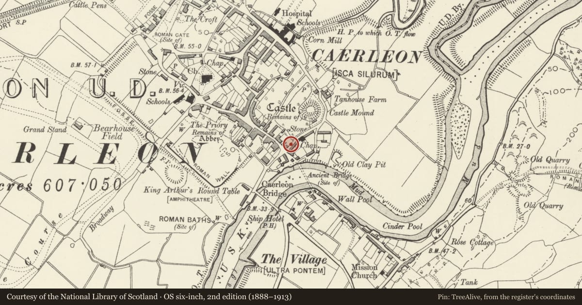
Slide toward Today to fade the historical sheet and see the modern map underneath.
David Rumsey Map Collection, Stanford LibrariesDavid Rumsey Map Collection, Stanford LibrariesDavid Rumsey Map Collection, Stanford LibrariesDavid Rumsey Map Collection, Stanford LibrariesDavid Rumsey Map Collection, Stanford Libraries
5 historical maps cover this location, the earliest the 1636 map "Cornubia : Devonia, Somersetus, Dorcestria, Wiltonia, Glocestria ..." (David Rumsey Map Collection, Stanford Libraries).
Historical maps covering this location
- 1636 · Cornubia : Devonia, Somersetus, Dorcestria, Wiltonia, Glocestria ... (David Rumsey Map Collection, Stanford Libraries)
- 1830 · V.3:11-15:XV.Britisches Reich. A. Kon: England. a. England ab sich: Shire:15-17, 33 (David Rumsey Map Collection, Stanford Libraries)
- 1895 · Sheet 11. Ordnance Survey of England and Wales. (David Rumsey Map Collection, Stanford Libraries)
- 1906 · 249 Newport (Hills) (David Rumsey Map Collection, Stanford Libraries)
- 1913 · Sheet 102. Newport. (David Rumsey Map Collection, Stanford Libraries)
Cadw's description
Location
Behind The Priest's House, fronting Castle Street.
History
This wall is a part of the wall constructed round The Mynde (now No 14 High Street) in 1839. The owner of the house and of Ponthir Plate Works, John Jenkins, was frightened by the possibility of violence and destruction of property by the Chartist Movement and built the wall right round his property to protect it. It is now in six different ownerships, but continues to be visually very important to Caerleon. Its fortress like appearance pays respect to the Castle Mound a large Norman motte within the enclosure.
Exterior
Squared local red sandstone and conglomerate rubble wall about 4m in height and about 25m long topped by castellations now hidden by creeper. Pointed arch doorway with dressed rubble voussoirs. This section must originally have been a part of The Mynde wall, for it abuts it directly and is of a similar character and date. Interior face not seen.
Reason for designation
Included as a fine wall built in 1839 with historic associations and group value with the surrounding buildings in the centre of Caerleon.
Nearby in the register
- The Priest's House with attached wall and gatesDomesticunder 1 mi
- Catholic Church of Ss Julius, Aaron & DavidReligious, Ritual and Funeraryunder 1 mi
- King's HouseDomesticunder 1 mi
- Garden Wall of The MyndeDomesticunder 1 mi
Other entries of the same register within about three miles of this one, by straight line.