Cof Cymru: National Historic Assets of Wales · Wales
Tir-hwch Farmhouse
Cwm, Denbighshire, Wales
A Grade II listed building in Rhuddlan, Cwm, Denbighshire, designated on 11 January 2002.
The record
- Designation
- Listed building, Grade II
- Broad class
- Agriculture and Subsistence
- Date of designation
- 11 January 2002
- Locality
- Rhuddlan
- Community
- Cwm
- Unitary authority
- Denbighshire
- Country
- Wales
- Coordinates
- 53.28082, -3.42441
- Cadw reference
- 26090
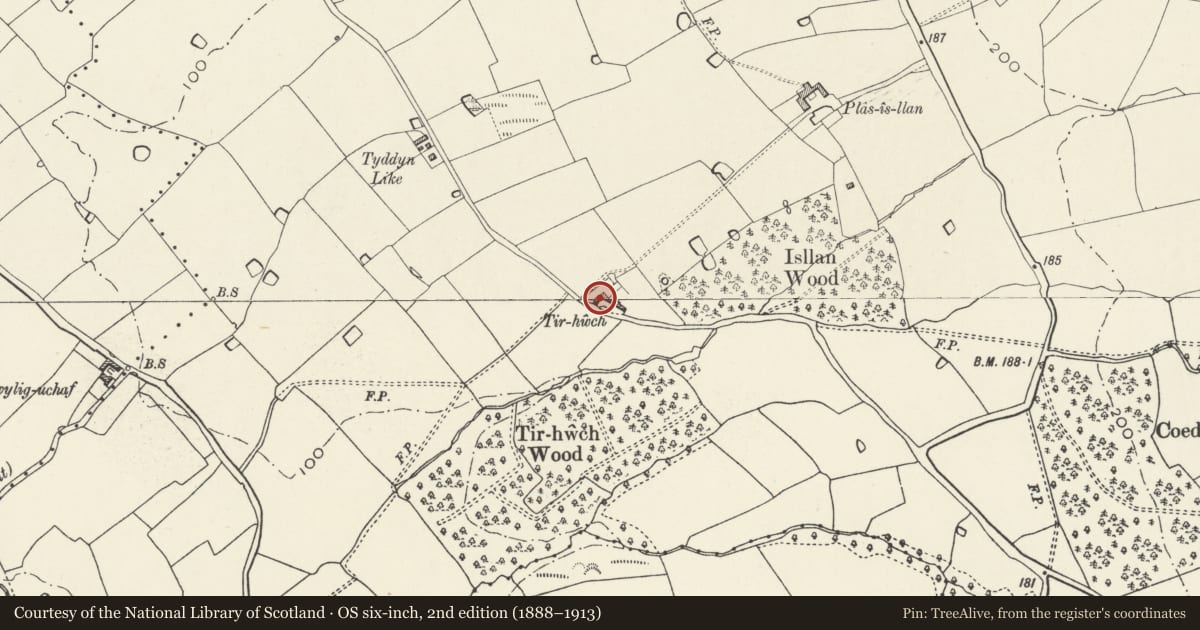
Slide toward Today to fade the historical sheet and see the modern map underneath.
David Rumsey Map Collection, Stanford LibrariesDavid Rumsey Map Collection, Stanford LibrariesDavid Rumsey Map Collection, Stanford LibrariesLlyfrgell Genedlaethol Cymru – The National Library of WalesDavid Rumsey Map Collection, Stanford Libraries
5 historical maps cover this location, the earliest the 1795 map "To Sir Watkin Williams-Wynn Bart ... the map of the six counties of North Wales is most humbly inscribed by his obedient humble servant" (Llyfrgell Genedlaethol Cymru – The National Library of Wales).
Historical maps covering this location
- 1795 · To Sir Watkin Williams-Wynn Bart ... the map of the six counties of North Wales is most… (Llyfrgell Genedlaethol Cymru – The National Library of Wales)
- 1830 · V.3:11-15:XV. Britisches Reich. A. Kon: England. b. Frstenthum Wales: Shire: 37-40 (David Rumsey Map Collection, Stanford Libraries)
- 1883 · Watershed map England, Wales 3. (David Rumsey Map Collection, Stanford Libraries)
- 1898 · 95 Rhyl (Hills) (David Rumsey Map Collection, Stanford Libraries)
- 1901 · Sheet 9 and 10. (David Rumsey Map Collection, Stanford Libraries)
Cadw's description
Location
At north-east side of a minor road about 400 m south-west of Plas-is-llan; small farmyard to south with a partly lofted range of agricultural buildings at right-angles to the house.
History
A farmhouse probably of the early C19, recorded in 1844 as the house of a tenancy of 30 acres (12 hectares) on the Mostyn estate.
Exterior
A two-storey, two-window farmhouse set at right-angles to the road, in local axe-dressed limestone with slate roof and tile ridge. Full-height wing at rear. End chimneys to the main range and to the rear wing in brickwork. Nine-pane unequal-sash windows to front elevation and road-facing side of rear wing at first storey; 12-pane sash windows to ground storey with segmental stone arches. The windows are in exposed frames. Front door with large over-light and similar arch. The front fenestration is symmetrical but slightly offset to the left, allowing greater space at the right chimney.
Reason for designation
A small estate farmhouse which has retained its late vernacular character well.
Nearby in the register
- Plas-is-llan West Agricultural RangeAgriculture and Subsistenceunder 1 mi
- Plas-is-llanDomesticunder 1 mi
- Plas-is-llan East Agricultural Range (now Domestic Units)Domesticunder 1 mi
- Tan-llan Farmhouse RangeAgriculture and Subsistenceunder 1 mi
Other entries of the same register within about three miles of this one, by straight line.