Cof Cymru: National Historic Assets of Wales · Wales
Penrhyn
Fishguard and Goodwick, Pembrokeshire, Wales
A Grade II listed building in Goodwick, Fishguard, Fishguard and Goodwick, Pembrokeshire, designated on 7 January 2002.
The record
- Designation
- Listed building, Grade II
- Broad class
- Domestic
- Date of designation
- 7 January 2002
- Locality
- Goodwick
- Town
- Fishguard
- Community
- Fishguard and Goodwick
- Unitary authority
- Pembrokeshire
- Country
- Wales
- Coordinates
- 52.00718, -4.99144
- Cadw reference
- 26066
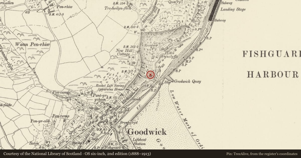
Slide toward Today to fade the historical sheet and see the modern map underneath.
David Rumsey Map Collection, Stanford LibrariesDavid Rumsey Map Collection, Stanford LibrariesDavid Rumsey Map Collection, Stanford LibrariesDavid Rumsey Map Collection, Stanford LibrariesDavid Rumsey Map Collection, Stanford Libraries
5 historical maps cover this location, the earliest the 1608 map "(13) Cambriae Typus." (David Rumsey Map Collection, Stanford Libraries).
Historical maps covering this location
- 1608 · (13) Cambriae Typus. (David Rumsey Map Collection, Stanford Libraries)
- 1891 · Sheet 10. Ordnance Survey of England and Wales. . (David Rumsey Map Collection, Stanford Libraries)
- 1898 · 210 Cardigan (Hills) (David Rumsey Map Collection, Stanford Libraries)
- 1898 · 210 Cardigan (Outline) (David Rumsey Map Collection, Stanford Libraries)
- 1901 · Sheet 13. (David Rumsey Map Collection, Stanford Libraries)
Cadw's description
Location
Situated on terrace above the road, some 150m before the Fishguard Bay Hotel.
History
Late C19 villa with architectural detail similar to some other houses on Quay Road and Main Street, Goodwick, but more ornate.
Exterior
Substantial detached villa, whitewashed stucco cladding, with slate roof, fretted bargeboards and brick end stacks. Two-and-a-half storey, 2-window range. Two narrow stucco gabled dormers set on short lengths of parapet with console scrolls abutting dormer sides. Each has small 4-pane sash with segmental-arched head to upper sash. On the first floor are 2 large 3-light 2-4-2-pane sash windows, with a segmental-arched head to each light, the whole window itself segmental-arched. On the ground floor are 2 large canted bays with 2-6-2-pane sash windows with unusual ornamental frames with bead-moulding and upper corners chamfered. Dentilated cornices and flat roofs. In the right gable end is a small attic window, a large first floor and a flat-roofed porch with arched doorway facing forwards and reached by slate steps from road level. C20 half-glazed door with plain fanlight over.
Reason for designation
Included as the best late C19 villa in Goodwick, bearing similarities of detail to others on Quay Road and Main Street, but here much more ornate.
Nearby in the register
- Fishguard Bay HotelCommercialunder 1 mi
- Berachah CottageDomesticunder 1 mi
- Berachah Presbyterian ChurchReligious, Ritual and Funeraryunder 1 mi
- Goodwick InstituteRecreationalunder 1 mi
Other entries of the same register within about three miles of this one, by straight line.