Cof Cymru: National Historic Assets of Wales · Wales
Heulfryn, Including Forecourt Walls and Railings
Bala, Gwynedd, Wales
A Grade II listed building in Bala, Gwynedd, designated on 13 December 2001.
The record
- Designation
- Listed building, Grade II
- Broad class
- Domestic
- Date of designation
- 13 December 2001
- Community
- Bala
- Unitary authority
- Gwynedd
- Country
- Wales
- Coordinates
- 52.91127, -3.59765
- Cadw reference
- 25994
Slide toward Today to fade the historical sheet and see the modern map underneath.
David Rumsey Map Collection, Stanford LibrariesDavid Rumsey Map Collection, Stanford LibrariesLlyfrgell Genedlaethol Cymru – The National Library of WalesDavid Rumsey Map Collection, Stanford LibrariesDavid Rumsey Map Collection, Stanford Libraries
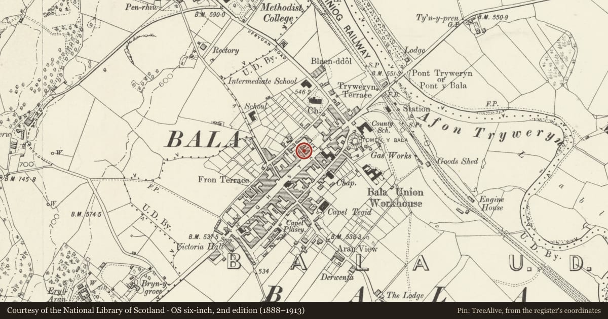
5 historical maps cover this location, the earliest the 1795 map "To Sir Watkin Williams-Wynn Bart ... the map of the six counties of North Wales is most humbly inscribed by his obedient humble servant" (Llyfrgell Genedlaethol Cymru – The National Library of Wales).
Historical maps covering this location
- 1795 · To Sir Watkin Williams-Wynn Bart ... the map of the six counties of North Wales is most… (Llyfrgell Genedlaethol Cymru – The National Library of Wales)
- 1830 · V.3:11-15:XV. Britisches Reich. A. Kon: England. b. Frstenthum Wales: Shire: 37-40 (David Rumsey Map Collection, Stanford Libraries)
- 1883 · Watershed map England, Wales 3. (David Rumsey Map Collection, Stanford Libraries)
- 1899 · 136 Bala (Hills) (David Rumsey Map Collection, Stanford Libraries)
- 1901 · Sheet 9 and 10. (David Rumsey Map Collection, Stanford Libraries)
Cadw's description
Location
Set back from the street-line behind a narrow low-walled and railed forecourt.
History
Late Regency former town house with later C19 alterations to windows.
Exterior
Three-storey late Regency former town house. Of uncoursed, squared stone blocks, the ground floor roughcast; renewed slate roof and end chimneys with plain cornicing. The facade is symmetrical and has a central entrance with half-glazed door and plain rectangular fanlight; open porch on Tuscan columns with simply-moulded entablature. Flanking this Victorian canted wooden bay window with moulded cornices and 4-pane casements to L with modern bay to R. The first floor has two large windows with 4-pane casements effectively serving as French windows; these open onto a balcony with cast-iron brackets and decorative ironwork. Plain 2-pane casements to the second floor. Low slatestone forecourt walls to the front, with surmounting spear-headed railings. The rear elevation has 16-pane sashes to the upper floors, and a tall arched stair window with marginal glazing.
Interior
The interior was not inspected at the time of survey.
Reason for designation
Listed as a second-quarter C19 house retaining good C19 character in the town centre.
Group value with the statue of T.E. Ellis adjacent.
Nearby in the register
- Siop DECommercialunder 1 mi
- Yr EryrCommercialunder 1 mi
- Statue Of T.E. EllisCommemorativeunder 1 mi
- TenovusCommercialunder 1 mi
Other entries of the same register within about three miles of this one, by straight line.