Cof Cymru: National Historic Assets of Wales · Wales
Farthings Hook Bridge (partly in the New Moat community)
Puncheston, Pembrokeshire, Wales
A Grade II listed building in Henry's Moat, Haverfordwest, Puncheston, Pembrokeshire, designated on 30 November 2001.
The record
- Designation
- Listed building, Grade II
- Broad class
- Transport
- Date of designation
- 30 November 2001
- Locality
- Henry's Moat
- Town
- Haverfordwest
- Community
- Puncheston
- Unitary authority
- Pembrokeshire
- Country
- Wales
- Coordinates
- 51.90674, -4.84050
- Cadw reference
- 25869
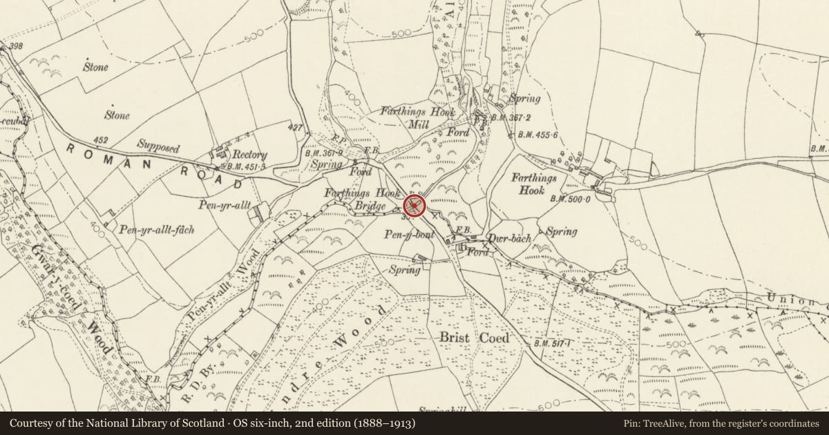
Slide toward Today to fade the historical sheet and see the modern map underneath.
David Rumsey Map Collection, Stanford LibrariesDavid Rumsey Map Collection, Stanford LibrariesDavid Rumsey Map Collection, Stanford LibrariesDavid Rumsey Map Collection, Stanford LibrariesDavid Rumsey Map Collection, Stanford Libraries
5 historical maps cover this location, the earliest the 1636 map "Cornubia : Devonia, Somersetus, Dorcestria, Wiltonia, Glocestria ..." (David Rumsey Map Collection, Stanford Libraries).
Historical maps covering this location
- 1636 · Cornubia : Devonia, Somersetus, Dorcestria, Wiltonia, Glocestria ... (David Rumsey Map Collection, Stanford Libraries)
- 1891 · Sheet 10. Ordnance Survey of England and Wales. . (David Rumsey Map Collection, Stanford Libraries)
- 1898 · 210 Cardigan (Hills) (David Rumsey Map Collection, Stanford Libraries)
- 1898 · 210 Cardigan (Outline) (David Rumsey Map Collection, Stanford Libraries)
- 1901 · Sheet 13. (David Rumsey Map Collection, Stanford Libraries)
Cadw's description
Location
Situated on a minor road some 700m S of the Church of Saint Brynach in Henry's Moat.
History
Road bridge over Afon Syfynwy, possibly C18 altered.
Exterior
Two-arch road bridge in rubble stone with two small and varied arches. N arch is deep recessed with stone voussoirs and semi-circular arch, S arch is not recessed, smaller and narrower and slightly pointed, also with stone voussoirs. On upstream side a a rough rounded cutwater between the arches, and C20 buttress each end. Stonework over arches is irregular, possibly much repaired, with rubble stone parapets and edge-on stone and slate copings. On bridge, against downstream parapet, a partially covered boundary stone reading 'Henrys Moat Boun..'.
Reason for designation
Included as a small rural stone road bridge of vernacular character, possibly C18.
Nearby in the register
- Farthings Hook Bridge (partly in Puncheston community)Transportunder 1 mi
- Castell HendreMotteunder 1 mi
- Velindre Pillar-CrossCross-marked stoneunder 1 mi
- Defended Enclosure 240m W of VelindreEnclosureunder 1 mi
Other entries of the same register within about three miles of this one, by straight line.